The father plays a key role in solving the wreck of the ‘Franklin’; the son becomes ‘The Little Man of South Wellfleet’
In 1823, Isaiah Holbrook Hatch purchased half of the Lombard family’s holdings north of Blackfish Creek — today, thanks to Charles Cole’s memoir of his childhood in South Wellfleet, we know that the area was today’s Cannon Hill. Born in 1798, Isaiah H. Hatch was the son of George Hatch of Truro; in 1820 Isaiah married Elizabeth Smith Young of Wellfleet. Peel back a few generations — as with other Wellfleet families — and you can find Mr. Hatch’s ancestor, Thomas Hatch, an early arrival in New England, settling in Scituate, in the 1600s.
Isaiah H. Hatch pursued the usual career of a Wellfleet man of that era. Charles Cole notes that he owned the ship Aurora anchored at the South Wharf, and his brother Stephen Hatch owned the Fanny. Captain Isaiah Hatch also owned pew number 43 in the South Wellfleet Congregational Church.
By the time of the 1850 Federal census, Mr. Hatch’s occupation is “farmer”, although he was referred to as ‘Captain’ throughout his life. Mr. Cole notes that Mr. Hatch grew alternating crops of corn and rye, the latter used to make brown bread and hasty pudding, New England staples. In the 1850 Federal agricultural census, Mr. Hatch owns 50 acres, but only four acres are under cultivation.
Mr. and Mrs. Hatch’s first child was Rebecca, born in 1821; she died at age 7 in 1828. Their second child, Elisa Arey Hatch, was born in 1823 and married in 1844 to Nathan Y. Paine, another of South Wellfleet’s distinguished citizens. Mr. Paine became one of the South Wharf owners in the 1840s, after Richard Arey moved away. A third daughter, Minerva, was born in 1828; she later married Joshua Paine. Their fourth child, a son, was named Isaiah Adams Hatch. Born a dwarf, he lived at home throughout his life, and achieved some fame later in life, as I’ll write about later. The Hatchs had another child in 1834, Harriet, but there is no record of her in the 1850 census, so presumably she died in childhood.
Mr. Hatch’s moment of fame came in 1849 when the Franklin ran aground in Wellfleet. Donald Trayser, a Cape Cod historian, puts the wreck near Newcomb’s Hollow. The Franklin was en route from Deal, England, to Boston, with passengers and cargo — wool and linseed oil, nutmegs, books, dry goods, and what the news called “a choice selection of nursery stock” that a Boston man had ordered to establish his horticultural business.
The news reports and later testimony of the crew described the situation on March 3, 1849, as one in which the wind increased to gale force, and drove the ship onto the bars early on that morning. The Captain, Charles Smith, packed a valise (some reports said he had gold coins and jewelry), summoned the passengers into a lifeboat, and left the crew to deal with the wreck. While leaving, a young woman was told to jump onto the lifeboat; when she did, the surf lurched the boat, and she fell into the sea. A few minutes later, the lifeboat capsized, and all the people in it were drowned.
Much later in the day, a group of Wellfleet citizens were able to launch a boat and rescue those remaining on board, although before the rescue others were washed off the deck and drowned. By the time of the rescue, the ship was in two pieces, with the sailors and passengers clinging to one of them. The Wellfleet men in the rescue boat were Mulford Rich, Joseph Swett, Benjamin S. Rice, Nehemiah C. Newcomb, Joseph Harding, Thomas Newcomb, and James A. James. Later, nine of the fifteen Franklin passengers who drowned were found: six in Truro, two in Provincetown, and one in Wellfleet. A new report on March 12 described the sighting of a body in the surf off Provincetown, a body that was “successfully grappled for and proved to be a woman, about 25 years old, dark complexion, black hair, black dress, with two rings on her left hand. Said to be one of the two lady passengers from the Franklin, she was taken up to town and buried.”
The story has it that the nursery stock from the Franklin was rescued by the Wellfleet citizens who turned out for the wreck; thereafter many fruit trees brought years of fresh fruit to the town. Nevertheless, the most important item salvaged from the ship was a valise – the Captain’s, marked C. Smith — taken by Isaiah Hatch.
Mr. Hatch carried the valise home and extracted and dried the letters he found in it; after reading them, he invited Ebenezer Davis, the underwriters’ agent, to visit his home so that he could share what he’d found.
The letters, signed by the two owners — Mr. John W. Crafts, a tallow chandler of South Boston, and Mr. James W. Wilson, a Boston businessman — implied that the Captain should destroy the ship so that they would benefit from the insurance payment and settle their financial problems. When the content of the rescued letters became known, the “Commissioner’s Court” in Boston summoned Mr. Crafts to appear. As later testimony showed, Mr. Wilson hid out for a few days, and finally turned himself in.
By April, both men had been indicted, and Mr. Crafts went to trial in Federal court in Boston, charged with “barratry,” which in maritime law is misconduct that results in damaging a ship, including scuttling it. In the case of the Franklin, the crime was to defraud the insurers. The penalty for the two men in this case, if convicted, would have been a $10,000 fine and ten years in prison.
This case is the only known one of barratry regarding the wrecks on the Cape Cod coast. Mr. Hatch’s crucial role played an important part in the drama reported by the press. One article in a New Bedford paper gave credit to “a wise and superintending Providence” who put Mr. Hatch on the beach with his hook, and sent him home to dry and read the letters in the Captain’s valise, and to bring “these purposes of fraud and villainy to light.”
The trial of Mr. Crafts stretched out through April and May. The Hatch family — Isaiah, his wife Eliza, and daughter Minerva — all appeared in court in Boston to tell their story of drying out the letters. Mr. Wilson, testifying for the prosecution, gave many days of testimony regarding the complicated ownership of the ship, trying to deny his actual role, although admitting his role in making the arrangements to destroy her. One writer called his testimony a “mass of chaos.” Mr. Crafts’ defense team worked hard to portray Mr. Crafts as a somewhat naïve businessman, and Mr. Wilson “an irresponsible adventurer having no permanent location.” Another reporter said that Mr. Wilson’s “aim seems to be to amuse the Court with characteristic Irish repartee.”
Early in June Mr. Crafts was found not guilty. I could not find any later legal action against Mr. Wilson, so perhaps he was granted immunity. Mr. Crafts’ attorneys made a strong case that Mr. Wilson was indeed a villainous man who had tricked Crafts; when the jury gave their verdict, the many spectators in the courtroom burst into applause.
All of the Franklin proceedings were reported in detail in numerous newspapers in Boston and the surrounding area. In October 1849, Henry David Thoreau took his first walk on the outer beach of the Cape with his friend Ellery Channing. Upon meeting a man who was still looking for salvage from the Franklin, he commented on the unfortunate events earlier in the year. He also discusses the Franklin wreck when writing about his visit with the Wellfleet Oysterman.
Captain Hatch’s life seemed to settle back to normal after his ’fifteen minutes of fame.’ He is mentioned in the Charles Cole memory piece as loaning his wagon to the South Wellfleet boys who stole back the cannon fired on the Fourth of July, and buried it for many years on Cannon Hill. He was listed as one of Wellfleet’s “Commissioners of Wrecks” in 1867. His pear tree was mentioned in a Barnstable Patriot article in 1871. The tree was claimed to be 130 years old; perhaps the remarkable age of the tree was given to head off any connection to the Franklin wreck. In another Patriot story, Mrs. Hatch broke her leg in 1874, an occurrence garnering mention in the local news column of the paper. Mrs. Hatch died in 1877 at 79 years of age.
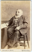
Starting in 1862, Captain Hatch’s son, Isaiah Adams Hatch, began to get some attention. In September that year The Barnstable Patriot reported that “Col. Isaiah Hatch” proposed to raise a company for active service in the U.S. Army wherein every applicant must be only four feet high or shorter. The report goes on to mention that “the Colonel is well known in the lower Cape towns as an active, intelligent man. His business has been that of a “Travelling Merchant”, supplying the Provincetown Market with the productions of his father’s farm, and always ready to convey passengers by day or night to any town in the county. Col. Hatch is 30 years of age, four feet high and weighs 80 pounds. Little folks from Cape towns are urged to fill up this Company immediately.” If anything happened as a result of this recruitment, I have not found any such report. Nor have I found any mention of how Isaiah Adams Hatch came to be designated “Colonel.” A later piece refers to him as a General. Perhaps he was held in the same regard as General Tom Thumb, a popular little man of Middleboro, Massachusetts, who lived at the same time.
In 1873, a Patriot Letter to the Editor notes “our friend Isaiah Hatch of South Wellfleet” is most agreeable to his customers – especially the ladies – with his dependable and safe conveyance to and from the railroad station.
Isaiah’s life took another public turn in the late 1880s, as Olivia C. Harriman penned a long Victorian elegy about him called “The Little Man”. Olivia and her family lived in Wellfleet where she was born; she wrote the poem when she was eleven or twelve. The verses note the sadness of The Little Man, as his five sisters have all died, followed a few years later by his mother. I only found records for four sisters, two of whom died young and the older ones, Elisa and Minerva, died of typhoid fever within days of each other in August 1865.
The poem could be purchased as a “broadside” for five cents. Mr. Hatch himself kept them available during his travels. Brown University has a copy in its archive.
Either the poem or his “traveling merchant” work seems to have given Hatch, the Little Man of South Wellfleet, a reputation, as there are a number of Barnstable Patriot articles

Isaiah Adams Hatch, the Little Man of South Wellfleet
noting his stopping by to visit people in one town or another. In 1878, a six-week trip he made to Boston and Cambridge was reported on in detail, noting the many sights he took in, and the friends he visited. Another ‘little man,’ E. Parker Lombard, became a companion on visits, and the two were noted as well-known on the Cape.
In 1879, perhaps looking ahead as to how he would handle his property, Isaiah H. Hatch sold it to George and Susan Rogers of Orleans. Susan Rogers grew up in Orleans. The next year, as shown in the Federal census, the two families are living together in the same dwelling. Isaiah H. Hatch may not have known how long he would live – he died in 1893 at age 94, a remarkably long life in the 19th century. Perhaps he made the arrangement with the Rogers family so that they would watch out for his son after his death. However, Isaiah Adams Hatch died shortly after his father, in 1894, at age 63.
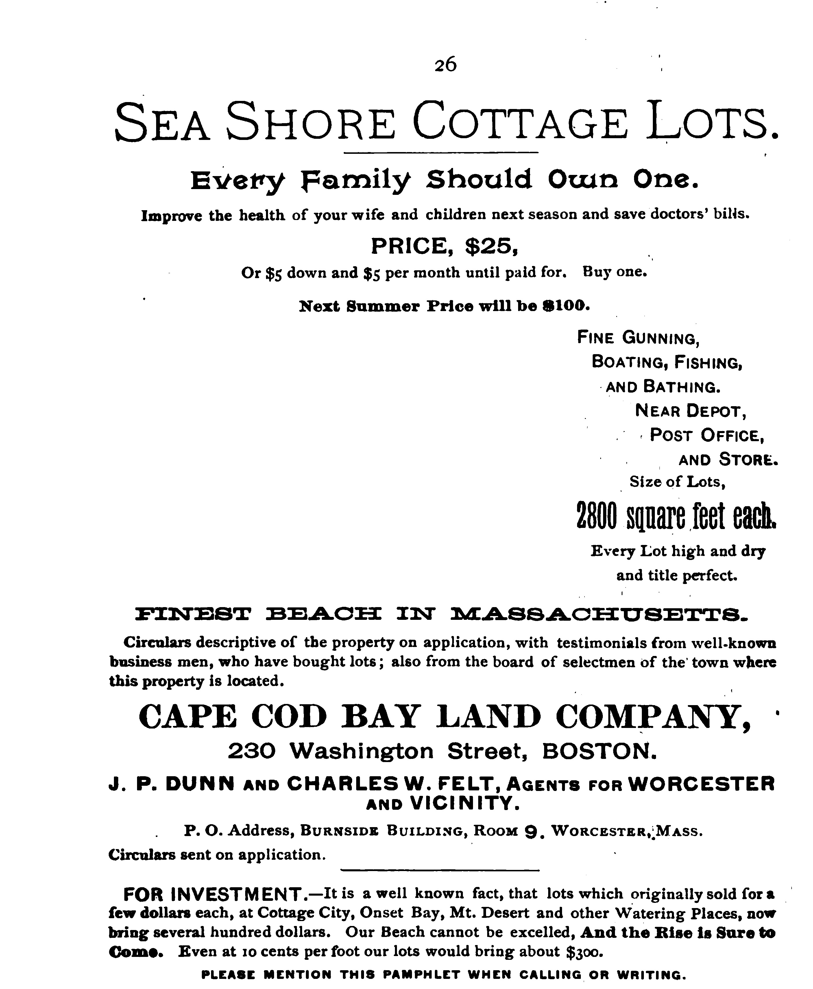
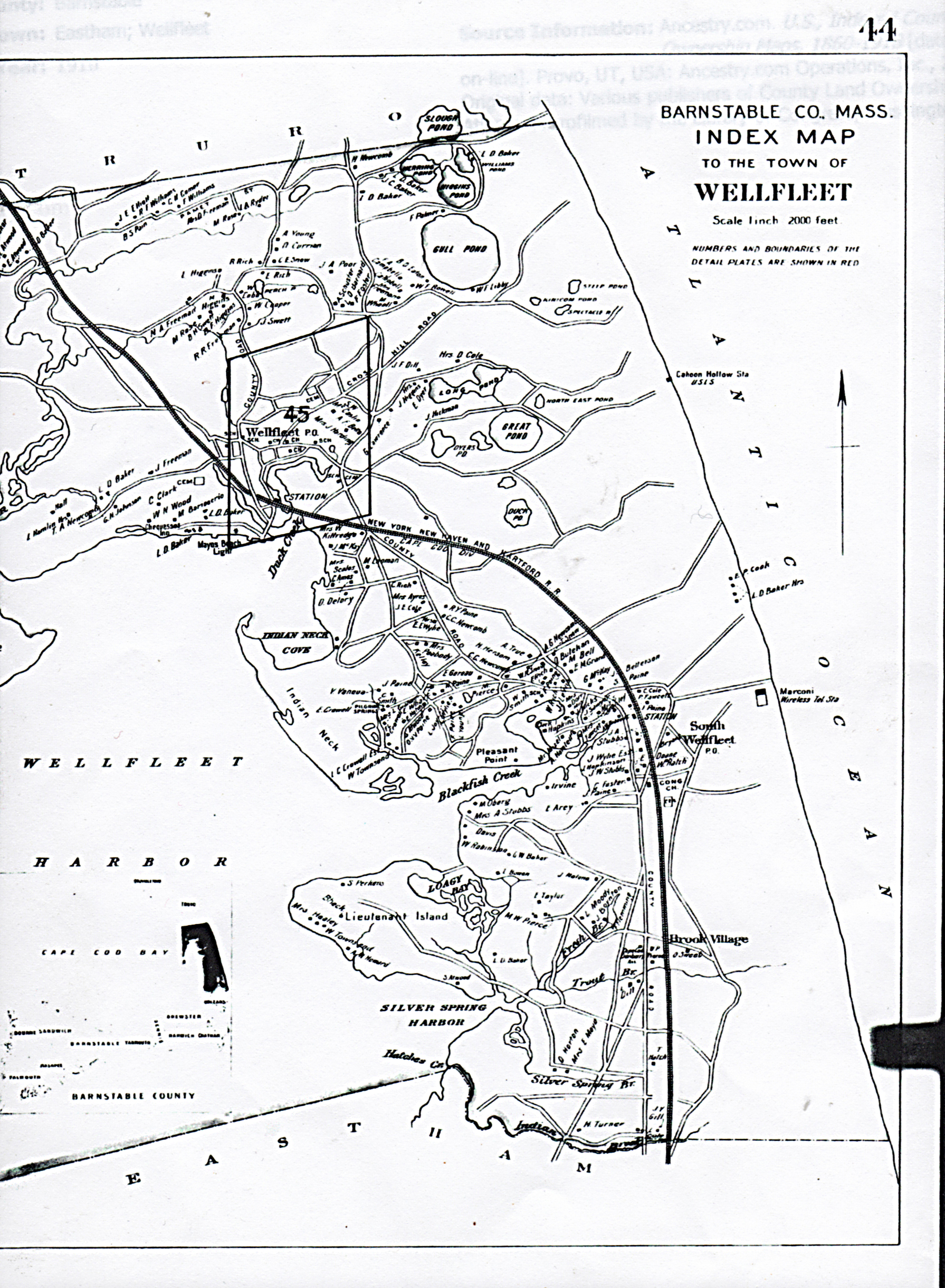
The Rogers family continued to live in the Hatch home; Mr. Rogers died in 1897. Perhaps then, Mrs. Rogers took advantage of the developing Wellfleet tourism and established her home as a guest house named the “Willows.” The Barnstable Patriot noted her visitors in their “South Wellfleet” column. Mrs. Rogers also took advantage of the real estate development Mr. Howard began in the 1890s, selling much of “Cannon Hill” to him. Mr. Howard’s Cape Cod Bay Land Company had a plan developed for Cannon Hill by 1897, just as there were plans for the Old Wharf, Lieutenant’s Island, and elsewhere. Mrs. Rogers died in 1905; her obituary noted that her funeral was in Captain Hatch’s home.
Soon after her death, her son sold the property to Ida Hicks of Cambridge. Five years later, Clarence Hicks and his wife, Asenath Pierce of Wellfleet, occupied the house and had two daughters, Ida and Myra, who grew up there. Since Clarence named one of his daughters Ida, there seems to be a relationship between the Ida Hicks who bought the house and land in 1906.
Many years later, it was Myra Hicks who gave up the secret of the buried South Wellfleet cannon on the Hatch/Hicks property. It must have been important enough that the story of its capture by the South Wellfleet boys was passed along from the Hatch to the Rogers to the Hicks family.
Sources
“The Notes of Charles F. Cole” manuscript from the Wellfleet Public Library
Family History records at www.familysearch.org
Provincetown Advocate available on line at http://advocate.provincetown-ma.gov
U.S. Federal Census collection at www.ancestry.com
David Kew’s Cape Cod History site: www.capecodhistory.us
Barnstable Patriot (various) online archive: www.sturgislibrary.org
Barnstable County Deeds available at www.barnstablecountydeeds.org
Newspaper account online at www.genealogybank.com.