INTRODUCTION: Wellfleet in the War Years 1939-1945
Posted on February 25, 2026 by pamticeblog@gmail.com
I’ve been curious for some time about what it was like to live in Wellfleet during World War II.
When I wrote this blog post about Camp Wellfleet, I shared the story of the family that had to temporarily relocate from their house so that the Army could conduct maneuvers on a nearby hill.
I was born during the war, so I was too young to have personal memories. My mother shared one: that during the war, you couldn’t take photos at “the Back Shore,” as she called the ocean beach, because there were military patrols there, and if you had a camera, it would be opened and the film exposed.
Another friend with a cottage on the dunes told me about the blackout shades there, still at the windows until just a few years ago.
I did not find a memoir written about those years in Wellfleet, although one may exist. Recent books about the bohemians who settled in Wellfleet have covered that time and were useful.
All of these stories made me want to learn more. How did the war and the addition of the military affect the lives of the people of the Outer Cape? I did not find anyone writing about the military activity that surrounded them. I pieced together the radar work in North Truro; most of the available material focuses on the 1950s rather than the war years.
Books and articles about “the Home Front” help explain the many government rules people had to follow in their day-to-day lives.
Since the war, there’s been a lot written about the Battle of the Atlantic, which affected Cape Codders, if not directly, then at least by causing unease about the possibility of an invasion.
Newspapers, thankfully digitized and online, were my primary source. I used The Barnstable Patriot, which regularly reported on town meetings and the military service of local young men. I could not find an online archive of The Cape Cod Standard Times, published from 1936 to 1975, though some microfilm is available at the Falmouth Public Library. There was some coverage of the Outer Cape in The Standard Times (New Bedford) that was available to me in the database newspapers.com. The Cape Codder did not start publication until 1946.
The Provincetown Advocate was the best source for reporting on the Outer Cape towns, from Eastham to Provincetown. The paper provided details of how the towns coped with the military presence, shortages, and the effort to provide for those fortunate enough to spend their summer vacation on the Cape. I was sadly surprised by the number of deaths in the Outer Cape area of young men in military training, events that the paper reported regularly.
During the war years, I also sensed a change in Wellfleet’s zeitgeist as the town of fewer than 1000 residents (1940), a fishing village, added layers of people from different walks of life. Bohemians, writers, artists, and intellectuals who may have moved to Provincetown earlier settled in Wellfleet. Different political views were expressed. There were a few immigrants, some exiles from other places in the world.
Over these years, town improvement projects were developed, and the town became more dependent on the tourist and summer-resident economy. The stage was set for the economic development of the 1950s.
I’ve widened my focus here, from South Wellfleet to the Outer Cape, Eastham to Provincetown, with a mention of Orleans if I found something of interest. Since I used the Provincetown Advocate, I learned a lot about that town; someone could write a book about the war years there. While I try to stay focused on Wellfleet, other towns get a mention when I find something interesting. Provincetown was much larger than Wellfleet and Truro, and so had much more to report.
I decided to organize this by year, starting in 1939, when the war broke out in Europe, and ending in 1945, when the war ended. Rather than summarize each year, I decided to report activities and events month by month, adding in war-related events as they happened. Each year is divided into two parts so that no one post will be too long. There were only a few contemporary photographs to share, so I added images of contemporary advertisements and movies.
PART ONE: 1939. WELLFLEET DURING THE WAR YEARS
World War II began in Europe in September, so I’m starting my Wellfleet war years project at the beginning of that year.
As the 1940 federal census will show, Wellfleet had 890 residents. It was heavily Republican, with 660 registered voters. Organizations were important: the churches, the Chequessett Grange, the Masons for the men, the Order of the Eastern Star for the women. Men also had the American Legion and the Highland Fish and Game Club, covering both Truro and Wellfleet.
Wellfleet had a Board of Trade, formed in 1937, and a group of summer residents called Wellfleet Associates, formed that year, to allow these property owners to express their views about the town. One of the first requests they had was to have the town name more roads. The South Wellfleet Neighborhood Association (SWNA) was also formed in 1937.
Whist parties were popular, and at many meetings, full meals were served, prepared by Wellfleet’s hard-working women. In the summer of 1939, Wellfleet Associates had a dance at Legion Hall, today’s Left Bank Gallery, where many gatherings were held. The SWNA had a card party at the recreation room at Cook’s Camps at Dallinger Heights, the old name for the hill near LeCount Hollow beach.
Scallops were more important than oysters in 1939, reflecting the change that had happened in the 1920s. In the summer of 1930, an effort was made to form a local cooperative to stabilize scallop prices, rather than have each shellfisherman sell to out-of-town buyers for whatever price was offered. The project never moved forward.
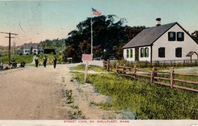
The Barnstable Patriot printed an article in 1939 about all the Cape Cod beaches. Wellfleet’s new beach on the harbor front (today’s Mayo Beach) was highlighted, along with mentions of Town Landings at Commercial Street, Indian Neck, and one near the Chequessett golf links. There were landings at freshwater ponds, and at several points where “town ways touch the ocean” on the back side of the Cape.
Another 1939 article in the Patriot named the “villages” of Wellfleet: Briar Lane, Great Beach Hill, Great Island, Griffin Island, Lieutenant Island, Money Hill, Pamet Point, Pucker Town, and South Wellfleet’s Spring Valley. An advertisement in The Provincetown Advocate offered 500 acres for sale on Great Island. The historian at the Wellfleet Historical Society and Museum found one reference to Pucker Town, which placed it in South Wellfleet, but there was no reference as to where.
Lawrence Gardinier was re-elected as a Wellfleet Selectman in 1939. Born in 1900, Gardinier had grown up in Wellfleet. In 1913, his father, George Gardinier, murdered his mother, Agnes, in her family home above the grocery store. The father had served some time in prison previously, convicted for smuggling Chinese immigrants into the country, and his wife had divorced him. After his release from prison, he came to Wellfleet hoping to be reunited with her, but she had declined.
The now orphaned Lawrence was taken in by the Taylor family. After serving in the Navy in World War I, he returned home to Wellfleet and married one of the Taylor daughters. He was first elected Town Moderator in 1936, after leading Wellfleet’s American Legion post since the 1930s, when the American Legion Hall was built on Commercial Street.
Gardinier is remembered today for his installation of the Town Clock, which tells the time on the hour and the half-hour in ship’s bell time. Wellfleet named the junction of Main Street and Holbrook Avenue “Lawrence Gardinier Square.”
1939 was the beginning of Charles E. Frazier Jr.’s political career. He defeated Charles Rich for the position of Selectman in February 1939. He was 30 years old and lived with his parents, Hattie and Charles Sr. His mother was a member of the Wellfleet Holbrook family, and his father was Canadian, from Nova Scotia. Frazier was educated in Boston at Boston College, where he received both his undergraduate and law degrees. He was a practicing attorney in Wellfleet.
Frazier’s work for the town before the war and his military achievements during the war led the citizens of Wellfleet to hold him in high regard. Much later, Frazier would be characterized as “controlling the town,” like a Tammany boss. He served as Selectman for 22 years, Town Moderator for almost as long, and Legal Counsel for 40 years.
It was a very cold winter in 1939, since the news reported that Captain Simon Berrio and his crew of the dragger Marion had to break up the ice in Wellfleet Harbor to clear the channel so that the fishermen could leave for their fishing grounds. The news also reported that the Town Meeting in February was brief, with $66,173 appropriated for the coming year. The schools were the most expensive, at $15,555, while the police were funded at $300. There were no police officers, as one of the Selectmen served in that capacity.
Mr. Frazier made news a couple of times in 1939 as he pushed the state of Massachusetts to finish the widening and paving of Route 6, which had been improved as far as “near the Wellfleet/Eastham Town Line.” The bumpy, curvy old road ran right through Wellfleet, taking a sharp turn to the left at the end of Main Street, today where Main Street, Holbrook Avenue, and West Main Street meet. The state advertised a contract for the roadwork in March but had to re-advertise in October. The Governor’s office had delayed the process for unspecified reasons.
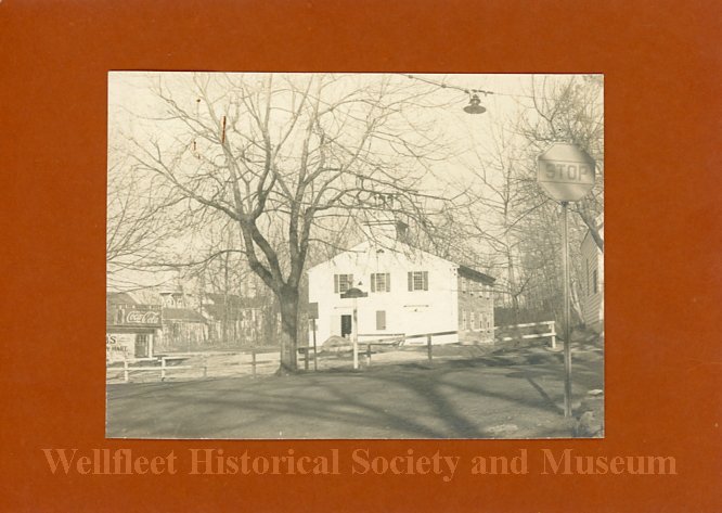
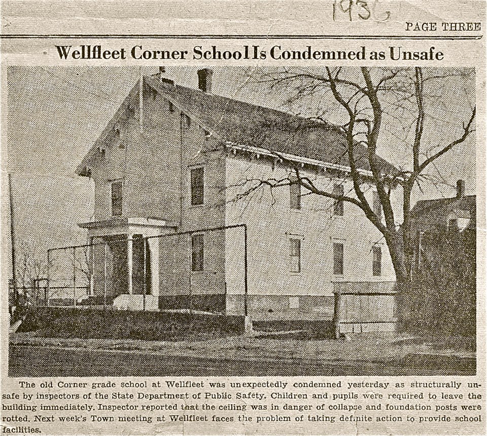
On that corner stood Wellfleet’s old elementary school, which was condemned by a building inspector in 1937. After securing state permission, the town financed a new school in 1938, built on the hill on Long Pond Road, where it stands today. In the meantime, the students had to be housed in temporary classrooms around town.
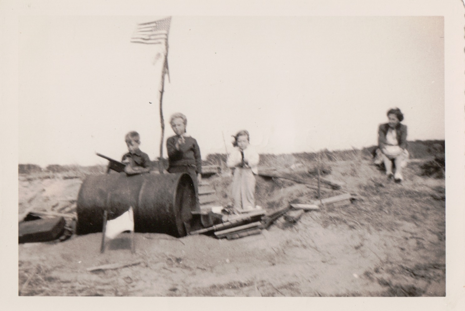
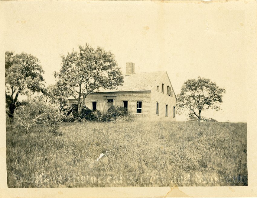
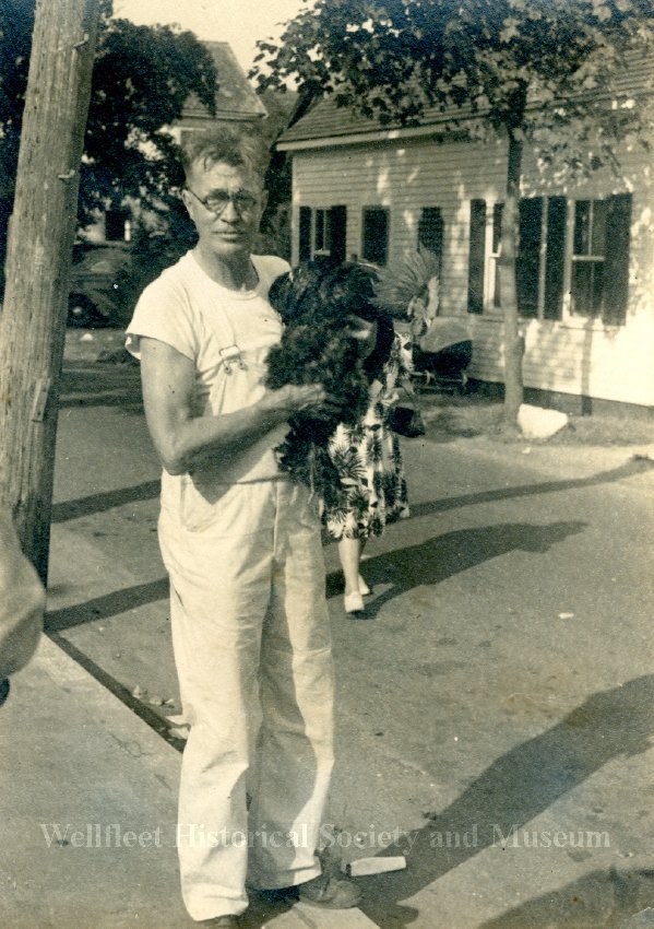
, image provided by Wellfleet Historical Society
In the Spring of 1939, the lieutenant governor came to dedicate the new school, and that fall, the first students began attending it. As the 1940 census shows, there were approximately 80 school-age young people in Wellfleet.
Summer resident Phoebe Atwood Taylor, a member of the Wellfleet Atwood family, was a popular mystery writer whose books were serialized in newspapers across the country. Her Asey Mayo character was a plain-speaking Cape Cod fisherman who solved crimes.
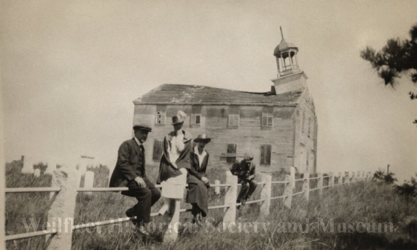
The South Wellfleet Neighborhood Association announced plans to place a new marker at the site of Marconi’s Wireless Station, replacing a crumbling concrete slab.
On Memorial Day, 1939, an annual ceremony was held at the South Wellfleet Cemetery. Later, the news reported that the cemetery had been “desecrated” with headstones broken, as “motorists used the shell-paved avenues as speedways.”
In the summer of 1939, the Wellfleet Board of Trade, the Wellfleet Associates, and the South Wellfleet Neighborhood Association held a joint meeting where the outlines their goals for the town: establish an Information Bureau to assist visitors, establish a new assessor’s survey map, establish a comfort station at the bathing beach, gain better control over gypsy moths and tent caterpillars, organize a town meeting in the summer, move the old church on Main Street, now called Colonial Hall, back to South Wellfleet. The SWNA sought a new directional sign to the Marconi Wireless site. The Wellfleet Associates wanted rubbish barrels set out around town.
In August, the Coast Guard celebrated the 150th anniversary of the Lighthouse Service, welcoming visitors to all the lighthouses: Highland (1798), Race Point (1816), and Wood End and Long Point (1827).
The Truro Neighborhood Association celebrated the restoration of the Old South Truro Meeting House.
The Provincetown Advocate reported proudly in August that Sinclair Lewis, the distinguished American author who wrote his first book while in Ptown in 1911, was at the Wharf Theater, rehearsing a role in the O’Neil play “Ah, Wilderness.” Lewis’s cautionary tale “It Can’t Happen Here” had been published in 1935.
In May, the Provincetown Library removed the works of John Dos Passos, allegedly at the request of the Catholic Daughters of America, because the books were judged to be “radical and obscene.” Later, the organization stated that only one of its members had requested the removal, and the Library clarified that only the Trustees could remove a book; Dos Passos’ books had been placed on the reserved shelf. Do Passos lived in Provincetown and later in Wellfleet.
Provincetown’s Catholic Daughters also sponsored a motion for the March special town meeting that everyone show “common decency in costume in public places” by forbidding the wearing of shorts and halters. The issue received widespread public attention and ridicule in newspapers across the country.
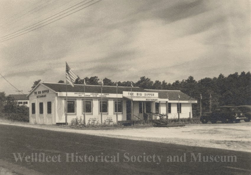
Also in the Spring, Lancaster Clark announced that he had purchased the Adams House, located on Route 6 in South Wellfleet. The restaurant dated back to 1918, and was described as a “former rendezvous of famous Provincetown painters, writers, and actors.” The restaurant’s name was soon changed to “The Big Dipper.”
The Fourth of July celebration in Wellfleet included a bonfire and a dance the night before, a morning parade on the Fourth that featured a Coast Guard delegation, the American Legion, and members of the Board of Selectmen. The Chairman of the Parade dressed as Uncle Sam, and Mrs. John Daniels appeared in a Statue of Liberty costume. Wellfleet schoolteacher Martha Porch dressed as Mrs. Washington, and Mr. Kemp was George. There were sports and swimming events at Mayo Beach in the afternoon. In the evening, the high school band held a concert followed by a fireworks display.
In the background of 1939 was the state of the world: aggression in Europe with Fascist Italy and Nazi Germany, and the beginning of World War II in Asia, as Japan was already at war with China. In his January State of the Union address, President Roosevelt called for strengthening the military and other American institutions. He submitted a $550 billion budget to Congress, which was later adopted.
Several news stories in 1939, before the war began, signaled the impending expansion of military activity on the Outer Cape. In February, work commenced on the reconstruction of the Cape Cod Canal, widening it from 315 to 480 feet and deepening it to 32 feet. The Canal would become a crucial element in moving merchant ships and oil tankers from the United States to Great Britain, keeping essential products flowing to the British.
In the Spring, there was a brief announcement of plans for a National Guard Camp in North Falmouth. This marked the beginning of Camp Edwards’ development.
In January, in Provincetown, the business community responded enthusiastically to the possibility that the U.S. Navy would build a naval base there. The businessmen also believed that constructing a large anchorage and parking for 300 cars would help develop tourism in the town and attract wealthy yacht owners. Later in the month, the local V.F.W. chapter sent a letter to Congress, detailing the advantages of the protected harbor for Naval training, a place of refuge, and a useful base, if needed, against German submarine activities.
For several years, Provincetown had been the site of testing newly built submarines. The submarines were brought there from the Electric Boat Company in Groton, Connecticut, and underwent a trial run. Provincetown was the site of the loss of the S-4 submarine in 1927, when 34 men were lost in the sunken submarine in the harbor, an event that is still commemorated every December.
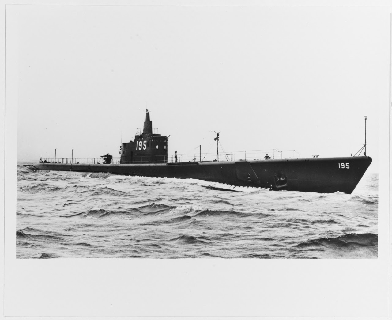
1939. U.S. National Archives
In March, two one-ton torpedoes were “lost” in the testing of the submarine Saury S-8, found by fishermen, and safely returned to the Sklaroff Wharf, where they were loaded onto a truck and returned to Connecticut. Turns out, they were dummies.
Submarines and their safety were front-page news in May 1939 when the U.S.S. Squalus sank off the coast of New Hampshire with the loss of 26 men, although a new rescue technique had been used and helped save 33 lives. In Chatham, the U.S. Naval Reserve held a ball to raise funds for the families of the lost men.
1939 Part Two: Wellfleet in the War Years
Posted on February 28, 2026 by pamticeblog@gmail.com
World War II began as the summer of 1939 came to a close; Germany invaded Poland on September 1, and on September 3, Great Britain and France declared war on Germany. Within days, Australia, New Zealand, and Canada were also at war. The war with Italy was not declared until June 10, 1940.
In Washington, Roosevelt immediately stated the United States’ neutrality and asked Congress to repeal the arms embargo and amend the Neutrality Act. By November, the “Cash and Carry Act” was enacted, allowing warring nations to purchase arms for cash but requiring them to transport them in their own ships.
The Battle of the Atlantic began, with German U-boats hunting down merchant ships to destroy the supplies, food, oil, and war material that the Allies needed to fight the war. Roosevelt declared that the U.S. Navy was on “Neutrality Patrols” and was ordered to report sightings of German U-boats. It would take another year for the U.S. to arm its merchant ships and fully end neutrality.
A few days after the war began, news reports heightened unease about activity in the Atlantic. A fishing trawler off Georges Bank reported seeing a large airplane with a German swastika clearly visible. There were reports of the number of Allied ships that German U-boats had sunk. There was a flurry of excitement in Orleans when two life buoys marked “Bremen” washed up on a beach. The German passenger ship had been ordered to leave New York and return home.
The Massachusetts National Guard began recruiting for the Coast Artillery Corps, with plans to establish a “military reservation in Bourne.” The Daily News in New York wrote about the possibility of the Germans setting up a submarine base off Martha’s Vineyard, a place that would be able to provide fuel and supplies. The United States was losing its sense of being impregnable. (It wasn’t until 1975 that an early 20th-century German plan to invade the United States, using Provincetown as a base of operations, would be revealed.)
Other news stories addressed the possibility that communication in the U.S. would need to be controlled and that the new medium, radio, would have to be included for the first time.
In mid-September, the Provincetown Advocate reported that the U.S. Navy and U.S. Coast Guard were investigating a mysterious vessel sighted near the Pollock Rip Lightship off Chatham, the east entrance to Vineyard Sound. It turned out to be the U.S. submarine Sea Dragon, undergoing trials out of Provincetown. The sighting was part of the new Atlantic patrols; in these early days, some coordination appeared to be lacking. The submarine trials in Provincetown continued, as reported in the Provincetown Advocate, with information provided by Mrs. Davis of Bradford Street, whose home hosted the Navy Trial Board and Electric Boat Company officials when they were in town.
The Advocate also reported in early October that two Navy destroyers had been at anchor at the entrance to Provincetown Harbor for two days, identifying them as the 395 and 397. The paper had not been able to learn whether they were part of the new patrol being established in the Atlantic. Formal censorship of war-related information would not be put in place until after the attack on Pearl Harbor. It took a while for “loose lips sink ships” to be a guideline.
After the war, The Cape Codder would characterize the war years on the Cape as a time when Cape Codders lived in a state of siege with “all kinds of hush-hush activities going on in the inner and outer waters of the Cape.”
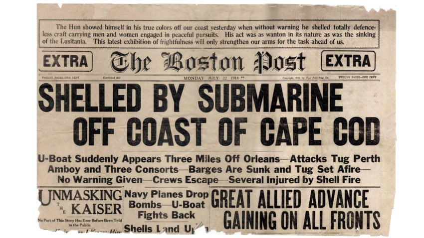
By late September, newspapers around the country were reminding Americans of the U-Boat incident off Orleans, now known as Nauset Beach, in July of 1918, when a U-Boat fired on a tugboat and barges, bringing the war to American waters. Chatham Naval Air Station sent two planes to bomb the sub, but it had submerged and disappeared. The wounded were brought to the Nauset Coast Guard station and then transported to hospitals in Boston.
An editorial in the Advocate welcomed FDR’s declaration of neutrality and appeared to try to soothe people with a prediction that Germany was in a bad economic shape and that the German people were against the war, so it would not last long —perhaps two years if “the French fight a defensive war.” Later in the month, the editorial focused on consumer goods, urging people not to worry or stockpile, as there were plenty of supplies available. It appears that some people, concerned about a lack of supplies and significant price increases, had been purchasing flour, sugar, and other staples, resulting in shortages in some areas and forcing store owners to limit purchases.
Another part of the war story was the effort to get all the Americans traveling in Europe onto ships and back home. On the third day of the war, the British ship SS Athenia was torpedoed by a German submarine near Ireland with the loss of 117 passengers and crew, including 28 Americans. This brought back memories of the sinking of the Lusitania in 1918, an event that led the Americans into World War I.
In Provincetown, the Advocate reported on September 14 that the Secretary of State had informed Mary Heaton Vorse’s daughter that her mother would arrive back in the United States in a few days. Vorse had been traveling and reporting in Europe for several years. In July of 1939, she’d written three articles for The New York Times about contemporary life in Germany, their economic recovery, the surge forward, and the strain it was putting on the German people.
In October, The Boston Globe published a story about a seven-foot apparition in a black cloak, chasing children through the streets of Provincetown and setting fires. The Globe reported that this “Black Flash” appeared every fall. Two days later, the Provincetown Advocate picked up the story with a Captain Blackstrap commenting that he’d met the Flash on the road to Helltown, a fishing community that was part of the town. In fact, there was an arson scare in the town, although the Police Chief was certain it was teenagers causing the trouble. The Black Flash remained part of Provincetown’s atmosphere throughout the war.
In November, South Wellfleet residents heard howling in Paine Hollow and named their apparition “Tarzan.” The men got out their shotguns and searched for it, but it was never found, although some people thought it was a steer that had gotten loose.
These incidents were perhaps a sign of the unease that began as the war got underway.
In November, one of Wellfleet’s newest residents addressed the Board of Trade, adding an international dimension to the Board’s regular work of making Wellfleet an attractive place for business. Paul Chavchavadze was a Georgian prince who’d been a cadet at Russia’s Imperial Cavalry Academy. When the Revolution broke out, he was ordered to join the “White Army” to defend the Czar. Paul’s father had been killed by the Reds. Paul had fled to London, where he met his wife, Princess Nina Romanov, a niece of the Czar.
Paul Chavchavadze and his wife, Nina, had moved to Wellfleet from New York earlier that year, purchasing the old home of a sea captain, Aaron Rich. To fund the purchase, they used an old brooch that Nina’s grandmother, Queen Olga of Greece, had given them as a wedding present. In the 1940 census, the family also includes their 15-year-old son, David.
The Board of Trade’s evening program at the First Congregational Church was an effort to better understand the Soviet Union. Perhaps they were moved by the disturbance between Russia and Finland, as there was a small Finnish community settled in Wellfleet. At the end of November, Russia invaded Finland, taking a portion of its land, in what is now called “The Winter War.”
Chavchavadze addressed the group on the last days of the Romanovs and the importance of the Cossacks to the Russian state; he stated that the secrecy of the current government prevented him from being informed about current events. He said that he was “happy to be chopping wood in Wellfleet while Europe seems to be again going mad.”
After a reportedly excellent chicken pie dinner prepared by the church’s Ladies Aid Society, the Board of Trade turned to other matters, including the plan to have an Information Bureau in Wellfleet by the summer.
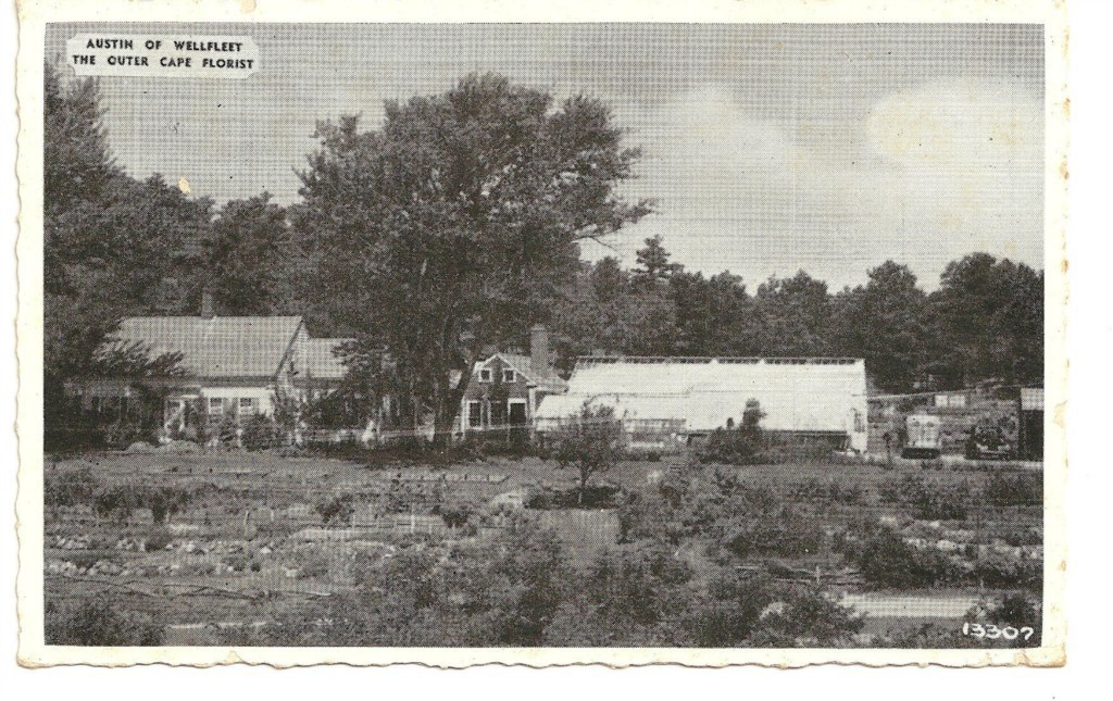
The Wellfleet Board of Trade was led by Oliver Austin, Jr., a successful Wellfleet florist who had recently opened another greenhouse and shop in Provincetown. Austin was also the ornithologist who, with his father, established the bird-banding station in South Wellfleet, which later became the Audubon Sanctuary.
In late November, Provincetown’s Police Chief received a letter from the “German Library of Information” located in New York City. In reporting this, the Provincetown Advocate asserted that it had also received regular mailings from the same source. The editor had received the German “White Book,” which asserted that British aggression was the reason the war had started in September. We now know that this agency was a part of the German government’s propaganda campaign that operated in the U.S. from 1936 to 1941 under Goebbels’ Ministry of Propaganda.
Wellfleet’s year ended with two destructive fires, one at the Floyd Atwood house and one at Louis Hatch’s house. The Atwood father and son were saved by Mrs. Atwood’s return home from a meeting, ensuring their escape from the fire. The elderly Mr. Hatch, who lived alone, was not so lucky. He died in the fire, and his home and barn near the South Wellfleet Cemetery went up in flames. At that time, the Wellfleet firemen had to run hoses over to Blackfish Creek to get water. A second issue concerning firefighting was the lack of a siren to alert the surrounding area. The Truro firemen arrived at the Hatch fire only after someone used a short-wave radio to call them.
The two fires spurred the town to get its siren reinstalled. It had been attached to the old school at the corner of Main Street, but was removed when the school was demolished.
A Cape tourist industry spokesman looked to 1940 as a successful year for the Cape, as no one was traveling to Europe. There was concern that the World’s Fair that had opened in New York in the spring of 1939 might draw visitors away from a Cape vacation.
1940 Part One: Wellfleet in the War Years
Posted on March 2, 2026 by pamticeblog@gmail.com
This is the third post in a series about life on the Outer Cape during World War II.
With the Winter War between Russia and Finland in full swing in the first few months of 1939-40, Wellfleet’s Finnish community helped raise funds for the relief of the Finnish people, bringing the international situation to the notice of the people of the outer Cape. There was a settlement in March, when the Finns were forced to cede territory to the stronger Russians who had invaded their land. It was reported in March that Wellfleet collected more than $100.
It was a cold winter. Wellfleet Harbor was closed off due to packed ice. Mr. DeLory filled his ice house on Long Pond with 10-inch ice with the help of 30 men. Workers installed the new fire siren on a tower behind the Wellfleet curtain factory. Wellfleet and Nantucket High Schools played basketball, with each team hosting the other on an overnight visit. Two women were injured while ice skating on the pond in Paine Hollow.
In late January, there was some hope revived for the dredging project in Wellfleet Harbor that the town had been working on since 1937. The Army Corps of Engineers recommended the project, but final approval awaited. Wellfleet was also considering creating an inner basin to attract boatowners who might also consider building a summer house in town.
The arguments over finishing Route 6 continued, with Mr. Frazier expressing great outrage when state highway funds were allocated to building new roadways further up-Cape. In March, an attorney from Boston presented an argument for a Mid-Cape Highway serving the entire Cape, arguing that better roadways were needed to increase tourism on the Cape and to serve the fishing industry, as the railroad service was winding down. Perhaps reflecting the widely held belief that the Cape was a military target if war broke out, the highway would also be needed to support troop movements.
In February, the Wharf Theater in Provincetown was destroyed by a winter storm, a blizzard with 80-mile-per-hour winds. This famous outpost, where American theater was developed, was gone. The Provincetown Advocate editor reminisced about Eugene O’Neill’s emergence as a playwright in the summer of 1916, when his “Bound East for Cardiff” was produced at the old fish-house on the wharf turned into a 60-seat performing space. Wellfleet’s Frank Shay was one of the young bohemians of Provincetown in the 1920s, involved in theater production. Mr. Shay was to play a leading role in a Wellfleet event later this year.
South Wellfleet’s Charles E. Paine turned 83 in February. Mr. Paine was famous for driving his horse, Diamond, “like the wind” to the South Wellfleet Railroad Station in January 1903 to telegraph President Roosevelt that King Edward VIII had received and replied to his message, the historic reply to Marconi’s first transatlantic wireless message. Of course, Mr. Paine slowed his horse down as soon as he was out of sight of Mr. Marconi and got the message delivered as promised.
The Marconi Wireless Station had long been washed away over the dunes, but the South Wellfleet Neighborhood Association made plans to make a memorial near its site, with the gift of the land from John Stone of Boston. The Town accepted the gift at the February Town Meeting. There were plans for a memorial park on site, with help from Italian American organizations. Mr. Stone was a wealthy man from Boston who came to South Wellfleet every summer, living like a hermit on the dunes, a story covered in this blog post. While the gift of land was reported in many newspapers from “John Stone,” the man was named “Albert Stone,” as the property owner in the Barnstable Deeds database. He continued visiting South Wellfleet until his death in 1959.
Testing new submarines continued in Provincetown with the spring arrival of the new submarine Tarbor. A U.S. Navy destroyer-tender, Dixie, arrived in Provincetown harbor, and 400 men went ashore for “night liberty” to enjoy the shops, restaurants, and bars in the town.
A major issue in Provincetown was the lack of sewers or cesspools, leading to pollution along the bayside beaches. There was no capture of the waste because everyone assumed that the tide would just carry it away. The town was also in the process of determining the legality of requiring catch basins for the drains of shoreline houses. The beaches were also littered with junk, so the town decided to use WPA funds for a spring beach clean-up.
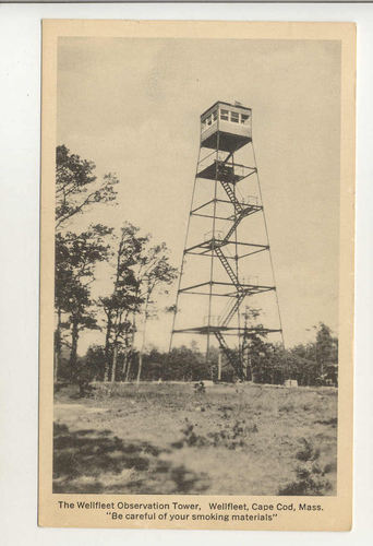
In a national story, the Town of Wellfleet reported that 4,282 visitors to the town had climbed the Fire Tower in the summer of 1939, visitors from 41 states and 12 foreign nations.
Many newspapers around the country picked up a Wellfleet story in March. Wellfleet had no arrests in the previous year, as reported by Selectman Chair John Daniels, who also served as the Police Chief, as there was no Police Department. Mr. Daniels turned over the job of Police Chief to Selectman Charles Frazier, Jr. In May, the Chief closed the lobby of the Wellfleet Post Office early because of the rowdy activity that was taking place there in the late afternoon.
In March, the Wellfleet Board of Trade hosted a debate between a “Communistic Party representative” and a “Finnish resident” of Wellfleet. I could not find a report of the actual debate, and the two debate participants were not named. In a later article, Frank Shay of Wellfleet reported that the Communist Party’s newspaper, The Daily Worker, gave the Board of Trade credit for “doing some hard thinking.” Shay said that there had been criticism of the Board for sanctioning a talk by a Communist, but he declared, “This is a democratic country. With the Nazis and the Fascists both attempting the throttling of the methods of democracy, we cannot further it by beating them to the destruction of democratic principles. No one who heard the talk at the last meeting can go away with his American convictions anything but strengthened.”
Also in March, Truro’s Old South Meeting House, recently restored, was struck by lightning and burned to the ground. In April, Henry Atwood announced that he would be starting a Wellfleet Boy Scout troop that would meet at the High School.
The Board of Trade discussed at its April meeting that there was a need to define the town’s right of access to its ocean beaches and to Gull Pond. They were concerned about access roads to the beaches and to the beach itself, as in some spots, the bluff had become perpendicular due to erosion. The ocean beach in South Wellfleet was referred to as “Glider School Beach” in memory of the Glider School that was once there, covered in this blog post.
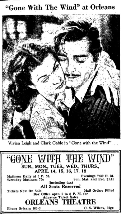
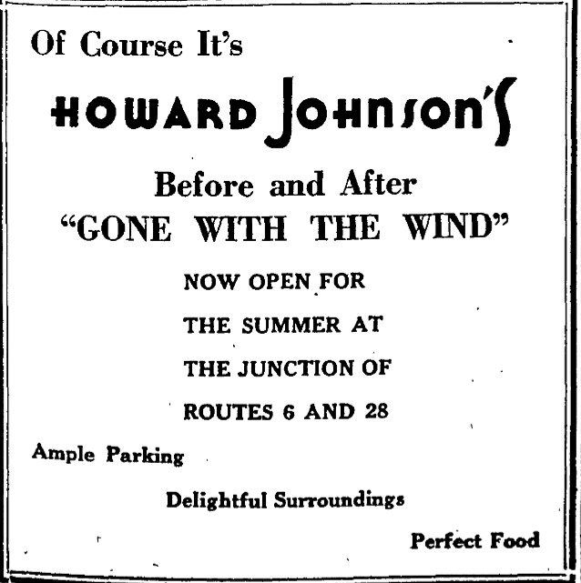
Gone With the Wind opened at the Orleans movie theater in April; from the advertisements in the Provincetown Advocate, it appears to have been a special event, with Howard Johnson’s and others encouraging movie-goers to have a special date night.
The three Wellfleet Selectmen, Daniels, Frazier, and Gardinier, who were also the Board of Assessors, announced that the property tax rate would be reduced for the year, from $35.50 in 1939 to $27.00. Mr. Frazier announced that they were working on a new assessor’s map and that all Wellfleet citizens should encourage more building in the town. The Provincetown Advocate editorialized that this “new thinking” in Wellfleet should be happening in all the outer Cape towns: “How can we raise our standards of civic service, develop our attractions, provide ample incomes for our people, and, at the same time, reduce the cost of property taxes?”
Germany invaded Denmark and Norway in April; the Cape Cod Red Cross chapter began raising funds for the “widespread suffering.”
The 1940 federal census was taken in the spring. Wellfleet had nearly 900 residents, a gain of over 50 since the last census, with a number of aliens, mostly from Canada. There were 40 men who listed their occupation as “fisherman,” including those who dragged for shellfish. Wellfleet’s curtain factory, actually a finishing factory for curtains sold by Montgomery Ward and Sears Roebuck, employed 28 people. Later, it was a candle-making shop. Today, the Public Library is in that location.
The Wellfleet Board of Trade had a full agenda at its May meeting at the Congregational Church, which included a baked ham supper. Mr. Charles Walker, an economic journalist, had recently moved to town and gave a talk to the Board about the power of cooperatives. This prompted a discussion about forming cooperative marketing for Wellfleet’s two main products, scallops and beach plum jelly. They discussed the importance of branding their products to increase prices. For the beach plums, they envisioned buying sugar cooperatively and having special glass jars made in bulk for the jelly producers. A committee was formed to pursue the matter. The agenda moved on: it was reported that the town’s street and directional signs were freshly painted for the upcoming season. There was concern about drivers who fling burning cigarettes out of their car windows and how a forest fire could start. There was a $25 fine for this act, and the Board discussed placing warning posters around town.
The Board decided to give $15 to Henry Atwood’s plan to start a Boy Scout troop; the Board already supported both Boys’ and Girls’ basketball at the Wellfleet High School. They asked Selectman-Chief of Police Frazier to prepare a lecture for high school students on careless bicycle riding. And, finally, they announced that a special Wellfleet Fair would be presented after Labor Day, under the direction of Frank Shay.
Mr. Daniels, the Wellfleet Selectman Chair, died in June. That left Lawrence Gardinier and Charles Frazier as the two remaining Selectmen.
What we now call “the drums of war” began to beat in the United States in June 1940. France fell to the Germans on June 22nd, and England prepared for an air invasion. Mary Heaton Vorse gave a talk in Provincetown at the Universalist Church about the fall of France, calling it one of the great turning points of history, and predicting that “we will be greatly affected.”
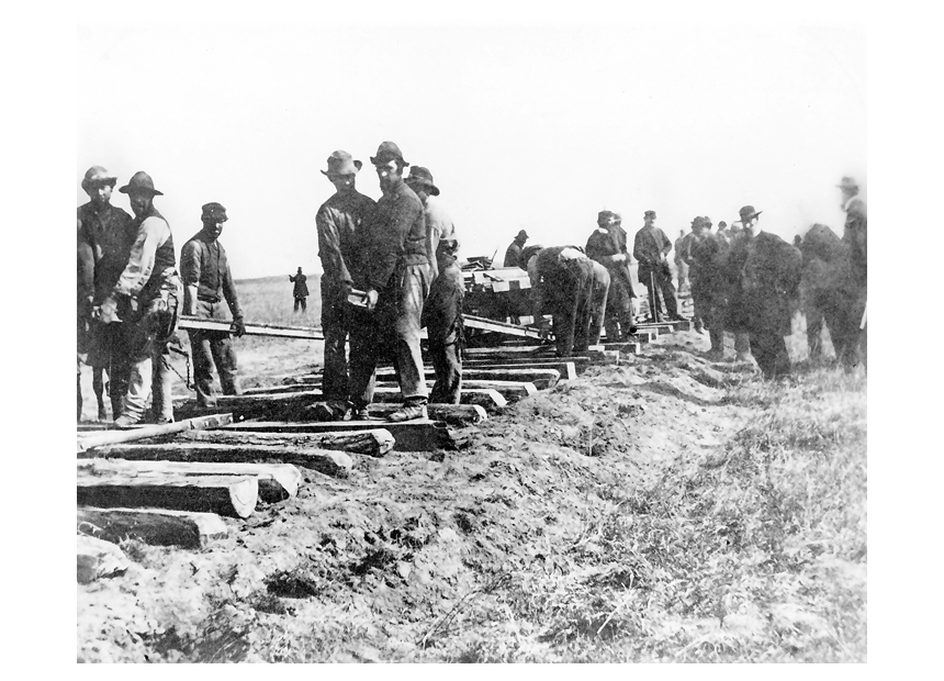
War planning began in the United States with several actions that brought the military to Cape Cod and would eventually affect Wellfleet’s citizens directly.
The U.S. Army leased Camp Edwards, the Massachusetts Military Reservation located in the towns of Falmouth, Bourne, and Sandwich. The Army began to plan a massive expansion to accommodate the influx of soldiers. The first peacetime draft, known as the Selective Service Act, was passed in September, and Wellfleet men would be registering by October.. To expand the Army, Congress federalized the National Guard in August. The Congress also appropriated the funds to build the training camps for the new Army, and work began at Camp Edwards in mid-September.
In the Wellfleet federal census of 1940, eleven men listed their occupation as “Carpenter,” as well as other men who listed their occupation as “Laborer.” The builders at Camp Edwards would construct nearly 1500 buildings: barracks, mess halls, officers’ quarters, chapels, recreational space, a hospital, and more. We know there were at least two Wellfleet men who worked on the project, as a November news story reported that they were unable to return to town in time to vote.
In June, the Alien Registration Act, or Smith Act, was passed by Congress, requiring every non-citizen over 14 years old to register. Aliens had to go to the post office to fill out a form and get fingerprinted. Part of the Act made it punishable for anyone, alien or citizen, to willfully advocate the overthrow of the U.S. Government. It was thought that registering aliens was a good way to keep watch over Nazis, Communists, and Fascists.
Aliens on the Cape, it was reported, often did not realize their status, since many had been in the country for some time and had never bothered to become citizens. Eventually, 358 Provincetown aliens registered. Wellfleet had 12 aliens in the 1940 census who presumably registered, since the fine for not doing so was a hefty $1,000 and could include up to 6 months in jail. During the pre-war and war years on the Cape, many people underwent the citizenship process and were sworn in at the Barnstable County Courthouse. For a while, there were citizenship classes in Provincetown.
In the June 20th edition of the Provincetown Advocate, there appeared an editorial “Bearing False Witness.” The editor remembered incidents during the last war when “witch hunts” were conducted based on “wicked whispered slander.” He reported three recent events in Martha’s Vineyard, in Wellfleet, and in Provincetown.
In Wellfleet, a nasty rumor had impugned one of the town’s finest citizens, unnamed, who had to ask the American Legion to verify his previous military service. In his 2022 book, The Shores of Bohemia, John Taylor Williams tells a similar story, when Wellfleet artist Edwin Dickinson was accused of being a Nazi because two magazines from Germany were found in his home by police. Dickinson’s children were teased at school. Dickinson’s beard, like that of a German U-boat crew, and his habit of painting while on the beach, made him a possible Nazi spy. Williams did not give the year of the incident.
1940 Part Two: Wellfleet in the War Years
Posted on March 4, 2026 by pamticeblog@gmail.com
This is the fourth post in a series about life on the Outer Cape during World War II.
Wellfleet had two big projects in the summer of 1940. In July, the annual meeting of the Wellfleet Board of Trade, the Wellfleet Associates, and the South Wellfleet Neighborhood Association took place at the Methodist Church, with a chicken pie supper. The group listened to a presentation by Frederick Melcher, summer resident and editor of Publishers’ Weekly, about the importance of marketing to the town, although he did not call it that. He spoke about the importance of distinct symbols, revealing a sample sign he had made with a blue scallop shell and a place-name, “Shirt-tail Point.”
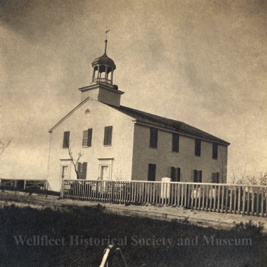
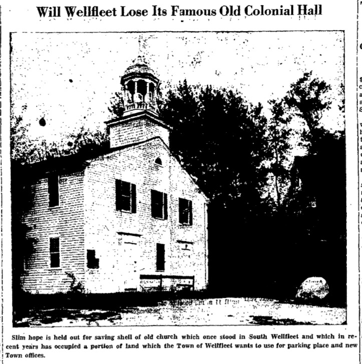
The groups began to discuss what to do with the Colonial Hall, the old South Wellfleet Congregational Church, covered in this blog post. The Hall had been moved to the center of town in the 1920s. Now it was in poor condition. It was standing on land that the town wanted to take for parking. Should it be repaired and turned into a Town Hall? Should it be moved? Destroyed? Reportedly, the Truro Neighborhood Association was considering buying it and moving it to the site of the Old South Meeting House, which had burned to the ground the previous winter. Wellfleet had just finished razing the old elementary school, as mentioned earlier. Should that site on Main Street be used for a new Town Hall? A vote was taken: saving the Hall was approved, but only by two votes.
Selectman Frazier then happened to mention that the town had recently sold the former school’s land to the New England Telephone Company for their plan to erect an attractive exchange building, like the new one in Orleans, for the time when Wellfleet is changed from its present system to the “crankless” method of calling the operator. Frazier emphasized the importance of the town taking the parking lot space to prevent private interests from buying it. The groups formed a committee to consider the options for Colonial Hall.
This discussion served as the kickoff for the project to save the Hall. The Preservation for New England Antiquities took a stand for preservation, arguing that at a time when Europe was losing its heritage to bombing, Wellfleet should consider preserving its heritage. Several hundred signed a petition to save the building, the land was acquired by the Town, and it would take most of 1941 to get the building ready for occupation as the town hall.
Also at this meeting, Selectman Lawrence Gardinier announced that Roosevelt had turned down the “improvement” of Wellfleet Harbor but held out hope that dredging the harbor still might be considered a defense measure project. However, the Town might have to build a dock.
Mr. Handy from South Wellfleet reported on two social events the Neighborhood Association would host over the summer: a card party at Cook’s Camps, and a garden party at Professor and Mrs. Frederick Hick’s South Wellfleet home, the “Bowed Roof.”
Finally, Frank Shay announced a plan for a Wellfleet “World’s Fair” to be held around and in Legion Hall, up and down Commercial Street, from Railroad Street to the Bank.
The summer of 1940 brought another celebration: the 150th year of the U.S. Coast Guard. Open houses were offered at all the Coast Guard Stations, Wood End, Race Point, and Long Point in Provincetown, Highland in Truro, Cahoon Hollow in Wellfleet, and Nauset in Eastham. Visitors were encouraged to go to Cahoon Hollow, as the macadam road to the station made the drive easy.
The Wellfleet Congregational Church celebrated its 220th anniversary with a dinner for 150 people.
Life Magazine did a photo spread on Cape Cod in its July 15th issue. Some were upset in Provincetown when the town’s business district was referred to as honky-tonk.

Wellfleet’s summer ended with its first Town Fair, organized by Frank Shay. Shay was one of the Greenwich Village bohemians who came to Provincetown. In 1925, he closed his bookstore on Christopher Street, loaded his books into a station wagon, and settled in Provincetown, where he became a drinking companion of Eugene O’Neill and Harry Kemp. His adventures are detailed in John Taylor Williams’ book The Shores of Bohemia.
Shay and his wife had moved to Wellfleet in 1938. The 1940 Town Fair would be one of Shay’s first efforts on behalf of the town. Williams describes a poster Shay developed for the Fair, “Well, Well, Wellfleet.”
The Provincetown Advocate reported in detail about the Fair. Shay announced the “people will be amazed by the wealth of products of hand, land, and imagination” that would be exhibited at the Fair. No displays of products of the sea were planned.
The Fair took place on Friday, August 30th, and was attended by 2500 people. A parade kicked off the day at 10:30 a.m., and the raising of the colors to open the Fair at 11 a.m. Admission tickets were sold out by 1 p.m.
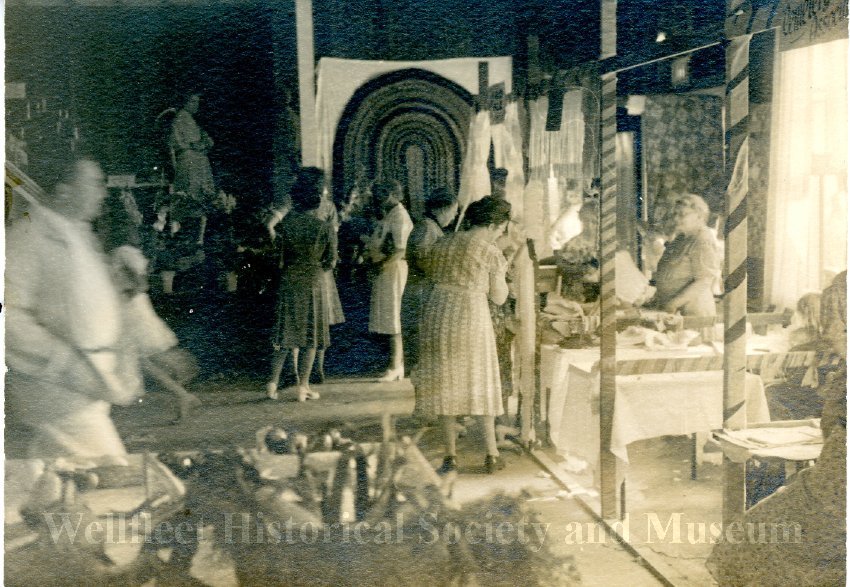
Using the Legion Hall as a base, the Fair included exhibits both inside the Hall and along Commercial Street. Exhibitors competed for prizes for the “Best Of” pies, cakes, beach plum jelly, pickles, hooked and braided rugs, quilts, and clam and fish chowders. Some had booths to raise funds: Mrs. Crowell sold cake to support the South Wellfleet Cemetery. Wellfleet High School students sold bowls of clam chowder for fifteen cents to raise funds for their annual trip to Washington, DC.
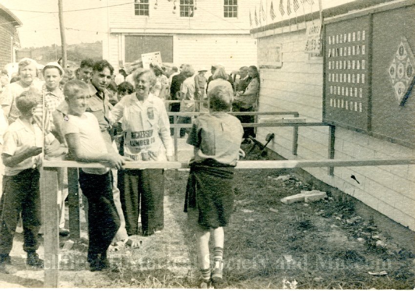
Fair 1940
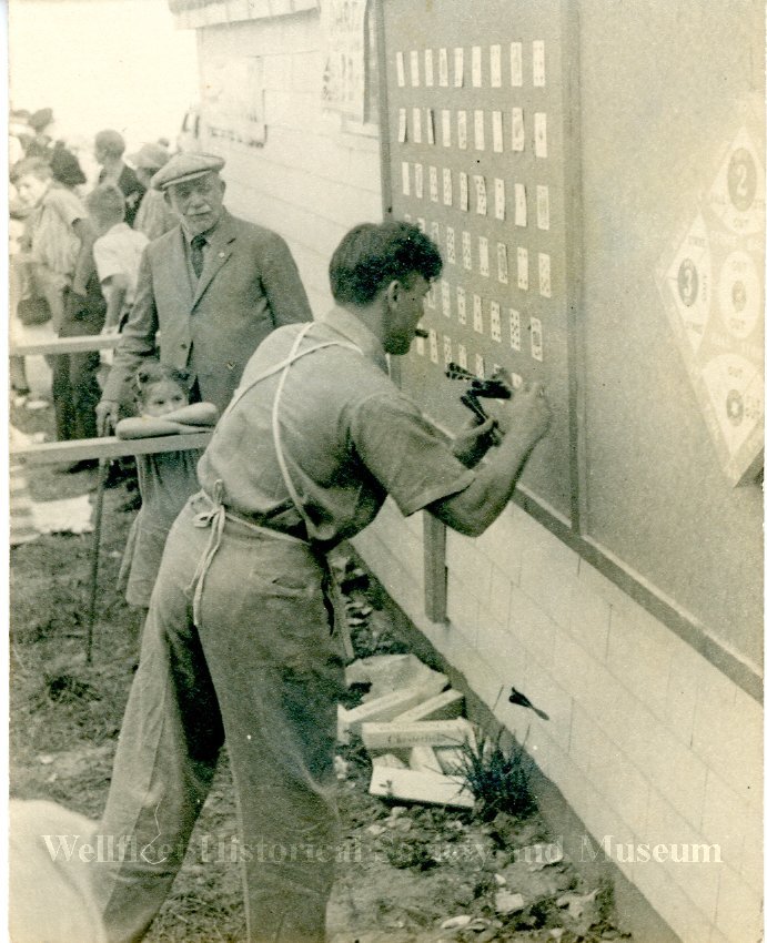
Locally grown vegetables and fruits were judged. Four parcels of Wellfleet property were auctioned. In the afternoon, there were “pitch” games: Crasho, dart poker, and Beano, the game we know as Bingo, using beans on the cards. There was an oyster opening contest at 3 p.m. The towns of Wellfleet and Truro competed for the best at cribbage and checkers.
Painters and artisans exhibited their skills. There were wood-carvers, candle-makers, and coppersmiths showing their work. In the evening, the Legion Hall was cleared, and old-fashioned dancing was offered: the Portland Fancy, the Trip to Nahant, and the Virginia Reel.
The war in Europe continued. Germany began bombing the English coast in July and August. The popular British actress, Gertrude Lawrence, married to the founder of the Cape Playhouse in Dennis, formed the Gertrude Lawrence Chapter of the American Theatre Wing for War Relief. Provincetown and Truro established chapters, and women began sewing and knitting clothes for children and refugees in England, using fabric and yarn provided by the charity. When the bombing began in London in early September, more support would begin.
In late summer, the U.S. Navy announced that it had no plans to create a base in Provincetown. Citing the U.S.’s role in defending the Western Hemisphere, Provincetown resident Naval Commander Archibald D. Turnbull began a new project. Insisting that the U.S. must be made war-ready, he founded a volunteer organization, signing up Provincetown veterans who could respond quickly to any emergency that might befall the town. By early fall, he had 72 men signed up. He was operating under the newly announced Massachusetts Committee on Public Safety, named just like the Committees set up during the American Revolution. Massachusetts was the first state to set up its civilian defense effort.
Later in the summer, Provincetown’s Henry James, a retired fisherman and owner of schooners, was featured in a lead story in the Advocate about his book, German Subs in Yankee Waters, as he wrote about the German U-boats in the North Atlantic in World War I. He recounted the story of the sinking of the USS San Diego off Long Island in July 1918, the only US warship lost during that war. The ship struck a German mine, killing six crewmen. Mr. James urged the U.S. to be better prepared for the coming war and to protect the fishing industry.
Congress established the Selective Service Act in September 1940, the first peacetime draft established in the U.S. The Provincetown Advocate gave specific instructions in its October 8th issue: “all men who have passed their 21st birthday and have not reached their 36th birthday must register on October 16th. There was no excuse: if you were out of town, you had to go to the registration where you were. If you missed this date, there were fines and possibly jail time. In Wellfleet, they expected about 100 to register, but that turned out to be 82, as reported later.
The Governor of Massachusetts issued a proclamation announcing the date and the rules. All the Town Clerks had to travel to Boston for a two-day training session on managing the registration process. In Wellfleet, Town Clerk Mr. Kemp appointed George Rogers as the Chief Registrar. The Provincetown Advocate named “Boy Scout Hall on Telephone Road” as the place where registrations would take place. The Boy Scouts were using the High School for activities, perhaps it was there.
After registering, all the men received a six-page questionnaire seeking information about their lives, occupations, and health, which would be used to determine whether they would be inducted. If they were in a certain job or had a physical infirmity, they would not be called to service. Later, in 1942, the federal government would rule that fishing as a deferment occupation could be considered on an individual basis by each draft board
The Cape had two draft boards, one covering the towns of Falmouth, Bourne, Sandwich, and Mashpee, and another covering the rest of the Cape. Later in the Fall, an Advisory Board to the Draft Board was appointed, and Cyril Downs of Wellfleet was among the members.
In early October, Eleanor Roosevelt and her secretary, Malvina “Tommy” Thompson, set out for an automobile tour, driving from Hyde Park through Connecticut, and then through Fall River, Fairhaven, and Buzzards Bay. Mrs. Roosevelt did the driving. She commented later on the “delightful atmosphere” of Wellfleet, Truro, and Provincetown. They stayed at the Colonial Inn, now the Ship’s Bell, and dined at the Flagship restaurant, where Anthony Bourdain would launch his career much later.
The next morning, the Provincetown Advocate interviewed her while she was having breakfast at the Inn and reading the Boston papers. The reporter noted that she was known as “the absent mistress of the White House,” but she said she knew how her husband was faring and that he would enjoy the ship models on display there.
She wrote an article about her trip in her syndicated column “My Day,” published a few days later, sent to her publisher by telegraph as they passed through Buzzards Bay again, on their way through Plymouth and then to Nahant to visit her son John and his wife.
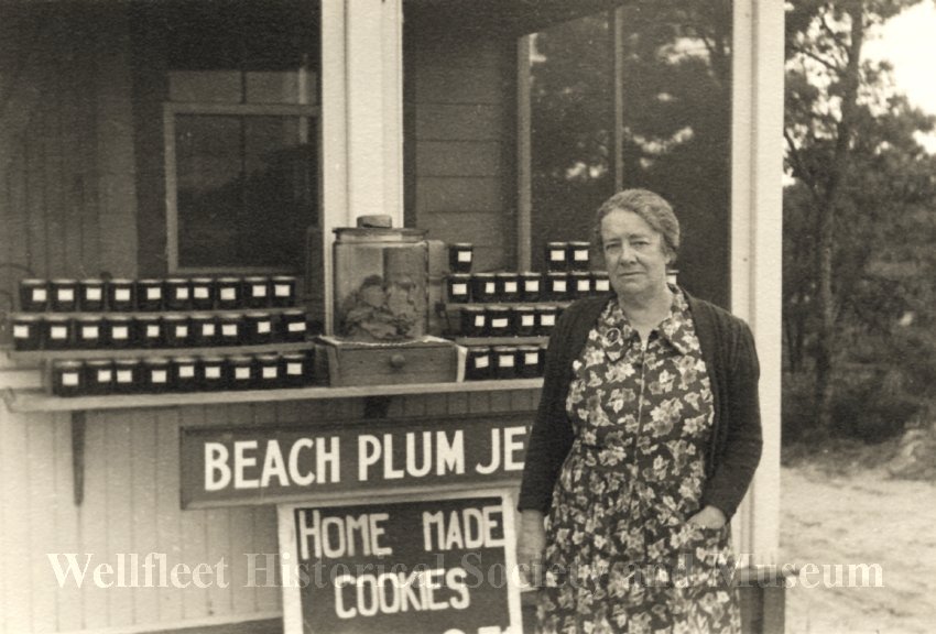
When they drove through Wellfleet on the return trip, she stopped at Anne Woods’ beach plum jelly stand and sent “several boxes” of the jelly to the White House. In the 1940 census, Annie Woods is listed as an 18-year-old with a widowed mother, working as a telegraph operator. Her home was indicated as “on the State Highway, in a northerly direction.” Perhaps she had a jelly stand in the summer months, catching the tourists as they drove by.
On November 5th, Election Day, Roosevelt was re-elected for a third term as President. Wellfleet strongly supported Wendell Wilkie, with more than 570 people voting, the most ever. Wilkie received 406 votes, and Roosevelt got 124 votes. Wellfleet voters also held firm against licensing any liquor sales in the town. Wellfleet had an active W.C.T.U. Women’s Christian Temperance Union, as they had a Christmas party for children later in the year.
Congressman Charles L. Gifford was re-elected. He was a Republican but ran as a pro-British supporter against an opponent who was an isolationist.
October brought another announcement: the airports on the Cape—Falmouth, Bourne, Chatham, Hyannis, and Provincetown—would all be upgraded, as the Cape was a strategic defense area.
In Wellfleet in November, a special Town Meeting was held, at which it was decided to acquire the old Colonial Hall and to have a committee examine the possibility of turning it into a Town Hall. Charles Frazier saw this as an important step in the progress of Wellfleet, commenting, “For the first time, the people seem to want a Town Hall.”
The Barnstable Patriot continued a long-time practice of printing columns reporting social news from all the towns on the Cape. These began to report the military engagements of the town’s young men: in November, Charles Huntley joined the Naval Reserve, signing up to learn mechanics for Naval aviation. He had to check in “fortnightly” to his base until he was called to active duty. James Berrio enlisted in the Army Air Corps.
In late November, there was a story about a military operation that did not seem to be under the censorship that would come later. The Barnstable Patriot ran a front-page story reporting that 20 to 30 experts from the U.S. Army Signal Corps would be coming to Truro with equipment worth $60,000 and would operate on a large plot of land on the high dunes there, leased from a Truro summer resident. The town offered them the Town Hall to serve as a barracks because it had a kitchen. The news reported that their exact mission was not announced, but they would be there for about six weeks.
The article stated that “clear Cape air” had brought the project to Truro, and went on to commend the air as the reason Mr. Marconi had chosen South Wellfleet, the reason the Coast Guard had recently moved a powerful communications center from Winthrop, Mass., and the reason why the RCA station in Chatham was there. It boasted about the number of radio “ham” operators on the Cape (although they were now silenced), and said the clear air was the reason for the success of the new radio station, WOCB, recently set up in West Yarmouth.
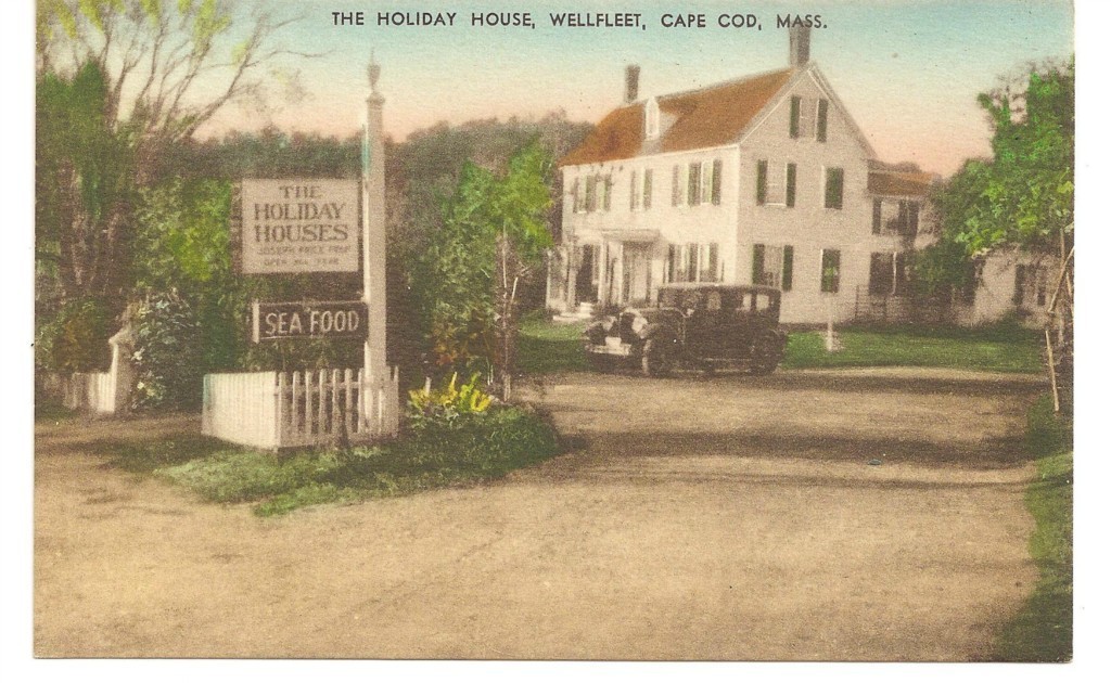
In mid-December, an Army truck overturned on one of the dangerous curves on Route 6 in Wellfleet. The three injured men had to be brought to the hospital in a bakery truck, as the outer Cape ambulance was in the repair shop in Provincetown. The other men were staying at the Holiday House in Wellfleet, now called the Copper Swan.
December also brought reports of who had killed deer during the hunting season and of several men vying to fill the vacant Selectman post left by Mr. Daniels.
There was considerable excitement in December when reports indicated that construction of Camp Edwards was nearing completion and that the possibilities for the Cape economy were promising, as 30,000 Army men would be there. There was no family housing for the officers, so they would need rental housing in some of the towns near the Camp. The soldiers would have time off when they were expected to become tourists in the Cape towns.
A chaplain at Camp Edwards asked Cape towns to consider adopting a battery of men to get used to having soldiers in their towns. Provincetown hosted a group of 100 men, giving them a tour, setting up a basketball game, and then a dance.
Just before Christmas, under the direction of Frank Shay, the citizens of Wellfleet assembled for a community party, gathered around a lighted tree, and sang Christmas carols to the organ playing of Oliver Austin, Jr. While they had coffee, cider, and doughnuts, Santa arrived in a sleigh drawn by a horse, and gave mittens to every child who wanted them.

1941 Part One: Wellfleet in the War Years
Posted on March 6, 2026 by pamticeblog@gmail.com
This is the fifth post in a series about life on the Outer Cape during World War II.
January in Wellfleet started off with an appeal to donate to the fund for the preservation of Colonial Hall, with $2,000 needed by the time of the February Town Meeting. Professor Carey Melville, a Mathematics Professor at Clark College in Worcester, led the effort.
Camp Edwards gained its full complement of men, and a Community Liaison Committee reached out to all the outer Cape towns, asking a representative to attend a meeting in Orleans. Throughout this year, there was reporting on how the military reached out to the civilian population to help maintain servicemen’s morale. The U.S.O. was formed, and plans announced to build USO Centers in Falmouth, Bourne, and Hyannis.
Citizenship classes were held in Provincetown.
Selectman Frazier reported, once again, that there were no arrests in Wellfleet in 1940, but the town “was no Garden of Eden.”
The Barnstable Patriot had a front-page story on January 9th, “Army to Stage Big Signal Rehearsal,” announcing that later in the month, 28 men and 20 officers of the First Aircraft Warning Company of the US Army Signal Corps would hold a practice operation in Truro. Lt. Albert Gilardi commanded the unit. The story announced that several civilian volunteers recruited from the American Legion would play a role in the operation, stationed at listening posts around the Cape. The “antique tower” at Highland Light, named the Jenny Lind Tower today, would be used as a civilian observation post. The Army signaling unit operated on “Town Hall Hill.” (Truro’s Town Hall Hill, also named “Storm Hill,” was where the Town Hall, formerly the Union Hall, is located. It was originally built to house fraternal organizations. The two-story frame building is near the First Congregational Parish.)
School was suspended for a week because of an outbreak of scarlet fever. Two of the men working on the Signal Corps project in Truro, staying at Wellfleet’s Holiday House, caught it and had to be quarantined.
The town elected Henry Atwood to the Board of Selectmen and Oliver Austin as Town Meeting Moderator. The Town Meeting began at nine in the morning, with a noon break for lunch of baked ham with pineapple, vegetables, and gingerbread with whipped cream for dessert. The town voted to build a new fire station at the intersection of Commercial and Bank Streets. The town also funded the digging of fire wells throughout the town to ensure the fire department had adequate water.
At the Wellfleet Board of Trade meeting, Charles Frazier railed against the letter he had received from the Commissioner of the Massachusetts Department of Public Works, informing him that the upgrading of Route 6 was in the six-year plan. Frazier demanded action, saying that it was part of building the defense of the state, that the suicide curves of the old highway were a danger to the movement of the military. He described an Army convoy going through Wellfleet, taking up two-thirds of the roadway, tail-lights obscured by gun carriages, making the operation a menace to other traffic.
Frazier was also closely watching the process of getting federal funding to dredge the Wellfleet Harbor channel and to build an anchorage basin. Congress had approved the project buy the President vetoed it. Frazier was sure the project would be presented again as a defense project. The project was included in the Omnibus Rivers and Harbors bill in October, but the actual work did not begin until the 1950s.
The meeting went on to other topics: helping with the recreational needs of the Army men working in Truro. Lieutenant Gilardi attended the meeting, confirming that his operation in Truro was secret.
James L. Twombley of the U.S. Geological Survey attended and reported that the new topographical map of Wellfleet would be ready in a year. The Yarmouth Register reported that work on the map began in 1936 and would be an update of the 1885 map. Aerial photos had been taken, and every hill over ten feet had been plotted.
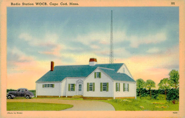
The editors of the Provincetown Advocate and The Barnstable Patriot, Paul Lambert and Jack Johnson, attended the meeting. There were complaints that the Cape’s “daily paper, The Cape Cod Standard Times, did not carry the schedule of the new radio station, WOCB.
WOCB was growing in popularity around the Cape. Charles Frazier was on the air in late February, supporting a new idea in the state legislature to move Labor Day to mid-September to extend the tourist season.
The Barnstable Patriot reported that the upcoming tourist season would be a good one, with the addition of Camp Edwards and the lack of travel to Europe.
In February, Wellfleet artist Edwin Dickinson announced that he would head a committee to raise funds for Herbert Hoover’s work in Europe—the “Committee of Food for Five Small Democracies”—to fight famine in Finland, Norway, Holland, Belgium, and “Central Poland.” This was just one of many efforts to help Europe and Great Britain, which were in the news on the Cape. Wellfleet had an active Red Cross Committee of women who sewed and knitted clothing at a space provided for them at the Wellfleet Savings Bank.
The February Board of Trade meeting honored four Outer Cape women: writers Susan Glaspell and Phyllis Deganne, Mrs. Worthington, founder of the Cape Cod Fishnet Industry, and Wellfleet philanthropist Mary K. Lawrence.
“The grippe, “what we call the flu today, infected several people, including the Army men staying at the Holiday House.
The Selectmen sent a letter to Lieutenant Gilardi, thanking him for the fine conduct of his men during their time in Truro and their stay at the Holiday House.
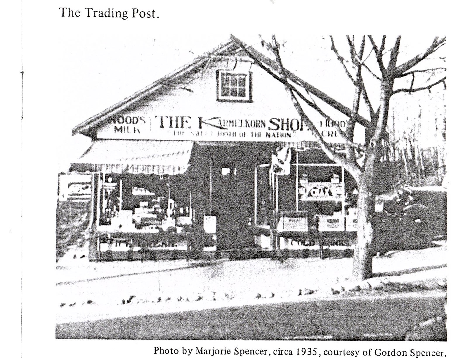
The work on creating the town Hall we know today got underway. Old buildings around the site were removed, including one called the “Trading Post,” which would be rebuilt close by. One of the old buildings was described as a former school moved there from “Pucker Town.”
In March, the fifth call of the Barnstable Selective Service Board was made. Four young men of Wellfleet were called: Wilfred Trahan, Edwin Hall, Howard Kemp Snow, and Zenas Adams. Earle Rich was already serving in the Navy, based at Charlestown Navy Yard. Typically, those took a train from Hyannis to Boston, where they had physicals and were then inducted. They were then furloughed for 14 days, when they would be ordered to report for training.
At the Board of Trade meeting, it was announced that the Program Committee had taken over public relations for the town, in the hope that favorable press coverage would attract “the kind of people we want.” The town was developing a new assessor’s map and finding available land since the L.D. Baker Estate was liquidating some of its extensive holdings. President Oliver Austin commented, “We don’t want the kind of honky-tonk summer people that go to Provincetown, nor do we want the ‘Privy Hill’ type of overnight camp in North Truro, nor the cheap summer boom business of Hyannis.” He noted that Wellfleet wanted artists and writers who could work anywhere, noting that the town needed a planning board and zoning regulations. During this year, the group painted the town’s street signs, kept the rubbish barrels emptied, sponsored the Boy Scouts, held a dinner for the High School’s basketball players, and a Christmas party for children at the end of the year.
In April, Wellfleet installed its first traffic light, a blinking yellow at the junction of Route 6 (now named Main Street) and Commercial Street. Also in April, Wellfleet joined 15 other towns to fight a destructive fire at Brewster’s Sea Pines School.
In April, Frank Shay gave his first Tuesday afternoon WOCB show, “Wellfleet On Air,” where he described many new projects in town that were creating a good impression of the town’s growth. The Colonial Hall, the new fire station, the new Trading Post store, and the upcoming telephone exchange were underway. He reported on Jack Hall’s new baby, on Edmund Wilson, and his wife’s purchase of a home on Money Hill, and on Princess Xenia of Russia visiting her sister, Nina Chavchavadze. He reported that the second Town Fair would be held in the summer and that the State Department of Agriculture was providing funds for prizes.
On May 27th, President Roosevelt, in his Fireside Chat Number 17, declared a National Emergency with strong language about the Nazi’s plan for world domination. Buried in the talk was an announcement that he had “set up the machinery for civilian defense.” He appointed New York City Mayor Fiorello LaGuardia to head the office, along with Mrs. Roosevelt. Now the outer Cape towns would all begin organizing and training for their civilian defense and emergency preparedness efforts, as Commander Turnbull had done earlier in Provincetown.
Two other events in May brought more military action to the Outer Cape. On May 29th, the Barnstable Patriot announced that an “outermost listening post” would soon be set up in North Truro, close to Highland Light. Workmen were scrambling to build a new road out to the site. It was declared to be the “first established military post in the outer Cape section.” This appears to be the project that Lt. Gilardi worked on during the winter months. In the Provincetown Advocate, there was only a brief mention that 1200 soldiers were to be established in the “Highlands Reservation.”
I did further research to understand what was happening in North Truro. Indeed, the First Aircraft Warning Company of the U.S. Army Signal Corps, activated in Truro in May 1941, was the beginning of the organized Aircraft Warning Service (AWS) on the East Coast. There were two parts to the Truro story. First, the Army had set up SCR-270 radar sets, the equipment mentioned in the January reference to this operation. The SCR-270 was one of the first early-warning radars. The activation in Truro resulted from escalating tensions in Europe and the need for a North American air defense system.
As AWS was set up, the Army turned to the American Legion to provide civilian volunteers trained in plane spotting and reporting. I did not find any specific mention of Wellfleet American Legion men participating in the project in Truro, but I am certain they might have. The Provincetown Advocate reported in December 1941 that American Legion men staffed a watch post at Beach Point, giving a detailed account of what it was like to spend eight hours on duty in this dismal spot. These posts were set up all over the East Coast; in Massachusetts, they were said to be six miles apart, which would place another near Nauset Beach. I did not find any mention of activity there. The AWS program became inactive in 1944 as the threat of an air attack diminished.
In 1947, The Cape Codder published a classified advertisement offering five barracks buildings for sale in North Truro under the Surplus Property Act of 1944. The site was referred to as the “Highland Light Air Warning Site No. 5.”
In the 1950s, North Truro became home to the North Truro Air Force Station, a significant Cold War radar installation. Additional experimental radar work went on in South Truro for long-range search radar.
I was also curious about Lieutenant Girardi and his military career. Born in Ohio, he was commissioned as a second lieutenant upon graduating from the University of California, Berkeley, with a degree in electrical engineering. The equipment he worked on in Truro was sent to Hawaii, and on December 7, 1941, it provided a warning of the Japanese attack. He was awarded a Legion of Merit in 1943 for his work in setting up the station at Truro and for setting up radar sites on the entire coast of Iceland. He was at D-Day in 1944 as Major Gilardi of the 555 Signal Warning Battalion. He served in the Military Occupation Government of Germany and helped reassemble German communications. After the war, he married, had three children, worked for technical companies, and died in New Jersey in 1997, another member of what we have come to call “the greatest generation.”

1941 Part Two: Wellfleet in the War Years
Posted on March 9, 2026 by pamticeblog@gmail.com
This is the sixth post in a series about life on the Outer Cape during World War II
In June, in Provincetown, Arctic explorer Rear Admiral Donald MacMillan reminded Americans that the Germans could launch an attack on the U.S. using Greenland as a base. In April, the U.S. government had signed an agreement with Denmark’s government-in-exile establishing Greenland as a U.S. Protectorate for the duration of the war. In June, MacMillan was reactivated by the U.S. Navy to go to Greenland.
A young woman, a high school student in Provincetown, told her schoolmates about her family’s flight from France after the Nazi invasion. The family was now living with the grandmother in Provincetown.
In early July, after the 1200 men arrived in North Truro, the WPA Recreation Director in Provincetown set up a few days of activities for them, as local citizens learned to provide recreational events for military men. There was a baseball game, and a dance, with both radio and phonograph music, and the younger women “hostesses” being chaperoned by older women of the town.
Also in June, Frank Shay, speaking on his radio show on WOCB, announced, “The people of Wellfleet have resolved themselves into a Committee of Public Safety, knowing that, if the mad dog of Europe in not overcome by Russio, or England, the Outer Cape will become the last coast of democracy and will have to be “defended by men, women, and children alike.”
During the spring and summer, the Cape raised funds for a “Flying Ambulance” for the RAF in England. They named it “The Cape Codder.” Before the plane was sent to England, it was flown around the Cape to various towns so that people could see it. During this time, many connections were made between Cape and English towns sharing the same name: Yarmouth, Falmouth, Truro, and the English Barnstaple with the Cape’s Barnstable.
In July, Admiral Turnbull of Provincetown was appointed Chair of the Provincetown Committee of Public Safety; by October, he would be leading the effort on the Outer Cape, overseeing the area from Provincetown to the Orleans town line. Trumbull is quoted as saying, “Fail to prepare, prepare to fail.” Civilian defense schools were set up in Hyannis and, later in the year, in Provincetown.
In early August, an Army training exercise appears to have affected the Brewster-Orleans area more than the Outer Cape. The Boston Herald reported on August 1 that 6600 troops from Camp Edwards would be staging a battle with one group playing the part of an invading Nazi army that had landed in the Brewster-Orleans area.
By late August, there was more Naval activity in Provincetown Harbor. The Provincetown Advocate reported, “The cruiser U.S.S. Tuscaloosa arrived last night and joined a large fleet of warships.” There was a dance for Naval personnel at the Town Hall. In October, the newspaper wrote, “Three of four destroyers of the new type and one submarine came in and anchored in Provincetown Harbor after dark last night and left again before it was really light in the morning.” A branch of Naval Intelligence opened in the Provincetown Post Office building, welcoming help from the public if anyone was observed interfering with Naval operations. In late October, the Navy constructed a steel docking float to “facilitate the landing” of officers and sailors.
In August, the U.S. Navy conducted “defense tests” at the Provincetown airport near the Race Point Coast Guard Station. They sought permission from the town to erect a temporary mooring mast for blimps that would “work with submarines in local water.” Twenty men and their officers were stationed there for three weeks.
Not all events were military. Wellfleet’s second Town Fair was held on August 23, under the direction of Frank Shay and a hard-working committee. The crowd was a bit smaller. Funds were raised for the Colonial Hall, the High School’s Washington, DC trip, the Lower Cape Ambulance, and a new fund for the Wellfleet Fire Department. Many prizes were awarded for poultry, handicrafts, baked goods, vegetables, fruits, and flowers; canned and preserved foods; clam chowder; and quahog pie.
There were very few crime reports in the Cape Cod newspapers, perhaps because tourism was so important. However, in the summer and fall of 1941, these stood out: the Truro Town Clerk, who also served as the Treasurer and Tax Collector, was tried and convicted for stealing the town’s funds, and the Provincetown Police Chief was indicted for covering up a crime in 1938. Also in Provincetown, two crimes, one involving strip-tease dancers at an event, and the other a New York City man arrested for “lewd, wanton, and lascivious behavior in the company of two sailors in a car behind Town Hall.”
A speaker at the Provincetown committee in October would push hard for the efforts to organize, since all citizens of Massachusetts would be expected to perform the duties assigned to them. During the summer, Turnbull explained that citizens who were already professionally trained in the duties required for civilian defense, such as firefighting and first aid, would be asked to serve and, if they refused, and no one else volunteered, they could be “drafted.”
At a Special Town meeting in Wellfleet in September, the agenda included some property transfers, including one in which the Methodist Church gave the land under the fire station to the town. There were a few more expenses to finish the Colonial Hall, including painting and installing plumbing. Another item concerned building a road through the South Wellfleet Cemetery. The Town Offices were relocated by November, as town officials moved from their “cramped and dusty offices over the library.”
On October 10th, the Army staged an “imaginary bombing” as a test for the fifteen Cape Cod towns to test their ability to handle an air raid. Admiral Turnbull, now in charge of the Outer Cape from Eastham to Provincetown, handled a telephone system connecting the towns. The Legionnaires who were part of the AWS watch posts reported their identification of all the planes to their report center.
A few days later, Turnbull discussed making a plan to use all of the Provincetown fishing boats to evacuate women and children from the town “in case there is a serious fire from incendiary bombs.”
Civilian defense organizing in Wellfleet during the summer of 1941 was taking place. There was a training course for both Wellfleet and Truro volunteers, taught by Mr. Beebe at Truro’s Odd Fellows Hall. Training courses were also underway in Hyannis. Wellfleet must have organized, because Charles Frazier mentioned “a corps of workers” who were commended by area officials for their alertness and efficiency during an October exercise, which would have been the air raid testing event described above. At a late October meeting of the Board of Trade, Frazier said that everyone in Wellfleet had received a form letter asking them to indicate their role in the town’s civilian defense. He encouraged the Board of Trade to support the efforts.
Lawrence Gardinier, who had been serving as the town’s Police Chief for most of the year, was the Chief Air Raid Warden. He reported that the town would soon be showing a film of an actual air raid and the methods local officials used to save lives. He organized a meeting in Colonial Hall/Town Hall and appointed eleven deputies, one for each section of the town.
The meeting covered other topics. Dr. Oliver Austin Sr., in charge of the Ornithological Station in South Wellfleet, gave a presentation about the birds studied there and affirmed that the Station was not against game bird hunting.
On October 31, 1941, the U.S. Destroyer Reuben James was torpedoed and sunk off the west coast of Ireland while escorting a convoy, with the loss of 115 seamen and officers. It was not the first U.S. ship to be torpedoed, but it was the first one lost. Provincetown’s Turnbull had commissioned the ship when he was an active Naval officer. Woody Guthrie made the event famous with his song, “Tell me what were their names? Did you have a friend on the Reuben James?”
A soldier from the 2nd Army Aircraft Warning Company fell from an Army truck and died in Truro. His name was William Faulkner.
In November, the U.S. Coast Guard was transferred from the Treasury Department to the U.S. Navy “as required by law.” That month, the Coast Guard began registering every person who worked on boats, wharves, and docks, even fish truck drivers.
A new course was offered at the Hyannis Civilian Defense training school: “Recreational Defense Training,” to help citizens learn how to handle recreational events involving soldiers in their midst.
In November, Wellfleet announced a Muster Day under the auspices of the Wellfleet Committee of Public Safety, where every man, woman, and child would report for civil defense duty. On that day, air-raid films would be shown at 3:30 pm for students and again at 8 pm for other Wellfleet citizens. Civil Defense Captains would explain their work. At the evening meeting, Mr. Frazier, the General Chair of Wellfleet’s Defense Program, introduced others playing a role in managing the town’s program. The bank president, Cyril Downs, was in charge of planning; his wife was in charge of the women’s division; Frank Shay was in charge of public relations; and Stacy Taylor was in charge of supplies.
A speaker from the State’s Committee on Public Safety spoke about the importance of citizens participating and getting trained so that they would not be fearful in an emergency. The speaker went on to announce that the military had already scheduled a blackout of the entire Atlantic seaboard to 300 miles inland, and that Cape Cod citizens would need to learn how to operate under blackout conditions.
December 7 arrived. I did not find any published information on how the Outer Cape residents responded to the Sunday afternoon news of the bombing of Pearl Harbor.
The first Cape Codder to be killed in the war was Private Robert S. “Scotty” Brown of Chatham, killed at Hickson Field, Pearl Harbor. His mother got a telegram from the War Department. The Barnstable Patriot listed the other men serving in the “war zone.”
The Provincetown Advocate had recently published a report of Provincetown native Lt. Commander Clarence M. Bowley, who was stationed at Pearl Harbor and was awaiting news. Admiral Bowley lasted through the war, received the Navy Cross for a battle in Okinawa, and was laid to rest in 1988 in the National Cemetery in Bourne.
The Barnstable Patriot announced the appointment of Admiral Chester Nimitz as the Commander of the Pacific Fleet, and wrote about his connection, through his wife, Catherine Freeman, to Wellfleet’s Freeman family, and his frequent visits to the town. Her sister, Elizabeth, lived there still, on Money Hill.
1942 Part One: Wellfleet in the War Years
Posted on March 12, 2026 by pamticeblog@gmail.com
This is the seventh post in a series about life on the Outer Cape during World War II.
The new year, with the country now at war, brought a measure of seriousness to life on the Cape. While the economy had eased from the last decade of economic depression, it was now time to help the civilian defense effort, cope with rationing, and make do with what you had. There seemed to be more wedding announcements scattered throughout the local newspapers. The young men, and eventually young women, serving in the military were reported as they were called up and then assigned. Later, their letters home became news stories.
The Battle of the Atlantic entered full swing, with many German submarines (U-boats) on the prowl to destroy the shipping supporting the British in their war effort. In the first half of 1942, over 400 ships were sunk. There are many accounts of the Battle; I found Michael Gannon’s 1990 book Operation Drumbeat particularly helpful. Here is a review.
Our government actively suppressed news of the extent of the U-boat attacks and casualties to maintain public morale and to hide the Navy’s initial inability to protect shipping. Over the early months of 1942, the convoy system was strengthened, forcing the U-boats back into the mid-Atlantic by late in the year. Eventually, the U-boat codes were penetrated, more air defenses were deployed, radar was further developed, and the United States was able to build ships to replace those destroyed faster than ever. The Battle was won in 1943.
The Battle of the Atlantic was reflected in actions regarding blackouts, dim-outs, and other civilian defense efforts along the Eastern seaboard. While the Navy protected offshore, the U.S. Army was responsible for protecting the homeland, so many orders to the citizens of the outer Cape came from them. The Coast Guard at the various outer Cape sites often carried out the orders. All the Cape Cod ham operators were ordered to cease broadcasting.
In January, The Barnstable Patriot wrote with wonder about the “electric brain” machine used by the First Army Corps in Boston. The machine was fed cards 6 inches long and 2 inches wide, and it kept track of every soldier and his information, including skills and assignments.
The Wellfleet Town Meeting on February 9th would be one with no new expenditures, with a few items related to property changes for road establishment. The three Selectmen published this appeal:
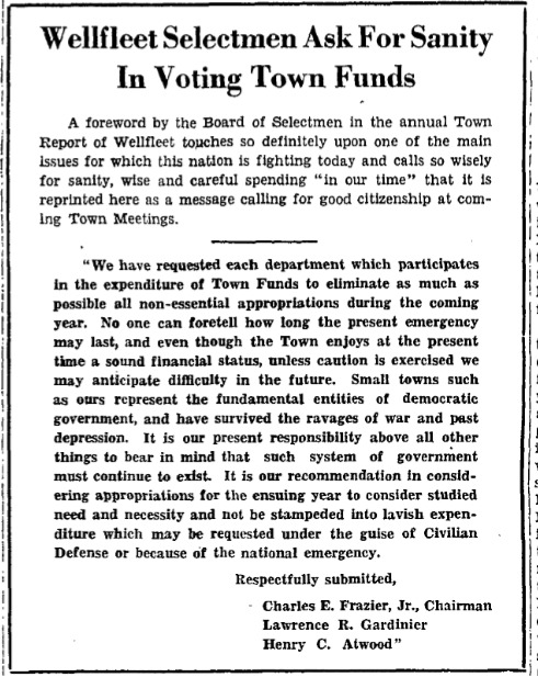
The American Legion was collecting old license plates; you could bring them to the South Wellfleet gas station or to Nickerson Lumber. Frazier complained that the telephone company was charging a monthly fee for the phone line the town had to install for civilian defense reporting. The annual meeting of the Massachusetts Selectmen was held in Boston. Wellfleet won the second prize for excellence of its Town Report. There was a special page in the report featuring a sketch of the new Town Hall, which the three selectmen paid for themselves.
The Wellfleet Board of Trade held its monthly meeting at the Congregational Church, with an excellent pot roast dinner prepared by the church’s ladies. Also invited were the 34 men of the Army Signal Corps, working at “High Head,” who were being housed at “Fort” Holiday House. President Austin expressed the town’s great concern about the upcoming season, mentioning the rubber shortage and the negative publicity surrounding the “submarine scare.”
Selectman Frazier spoke about the need for stronger advocacy for the return of passenger rail service. (Passenger service on the Cape has been in disruption since the 1935 bankruptcy of the New York, New Haven and Hartford Railroad, which had taken over the Massachusetts lines of the Old Colony Railroad, tried to shut them down, but was under orders from the Supreme Court to keep operating.) Frazier spoke of Wellfleet as an ideal place for women whose husbands were in the military to bring their children for the summer. Frazier, the Santa stand-in, thanked everyone who had donated to the Christmas party for 200, which made the cost far less than the previous year.
The Army Signal Corps men were asked how the town could help make their stay more enjoyable, and they requested that the movie theater be reopened. They would even pay full price. Henry Atwood, the owner, spoke of the trouble in priming the theater’s pump. Board of Trade members were encouraged to buy a few tickets each to help with expenses. The theater was in the old Lyceum building, next to the Congregational Church, pictured here.
Near the end of January, another meeting for representatives of several outer Cape towns was held at Wellfleet’s American Legion Hall to discuss railroad passenger service. There was a suggestion made that the towns consider a “railroad buggy,” a gas-powered railroad car to move passengers a short distance. As it turned out, service was not restored beyond Hyannis, and passengers had to switch to a bus to reach the outer Cape. There were five buses a day from Hyannis to Provincetown, the trip taking about two hours.
Late in January, at an event for 200 people at Wellfleet High School, 107 graduates of Civilian Defense courses were awarded their certificates. There were 23 Air Wardens, 17 for the Canteen Course, several for Motor Corps, and the remainder for Red Cross training. The instructors received a cash award and a handmade silver pin. The High School band played, and coffee and cake were served.
The Canteen volunteers made a chicken pot pie supper for the men at Holiday House, and then brought them to the high school basketball game, followed by a dance. The soldiers were also invited to an Open House at Mr. and Mrs. Cyril Downs’ home.
Before the end of January, many Wellfleet citizens went to the post office to buy their Car Tax Stamp, a green stamp that they paid $2.10 for, to display on their windshield or dashboard. The stamp covered the period from February to June 1942, and on July 1, the start of the next fiscal year for the federal government, the tax would be $5.00 for the year. This was a war tax for vehicle owners using public roads. The $2.09 stamp is pictured here. An additional one cent was used to send a postcard to the IRS to report the owner’s name and vehicle identification.
The State Rationing Administration announced that Provincetown, Truro, and Wellfleet would get one passenger vehicle tire each in February, a 30% reduction from January. Wellfleet and Truro would each get one truck tire, while Provincetown would get six. Drivers were warned not to speed, to save gas, and to take care of their tires.
At the February Town Meeting, it took extra time to assemble a quorum, and three teachers had to be brought over from the school. The 66 voters approved $71,588 in appropriations for the town and approved a slight decrease in the tax rate. There was the usual dinner at noon, and not much left to do after it. They voted to continue spending $1,000 per year to finish mapping the town because the process was identifying taxable property that was generating income. The town was described as encompassing 15,000 acres. (Today’s description of the town puts it at 13.200 acres of which 8,000 are in the National Seashore.) The Town Hall rebuilding was declared completed, and doing something with the second floor would have to wait until after the war. At the election a few days later, Frazier was re-elected with a wide margin, the only contested position.
The Board of Trade meeting discussed the train issue again; Frazier reported that there would be a daytime “Cape Codder” from New York to Hyannis, but no nighttime train. He was hopeful that the bus service from Hyannis to Provincetown would be improved; later, a schedule of five buses per day was established. The trip took about two hours.
Some of the machines at the Wellfleet curtain factory have been making bandages; Frazier wished for more defense work for the town, but machines to do the job are tough to get.
Mrs. Worthington of Fish Net Industries in Truro has started making fish net shopping bags called “Cape Cod Carriers” for women to save on paper bags and wrapping. They were on sale at Saks Fifth Avenue and Macy’s in New York.
The third Selective Service registration took place at “Boy Scout Hall” in Wellfleet on February 16th.
It was announced that Mrs. Downs and others have established a serviceman’s club on Main Street< on the “Freeman block.” In South Wellfleet, a legacy gift was made to the Library to purchase non-fiction books.
The Barnstable Patriot announced “The Cape Cod Plan” to promote a national spiritual awakening. Supported by Protestant, Catholic, and Jewish religious leaders, the Plan called upon individuals to pray in the morning, at noon, and in the evening, the following seven words: “Father thy will be done through me.” The Patriot also warned against criticizing the President, noting that he was the Commander-in-Chief to their sons, and they must respect him in order to serve their country.
The first “Practice Blackout” took place on Sunday evening, March 15th. The siren warning began at 10 pm, when all street lights were extinguished, and cars pulled over, turning off their lights. The all-clear sounded a half hour later. It was announced that a second practice would occur on April 7 at an unannounced time. During the April blackout, Wellfleet had five “incidents” to handle: three locations in town were bombed, and two cases of looting happened in two places, which civilian defense workers had to address. Frazier reported that the event was handled perfectly.
There was unease over an incident in which several windows at the Provincetown Light and Power plant were broken, a plant that had recently been placed under Coast Guard jurisdiction. Rumors circulated that it had been shelled, and even the Boston newspapers took up the investigation.
Word was out that gas rationing was coming, and the concern over summer tourism heightened. Wellfleet’s Frank Shay, now working in Washington for the government, reported that an authority had told him that cars on the road would diminish by 15% by October.
Mary Heaton Vorse was upset by The New York Times’s review of her new book, Of Time and The Town, in which Provincetown was described as having gone from a fishing village to a place of lawlessness, art, and literature.
People were advised on how to prepare a blackout room in their home with enough light so that basic functions could be carried out. There should be enough light to read or sew. Homes should have a light on the way to the basement so that the furnace can be tended.
The Town Hall flagpole was re-dedicated in Wellfleet. The pole was one that the town had dedicated earlier, near the old town offices. Selectman E.P. Cook had donated it, a mast salvaged from the 1912 wreck of the Quonnapowett off Wellfleet. The pole was moved to the new Town Hall, and Mr. and Mrs. Lawrence donated a new flag. The Lawrences were a retired couple living in Wellfleet, where Mary K. Lawrence’s father, Benjamin Witherell, was born.
In a move toward gas rationing, gas stations were limited to 72 hours per week; stations on the Cape were allowed to open on Sundays to accommodate visitors who might need to fill up before returning home.
In April, the Boy Scouts on the Cape participated in a Cape-wide practice of the age-old courier system, carrying a message from Provincetown to Camp Edwards in teams of two.
Orders finally came from the Army in late April that all homes and street lights visible from the water are to be blacked out under regulations designed to protect shipping that is in danger when silhouetted by shore lights. Initially, some thought the order referred to homes facing the ocean and not the bay. The Army clarified: if you can see the water from a window, that window must be blacked out. All outdoor signs were extinguished, and all street lights were dimmed or shielded.
The Coast Guard put out a warning to fishermen that objects found floating could be explosives and should not be picked up. Divers salvaged a sunken merchant ship near the Cape Cod Canal, retrieving cargo from India, including Persian lamb skins, Indian rugs, coconut and lemon oil, and badminton sets.
Sugar rationing began for commercial users in April, and for household users by May 1st. Every family had to register to receive Ration Book One of 28 stamps, which allowed one pound of sugar every two weeks. This was the country’s first rationing of a commodity.
In the middle of May, gas rationing began on the East Coast, a result of the U-boat sinking tankers that brought fuel from the Gulf of Mexico; the government hoped to buy time to establish overland delivery systems. By December, the whole country would be rationing gas. Cape Codders applied for gas rationing cards; the categories were A for most motorists allowing 3-4 gallons per week; B with sub-categories for essential war workers and those sharing the car with three passengers, allowed eight gallons per week; C for essential workers such as doctors, clergymen, police officers and civilian defense workers, allowed unlimited amount; and D for VIPS and other important person, unlimited gas.
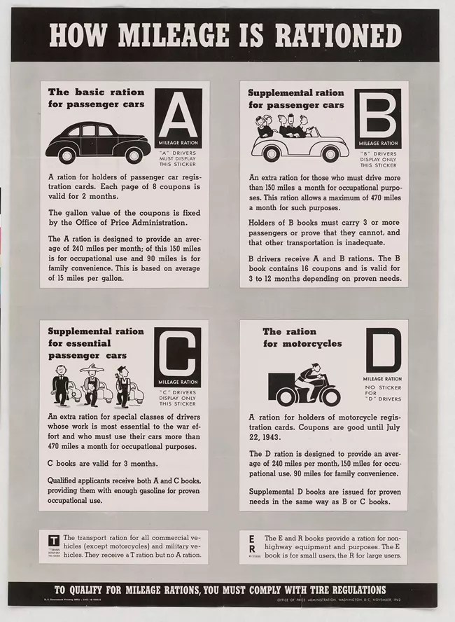
The Provincetown Advocate reported the number of Wellfleet residents who signed up, along with their categories; no Cs reported, but many Xs. Perhaps there was a mix-up. The numbers show how many cars were owned in Wellfleet at this time. Wellfleet A Cards: 58; 86 B cards, and 43 mysterious X cards with a total of 187. However, because there was no gas source in Wellfleet Harbor, some of this reporting may have covered obtaining gas for fishing boats.
Meat, coffee, and shoes would be rationed later in 1942 and in 1943.
On June 4, 1942, an event occurred at the Nauset Coast Guard Station that remained secret until after the war ended. A lifeboat with 20 men, exhausted and windburned, arrived after entering Nauset Inlet. They were from a British freighter, Mattawin, that had been torpedoed on the night of June 2, one of four lifeboats that got survivors to safety. The Coast Guard cut off all public contact while the men were cared for by local doctors and Red Cross workers who were sworn to secrecy. Nautical historian Eric Wiberg wrote about the event here.
Then on June 12th, four men left a German submarine in an inflatable and rowed to shore, landing near Amagansett on Long Island. By late June, the story was in the national news; the details are here. The fact that German spies had actually landed on the East Coast surely must have increased the actions of the U.S. Army in protecting the homeland, as actions for the remainder of the year would demonstrate.
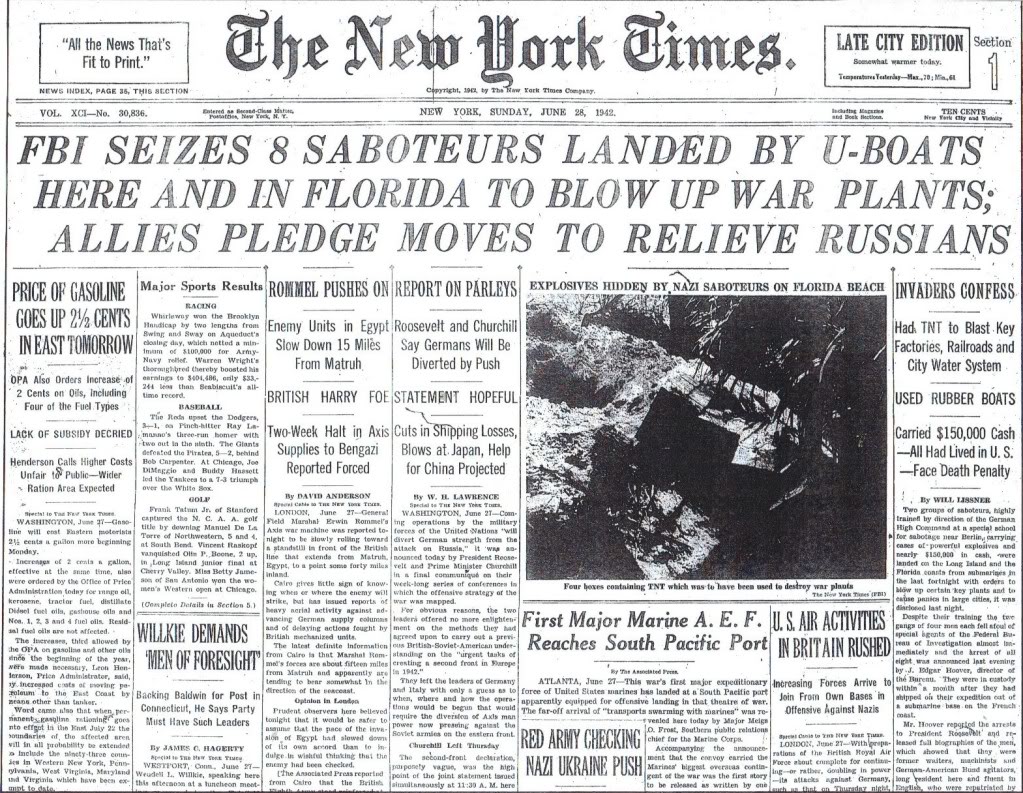
In mid-June, Charles Frazier left Wellfleet for Quonset Naval Station in Rhode Island, joining the U.S. Naval Reserve as a lieutenant in naval aviation, intelligence division. Admiral Turnbull of Provincetown had already been reactivated in the Navy. Truro’s fire chief and head of the Outer Cape Ambulance, Richard Magee, rejoined the Army Air Corps. He had been a pilot in the First World War.
An Eastham citizen, Warren Wilson, was reported as a casualty in mid-June; a torpedo hit his ship in the Caribbean. A Truro man, a Colonel in the Army Air Corps, was killed in the Far East.
The Provincetown Advocate announced that the U.S. Navy would be taking over the Provincetown Inn for Coast Guard training for 150 men. Both Provincetown and Wellfleet put out the word to collect the names of everyone serving in the military so that “walls of honor” could be created in each town before the upcoming Fourth of July celebrations.
The Wellfleet Board of Trade meeting in June was indecisive about planning events, as they thought hardly anyone would be there to participate. They finally decided to hold the Fourth of July parade and a formal dedication of the Town Hall, since the South Wellfleet Neighborhood Association had designed a plaque detailing the building’s history, and left a decision about the Town Fair for later.
On June 25th a significant event took place in Provincetown. The Provincetown Advocate reported the day’s events in great detail. Shortly before 7 am, the Civilian Defense Chair got a call from the Coast Guard to stand by for survivors coming ashore. All Civilian Defense workers, auxiliary police, doctors, and others trained in First Aid in the area were ordered to their posts. A hotel owner in the center of town opened his accommodation as a place to shelter the rescued people. The workers prepared the quarters, warmed sandbags, made soup and coffee, and assembled clothing items.
The event had happened “off the Back Shore” at around midnight, the night before—people as far south as Eastham had heard the explosions and seen bright flares. A “nest” of U-boats had torpedoed an American freighter and a passenger ship (unnamed). There was a loss of 94 men, including 14 American soldiers.
People came from their homes in Provincetown to watch the operation, standing grimly quiet.
From the late morning through the afternoon, ambulances, some created from beach wagons and trucks, brought the survivors from the wharf to the hotel. Late in the afternoon, Army, Navy, and Coast Guard officers assembled, and the bodies of two soldiers were brought in, placed in ambulances, and taken to undertakers. A group of additional ambulances was assembled, but there was no report of additional bodies.
The head of the Provincetown Civil Defense wrote his report, and it was printed in the newspaper with only a few redactions. He thanked the large group of volunteers who helped that day; the Canteen head, Mrs. Baumgarten, worked from the morning of the event until 2 pm the following afternoon.
This was the first Civilian Defense unit in the United States met the actual challenge of war.
1942 Part Two: Wellfleet in the War Years
Posted on March 14, 2026 by pamticeblog@gmail.com
This is the eighth post in a series about life on the Outer Cape during World War II.
There were no fireworks on the Fourth of July in Wellfleet in 1942. Instead, the Town had a longer parade that included military units from the Army Signal Corps and the Coast Guard from Cahoon Hollow Station. Frank Shay must have been back from Washington because he was one of the organizers. The parade ended in front of Town Hall, where 500 gathered for a ceremony. Prayers were read for the soldiers, the sailors, and the parents. Oliver Austin read the names of all those from Wellfleet who were serving in the military, and Mr. Paine, from Provincetown, dressed as Uncle Sam, penned their names on a scroll of honor. Later in July, three more young men were called up.
The Provincetown Advocate printed a denial on its front page that “the Atlantic seaboard is littered with bodies,” a rumor that Time Magazine, among other publications, had been circulating. The paper reported that Wellfleet, Truro, and Provincetown were peaceful, lovely, and enjoyable and that they were not under martial law.
In mid-July, the national head of civilian defense came to Provincetown to award the first citation to the workers who had handled the survivors of the torpedoed ship brought ashore on June 16th. There was a short ceremony: a scroll presentation, and lunch was served with clam chowder, lobster rolls, blueberry pudding, and coffee.
Women were now signing up for military service. Provincetown’s Katherine Young was the only Cape Codder to be chosen for officer training in the Women’s Auxiliary Army Corps. In six weeks, she would complete a tough training course to show “women could take it too,” and receive her second lieutenant bars with the class of 436 women who were the first ever to be commissioned.
At the annual meeting of Wellfleet’s Board of Trade, Wellfleet Associates, and South Wellfleet Neighborhood Association, the Sheriff of Barnstable County spoke to the groups, criticizing the censorship that “keeps the real truth from the people of Cape Cod so they do not realize the seriousness of the war situations.” He charged his audience to stay alert, noting that the Cape is a “logical place to land spies and saboteurs.” No doubt he was referring to this incident in June 1942 when German spies landed on Long Island.
At the same meeting, a lengthy discussion concluded that it was not appropriate for the town to hold a town fair and that some other effort should be made to raise funds for war work. Helen Hicks reminded the group that the men serving at the Cahoon Hollow Coast Guard station were no longer local men with homes nearby, and so they should be invited to Wellfleet homes for a “home-cooked meal, and home-surroundings.”
In late July, Oliver Austin Jr. was commissioned as a lieutenant in the U.S. Naval Reserve. He and his wife closed their greenhouse in Wellfleet and their two stores in Orleans and Provincetown. His father remained the owner and director of the Ornithological Station in South Wellfleet.
In late July, the Coast Guard clarified that picture-taking is allowed, but no photos of any waterfront location are allowed. The Peaked Hill Coast Guard station reopened. A liquor salesman in Truro was charged with illegally storing gasoline on his property; he was tried in August and fined $50.
Two more Wellfleet men were called up.
There was a surprise air-raid drill on the outer Cape in August; in Wellfleet, there was one staged incident: an imaginary bombing. The site was not reported. A canteen was set up at the Wellfleet Methodist Church for the workers.
Perhaps to use the energy he gave to the Wellfleet town fair, Frank Shay worked with the soldiers in the Army Signal Corps battalion stationed in Truro to produce an all-soldiers’ show. “This is The Army?” opened in Wellfleet on September 3, followed by shows in Truro and Provincetown on September 4 and 5. Frank Shay produced it and authored some of the sketches. One female role was played by Phyllis Dodd of Wellfleet. The soldiers were actors and vaudeville performers in their civilian lives. The show sold out, raising $1,000 for “items of comfort and entertainment not included on regular Army rations.” Frank Shay turned over all his rights to the material to the War Department.
In August, the U.S. Coast Guard took over the Provincetown Inn as a training site for newly recruited men, who underwent a two-week training program, 150 at a time.
The New England Rationing Executive announced that churches offering a church supper as a community event could get an extra allotment of sugar. Extra sugar would not be available for social events such as a bridge party, where ice cream and cookies were served.
In September, Wellfleet and other towns began accelerating their collection of scrap materials. The women of Wellfleet held leadership roles in the effort; Mary Freeman organized a house-to-house collection in October, telling people to set their donations outside, with a small American flag on top. Frank Payne of South Wellfleet contributed the cables and metal he had collected from the Marconi site.
After it ended, the summer season in Wellfleet was characterized as “dull.”
This was the year in the U.S. when Victory Gardens became popular. Massachusetts began urging people to grow vegetables at home during the winter, as half of the canned vegetables were expected to be used to feed the military and support Lend-Lease. A free course was offered in Hyannis. However, fertilizer was scarce, available only to people with home gardens, not for use on their shrubs and lawns. There was no reporting of growing vegetables in Wellfleet gardens, although I’m sure people did. Perhaps it was not worth commenting on.
Provincetown got a boost in the fall when NBC’s Maurice English, the chief editor of the network’s International Shortwave Division, broadcast the story of Provincetown in the war on the show “New York Calling London.”
In October, during the usual “gunning season,” the Army issued the Coast Guard regulations governing the areas where waterfowling was allowed. On the outer Cape, no shooting could take place on the Back Shore, and in only a limited area on the bay side. All hunters had to get identification cards issued by the Coast Guard.
Looking ahead to winter, Cape Codders were told they should switch from oil to coal for heating if they could. It was also announced that rubber boots would only be sold to people with jobs that required them. Massachusetts set the speed limit at 35 miles per hour, and the Cape bus schedules were adjusted accordingly.
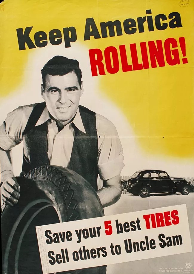
In October, after the business portion and dinner of the Wellfleet Board of Trade meeting, Wellfleet citizens were invited to watch three war films. It was still too early for the Frank Capra propaganda films of the war; the films that night covered life aboard a U.S. submarine, the life-giving properties of vitamins, and how a modern bakery makes bread. At the meeting, the Board of Trade appointed someone to keep a card index of all those serving in the military and voted to give each one a subscription to the Provincetown Advocate for Christmas.
Late October brought good news: the scallops returned to Wellfleet, and there was “hard cash” coming into town from the 15 boats engaged in the business, with eleven boats carrying two men each, and four boats with one man. Each man was allowed ten bushels per day. George Rogers handled gas rationing at the Town Hall and reported the numbers.
There were two warnings about rationing and dim-outs: beginning in late November, sugar rationing books would be used for coffee rationing, and new regulations would be announced requiring painting or taping the top half of your automobile’s headlights. Perhaps for those complaining about the coffee rationing, the rationing board said, “Our sailors risked their lives bringing coffee to us from South and Central America.”
In the November 3 election, Wellfleet voted overwhelmingly in favor of Governor Saltonstall’s third term. The voters also kept the town “dry” by voting No on three referenda to license all liquor, beer, and wine. They voted against referenda on horse and dog betting. But they voted for birth control, a referendum that exempted “certain contraceptive activities” from criminal penalties. However, the state of Massachusetts voted down the birth control referendum.
On Saturday night, November 28, Boston’s Cocoanut Grove fire occurred, killing 492 people. Private John Curtin of Eastham, stationed at Camp Edwards, had taken his wife there; she went to the powder room, they were separated, he escaped, and she did not.
On the night of December 3rd, gale-force winds came up, beaching two of Wellfleet’s scallop boats.
A practice blackout was announced for some time between December 4 and 8. The signals were reviewed ahead of the event so people would remember what to do. The “Alert” was three short siren blasts, followed by one long siren blast. The “Alarm” was a short signal for three minutes. The “All Clear” was a long blast, or the tolling of bells. Simultaneously, at this event, Army troops in vehicles dressed in field uniforms and helmets would “feign destruction of vital installations protected by State Guardsmen.” The actual event occurred at 6:30 am on Sunday, December 6. Lawrence Gardinier pronounced the Wellfleet event as successful. Mr. Gardinier, aided by the Army, chased a “paratrooper enemy” to the Eastham line. Mr. Kemp handled two other unspecified events.
In mid-December, the regional director of the Cape and Islands Region 7 civilian defense area announced that a new phone number, Hyannis 10,000, was available for reporting any enemy activity. There would be no charge for the call. Residents were warned not to report morals, personal feuds, or short weight on pork chops, but to report fires, signals, flares, suspicious landings, wreckage flotsam, parachutes, submarines, mines, or torpedoes. They were warned not to investigate, just report, and not to talk about it. The reporting system was captured in a poster, pictured below. (One of these posters sold for $2300 in 2023.)
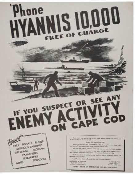
The year ended with a major snowstorm that stranded some Wellfleet residents in “outlying” areas. Jack Hall used a horse and sleigh to move his wife and young child off Bound Brook Island. The Cahoon Hollow Coastguardsmen rescued families isolated in the north Wellfleet woods, bringing them to Gull Pond Road. Edwin Dickinson had to walk two miles with a sled to get supplies. This storm story was featured in numerous Massachusetts newspapers.
1943 Part One: Wellfleet in the War Years
Posted on March 17, 2026 by pamticeblog@gmail.com
This is the ninth post in a series about life on the Outer Cape during World War II.
In January and February 1943, the story of a U.S. Navy antisubmarine patrol featured one of Wellfleet’s own: Wallace Pierce, Ensign, who was a part of the ten-man crew. In 1942, during the Battle of the Atlantic, an American airman signaled “sighted sub, sank same,” providing a morale boost to the battered Americans, even though the submarine was not sunk that time. Now, there was a story that, indeed, a submarine was sunk, and the Navy must have wanted the story posted widely to help cheer Americans.
Wellfleet’s Wallace Pierce was photographed with the crew at the British Ministry of Information in London; he also appeared on a British broadcast that his family and friends heard in early February, and The Boston Globe ran a detailed story about how the crew found and sank the U-boat. The crew’s base of operations and the location of the sinking were, of course, not disclosed.
In mid-January, a Coast Guard Auxiliary Flotilla was organized for Wellfleet by fisherman Wilton Hopkins, commanding the group. Joining other flotillas all around the Cape, this group would assist the Coast Guard with Wellfleet Harbor and inshore patrols, freeing up Coast Guard time for deep-water work.
In the 1940s, doing laundry was hard work for women. Few people had washing machines. Accordingly, when Acme Laundry in Chatham announced it would only do laundry for Army officers and others at Camp Edwards, there was outrage. Cape Cod Hospital also used Acme. The Cape’s Congressman got involved. It appears to be a complicated story about the two laundries in Chatham and Yarmouth, about how the Army did not include laundry facilities in the original plan for Camp Edwards, and about a new entity, “Defense Laundries, Inc.,” that displaced local customers. It took about two weeks, but the situation was remedied, and life continued on the outer Cape in the winter of 1943.
The U.S. Coast Guard announced recruitment for SPARS, the women’s reserve. It offered work at $40/week, a four-month training program, and a “smart Mainbocher-designed trim blue uniform sporting the Coast Guard insignia.”
Provincetown’s Katherine Young was now a Captain, assigned to the second WAAC Training Center in Daytona, Florida, where she was in charge of publishing the Daily Bulletin. The women assigned there were understudies for male officers, “preparing for the time when the WAAC would be completely run by women.”
In January, it was announced that the schools in Wellfleet would be closed for February to save on fuel oil. There would be no spring break in order to make up some of the time.
A woman applied to be a member of the Truro Highland Fish and Game Club, which had many Wellfleet members. The Club’s members were steadfast in saying no to the request and suggested that women form their own auxiliary.
Two Wellfleet women reported for duty at Camp Edwards’ Army Nurse Corps.
The Wellfleet women who sewed for the Red Cross reported finishing 45 garments and 75 surgical dressings in February. They moved their meetings to the parlor of the First Congregational Church and held them on Mondays.
The Wellfleet Town Meeting in February was “dispatched with speed and good feelings.” After it took a while to assemble a quorum for the 10:30 am meeting, it was decided to move the time to 1 p.m. in future years. Those who worried about losing the traditional lunch-time “church supper” were assured that a meal would be served in the early evening. The voters decided to continue the survey of town properties because it was identifying untaxed land that could be added to the tax rolls. The Selectmen were authorized to sell property taken through a tax title procedure.
In mid-February, residents of the outer Cape were given detailed instructions in the Provincetown Advocate on how to apply for their Ration Book Number Two. The application process in Wellfleet was planned to take place at Town Hall, with teachers handling the paperwork, under the direction of the Wellfleet High School principal. Applicants were reminded to bring Ration Book One and to complete the declaration form for each family member on a single form. For coffee and canned goods, people were instructed to enter only amounts exceeding the permitted limits.
For coffee, as of November 29, 1942, each person over 14 years old is allowed one pound on hand, so the new form requires only the excess. For canned goods, each person is permitted five cans of eight ounces or more. Cans under eight ounces and home-canned goods are not counted. In the same issue of the paper, an advertisement for a market in Provincetown noted that no canned goods could be sold between midnight on February 20 and March 1, when rationing goes into effect.
The Wellfleet Board of Trade announced a War Bond Rally for February 22. There would be films, including an afternoon matinee for children and an evening show for adults, as well as a minstrel show. Everyone who bought a bond between February 15 and 23 would be admitted free of charge.
War Bond sales were a massive government campaign to finance the war, using extensive propaganda and targeting one town against another in competitive races.
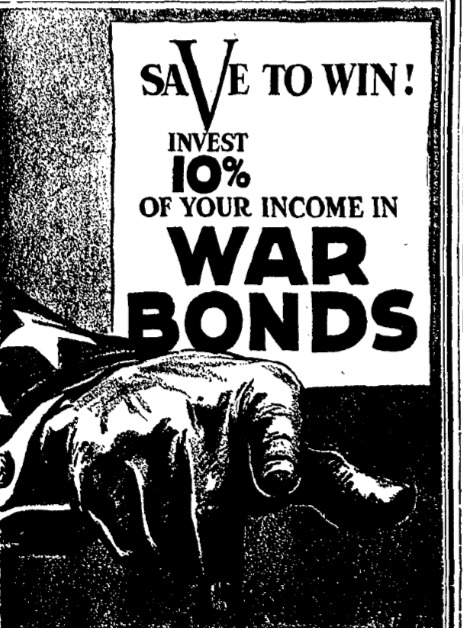
Wellfleet High School Principal Cochrane announced a High School Victory Corps. Both boys and girls were to be trained “to participate in the war effort more effectively.” Their course would include physical and military training, trade school courses, and opportunities for community service.
In late March, just a few lines in the Provincetown Advocate announced that an Anti-Aircraft Range had opened in Wellfleet, a part of the Camp Edwards operation. “It is a major AA training center and the new installation provides facilities for firing, bivouac, and tactical maneuvers for three full battalions.” The Standard Times of New Bedford described the range as offering a “perfect to-mile firing line” and the heavily wooded section suitable for troops testing field problems and maneuvers.” Brigadier General M.C. Handwerk was the Commander. Regular newspaper warnings began about dangerous areas off the coast of South Wellfleet during artillery firing.
Three battalions of men would put between 2,600 and 3,000 soldiers in Wellfleet. Later reports in November said there was one full battalion, or 821 officers and enlisted men assigned to Camp Wellfleet.
Under the South Wellfleet Neighborhood Association’s oversight, space was provided at Pond Hill School for soldiers to relax, read, and write letters. The building housed the South Wellfleet Library and was the site for community suppers as it is today. Miss Dooley of the Association was mentioned in news reports about the Camp in 1943 and 1944 for their work caring for soldiers. The Association asked local people to contribute games to help in their work.
A representative of “Massachusetts State College” came to Wellfleet and many other Cape towns in mid-April to teach people how to can meat and fish. The class was held at the “Community Building” next to the Curtain Factory. Home food supplies could be increased by raising chickens, pigs, rabbits, and squab.
The Wellfleet Board of Trade had its annual “Ladies Night” event in April, honoring Mary Heaton Vorse for her recent book, Mrs. Marie Echeverria for her Red Cross work, Francis Holbrook for his lifetime work in the town, and Frank Payne for his “courageous work” on the Wellfleet Rationing Board.
The Provincetown Advocate reported in May that three truckloads of soldiers from South Wellfleet drove into Provincetown for a short visit. The men were reportedly cold and hungry, and were living in pup tents at the anti-artillery base. They shopped at the Burch Bakery and went to the Atlantic House, “eating like 17-year locusts.”
People from Provincetown were watching a formation of planes off the Back Shore when one crashed, killing a young Navy radioman. The pilot parachuted out and was picked up by a fishing boat.
At the Wellfleet Board of Trade meeting in May, Andre Vulliet, a Wellfleet homeowner and the Director of the French Information Center in New York City, spoke about the French Vichy government and the military operations in North Africa. His office had recently been taken over by the Office of Strategic Services, the precursor to the CIA, and was moved to Washington, D.C.
In mid-May, all the civilian defense workers on the Cape were warned that the U.S. Army planned a Cape-wide surprise invasion maneuver, and they were to call in what they observed to the Hyannis 10,0000 number.
Wellfleet’s beloved doctor, Clarence Bell, died on June 6, 1943. His practice in Wellfleet opened in 1908.
In late June, the good news was announced that the Cape Cod Steamship Company’s steamer Steel Pier had been permitted to sail between Boston and Provincetown daily, with gasoline usage approved. The Coast Guard helped bring it back into service after a 1941 break, because the 1650-passenger ship could also be used to move men and supplies, saving truck trips. Another part of the good news was that there would be a bus service from Provincetown to Wellfleet and back each day, providing another way for outer Cape residents to reach Boston.
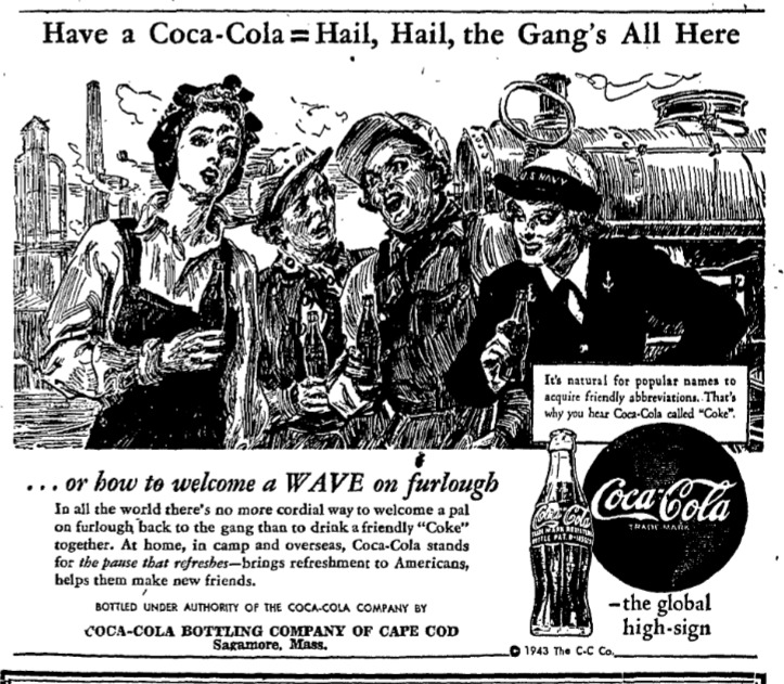
A note about working Wellfleet women
This advertisement featuring working women helped me realize that I had not mentioned the WWII phenomenon of women working. Did the War change the jobs that Wellfleet women could find? In 1942, an article in The Barnstable Patriot quoted a Massachusetts Director of Employment Services as urging companies to consider hiring women, as “women’s fingers are nimble and their brains are agile and receptive.”
I was surprised when I looked at the 1940 federal census pages and saw how many Wellfleet women held jobs outside the home. In fact, it made sense. Wellfleet was emerging from the Depression years, and Wellfleet men had jobs fishing, in a few government positions, in stores and other businesses, and supporting summer tourism. Women needed to work.
In the 1940 census, the largest employer in Wellfleet was the curtain factory, which employed sixteen women, some of whom were part-time. The next most popular job was “housekeeper in a private home,” listed by thirteen women. One woman said she took in laundry in her home. The town had four teachers, two librarians, three telephone operators, and one cook in a restaurant. Seven said they were “salesladies” in stores. Six were employed in their own family businesses — one as the proprietor of a shop, another in her own restaurant, two managing the family’s summer cabins, and one, Mrs. Austin, with responsible roles in the greenhouse and garden of the Austin business. There were four “practical nurses,” one registered nurse, and one school and district nurse. There was no opportunity on the Outer Cape to take on a “Rosie the Riveter” role.
Did Wellfleet women move off-Cape to find jobs? That question is more difficult to answer. In the “personal notes” section of the newspaper, in articles about what people were doing, the Wellfleet column often mentioned young women returning home from college, getting engaged, and marrying. Only one I recall, Helmi Lee, attended business college in Boston and then had a job “in business” there. There may have been others.
A few Wellfleet women joined the military: the Army’s WAACs began in 1942, followed by the Navy’s WAVES and the Marines. The Coast Guard SPARS followed in early 1943. Women were in non-combat roles to support the war effort. The Wellfleet Honor Roll (to be described in the upcoming Post-War note) names eight women who served in the Army and three in the Navy.
1943 Part Two: Wellfleet in the War Years
Posted on March 19, 2026 by pamticeblog@gmail.com
This is the tenth post in a series about life on the Outer Cape during World War II.
The Wellfleet Fourth of July parade had no gas-powered vehicles this year because of the rule prohibiting automobiles for pleasure drives. Jack Hall, dubbed “The Laird of Bound Brook,” led on a white horse. The parade concluded with a ceremony in front of “Colonial Hall,” a label still in use for the Town Hall, with a speech by Congressman Gifford, and an original song written and performed by Martha Atwood Baker, Wellfleet native and the “Cape Cod’s only Metropolitan Opera prima donna.”
One of the units marching in the parade was the Wellfleet-Truro company of the Massachusetts State Guard. When the Massachusetts National Guard was federalized, the state began a State Guard, and soon many towns had a State Guard Company. Wellfleet and Truro combined their efforts, though this sketch pictured below shows the unit in Wellfleet. Selectman Lawrence Gardinier served as the Captain. High School Principal Cochrane served in the unit.
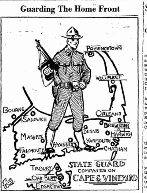
In July, urgent messages urged people to save and donate two items: tin cans and “kitchen waste grease.” The Provincetown Advocate took time to explain why. Tin cans were to be flattened, with the top and bottom inserted, before you stamped on them. The can “could save two lives,” as the tin would be used to make surrettes, small vials containing morphine, attached to a hypodermic needle. A wounded soldier could use the morphine himself to counteract shock and to relieve pain for ten to fourteen hours, thus arriving at a field hospital in better shape. In Wellfleet, the tin cans could be dropped at Mr. Daniel’s store.
Like every other town in Massachusetts, Wellfleet was assigned a quota for waste fats: 166 pounds. The fat was to be saved in a clean metal container and taken to the butcher. The waste was a source of glycerine used in many items needed for the war effort, including paint, medicines, and nitroglycerine for explosives.
In mid-July, a plane “on a training mission out of Camp Edwards” crashed into the ocean off Wellfleet, killing the pilot who stayed in the plane trying to land it. Three men parachuted out, one landing on shore, and the Coast Guard picked up the other two.
Wellfleet announced the formation of a committee to determine how to memorialize Dr. Clarence Bell. They planned a new building, knowing it could not be built until after the war, which would be either a library or a health center. The town would vote on the project.
On August 2, news broke of the purchase of land for a Boy Scout camp in Wellfleet. The Worcester Scouts made the purchase. This camp was on Duck Pond and is now labeled “the former Boy Scout Camp” when it was part of the Wellfleet Conservation Trust’s annual walk in 2019. The Scouts labeled the site “Treasure Cove.” It was shared with the Cape Cod Council of Boy Scouts. In October 1943, the Cape Council received a donation of 150 acres for a camp in Yarmouth.
August brought the sad news of three young women campers losing their lives. On a Friday, three canoes with two campers and one counselor each left from Camp Nobscusset in Dennis to paddle to Provincetown. The wind came up, the water in the bay became choppy, and one canoe was upturned, causing the drowning of three girls. Two bodies were found on the following Sunday, one in South Truro and one on Great Island in Wellfleet. A search continued the following week, with Coast Guardsmen, Boy Scouts, and others searching the shore. Finally, on Thursday, the last 12-year-old was found on the beach in Brewster. The camp was closed permanently.
In mid-August, the Commander of the Eastern Defense Command and First Army issued stricter regulations prohibiting the use of cameras and sketching along any Cape Cod shoreline. Anyone violating the rules was subject to a one-year prison term and a $5,000 fine.
Two hundred blackfish went ashore in Eastham. Eleven men worked through the night to remove the melon from the head, thus capturing the oil that was shipped to the processing plant in New Bedford.
Popular High School Principal Richard Cochrane announced his departure to become the principal of Sherburne High School. Mr. Duarte, a math and science teacher at Provincetown High School, was designated as his replacement. The Methodist Church held a reception for the Cochrane family.
Wellfleet women were included in an appeal from a Provincetown woman to send her their “cheap” jewelry, which could be used by soldiers in “South Seas Islands” as payment to local people who would dig foxholes and help move wounded soldiers.
On September 8, 1943, Italy unconditionally surrendered. The news reached the Provincetown Advocate at around noon that day, and the paper posted it on a board outside their office. Visitors who often lacked radios could see the news, and the town’s overall mood was cheerful. Of course, unknown at that point was that Germany would occupy the north, and the Allies the south of Italy, and more fighting would continue. Governor Saltonstall sent a message to all the Massachusetts local governments that churches should ring their bells or other signals could be used to acclaim the event.
At the Wellfleet Board of Trade meeting in late September, the Army announced that its engineers would build a “modern sewerage system” for Camp Wellfleet, and that waste would not be discharged into the ocean, as initially planned. Congressman Gifford led the negotiation.
An Army Chaplain who had served for two years in the Pacific and was now assigned to Camp Wellfleet addressed the Board on the work of Army chaplains. He described how loneliness could become a disease. He discussed the concerns soldiers have, ranging from global security to fears that “women will be more interested in business and industrial work than in cooking, sewing, and making homes.”
The meeting also included a discussion of using the town’s fire siren to give the location of a fire. Selectman Gardinier opposed this because people tended to get into their cars to go to the fire, which interfered with the firemen. He also reminded the group that the siren signaled air raid alerts and was used to call out the State Guard. The group decided to leave the fire location known to the telephone operator and planned a meeting with the telephone company to discuss the procedure to be followed.
In the summer and fall of 1943, letters published in the Provincetown Advocate by soldiers and sailors described their experiences, of course, without specific locations. The letters had usually been received by a family member who chose to share them. In the August 26 issue, a soldier wrote about fighting in Sicily and the ants they had to endure while sleeping. In the September 23 issue, Navy Master’s Mate 2 wrote about how he felt when he heard that the Coast Guard cutter Escanaba was sunk in the North Atlantic with the loss of 100 men he had served with, as part of a storm-tossed voyage from Argentina to Britain.
In early September, Wellfleet people expressed their hope for a successful scallop season, as the past year had been. A good year brought $75,000 into the town. The editor of the Provincetown Advocate commented in an editorial that Provincetown could also have this success if the harbor were cleaned up and the sewage from homes on the shore were captured instead of washing into the bay.
In early October, Isaac Paine, 77 years old, of South Wellfleet, died of burns he suffered when he attempted to extinguish a fire that destroyed his barn. He died at the hospital in Hyannis. Mr. Paine, known as Ikey, was the subject of an earlier blog post.
In October, another plane went down, this time in Cape Cod Bay, a “routine training flight” out of Squantum Naval Air base, with five British airmen losing their lives. For a few days, aircraft, including a blimp, searched the water for survivors. Wreckage from the plane was found by a dragger and brought to Provincetown.
Cape hunters were apprehensive about the hunting and shooting season due to ammunition shortages. Waterfowl, rabbits, and deer each had specific weeks designated for hunting. The Coast Guard continued to process identification cards for hunters and shooters. In December, a Wellfleet visitor shot a 150-pound buck.
There were additional reports of blackfish coming ashore. About 20 blackfish came ashore in Blackfish Creek after a flotilla of boats worked to prevent many others from washing up. Then another 140 blackfish came ashore in both Wellfleet and Brewster. These were harvested for their oil.
The Coast Guard closed its training center at the Provincetown Inn, but news reports indicated that the Navy and Air Force might be using the facility to house ground crews.
Wellfleet got a new doctor, Dr. Reuben Marvel, an old friend and classmate of Dr. Bell. Wellfleet’s new minister at the Congregational Church, Reverend Lynn Townsend, and his wife learned of the death of their son, Robert, a marine, in the South Pacific.
In mid-October, The Yarmouth Register reported that the Army engineers had issued two $200,000 contracts to two contractors to build housing at Camp Wellfleet for enlisted men and officers.
Later, in the Provincetown Advocate, the building program at Camp Wellfleet was expected to be completed by mid-November. The site was also called the “Camp Edwards Anti-Aircraft Artillery Training Center.” There were seventeen barracks buildings, five mess halls, four administration buildings, and other structures, forty-one in all, meant to serve a whole battalion. (Had the men been in pup tents since the opening in late March? — a local historian read this and sent me a note — YES, the men were in tents all those months.) Early reports on the Army’s training sites had made it clear that the American people wanted their soldier sons to be adequately housed.
The Army Air Force civilian observers in Provincetown recently discontinued their 24-hour operation, and all 75 volunteers who maintained the 24-hour watch received pins to commemorate their service. The watch post was first at Beach Point and then at Standpipe Hill.
In early November, 734 copies of Ration Book Number Four were issued in Wellfleet. The first stamp in the book, pictured with an airplane, was for one pair of shoes. The Green stamps, A, B, and C, were for jams, jellies, and fruit spreads. Stamp 29 was good for five pounds of sugar until January 15, 1944.
There was a shortage of turkeys for Thanksgiving, so many people ate chicken instead. Perhaps this was when Jack Phillips and Hayden Walling began raising turkeys in small structures along the pond in North Wellfleet. The two may have undertaken this task because it would make them part of the food production industry and thus eligible for more gasoline. The tales of the bohemians in the Wellfleet woods would be told many years later.
In December of 1943, Frank Rose of Wellfleet was in charge of loading Provincetown sand onto boxcars, some 1500 each year, that were shipped to various industrial users, including the railroad itself. Provincetown sand was a valuable commodity from the 1920s through the 1960s.
The year ended with a report of 55,700 tons of paper collected on the Cape, 1,100 pounds in Wellfleet, and a reminder to save all Christmas wrapping paper for the next drive. The tin can collection mentioned earlier was successful, with 13 tons of tin cans shipped by freight car off the Cape in late December.
1944: Part One: Wellfleet in the War Years
Posted on March 22, 2026 by pamticeblog@gmail.com
This is the eleventh post in a series about life on the Outer Cape during World War II.
The winter of 1944 was relatively uneventful in Wellfleet, with a sense that people were just hanging on, trying to keep things going. Charles Rich, who had challenged others running for Selectman, announced his challenge to Selectman Henry Atwood. Two Wellfleet women, Mrs. Henry Atwood and Mrs. Earl Rich, announced they would serve as Den Mothers for a new Cub Scout troop. They planned to raise funds for uniforms by collecting and selling scrap paper. Wellfleet successfully met its quota for the Fourth War Loan. Even so, they planned a War Bond Rally at the American Legion Hall on January 31.
The U.S. Army issued orders lifting regulations on shielding street lamps, a sign that U-boat activity in the North Atlantic was easing. Later accounts of the Battle of the Atlantic would cite the development of radar as one of the principal reasons the Allies were able to win the battle. Radar systems on escort ships and aircraft could detect surfaced U-boats even in the fog and at night, preventing them from operating in certain areas. Later, when the atomic bomb was revealed, its development was discussed as the principal reason why the Allies won the war, but others would name the development of radar as equally important.
Equally important to radar was the breaking of the Enigma codes, a story that was covered in the 2014 film The Imitation Game. An article in Cape Cod Life Magazine in 2015 told the story of the sailors at the Marconi Station in Chatham, where a code-breaking operation was situated. Today, that site is the Marconi-RCA Wireless Museum.
Wellfleet representatives attended a meeting in Boston to press the state for the highway project, continuing the advocacy that Selectman Frazier had begun in 1939. The Massachusetts Commissioner of Public Works later confirmed that there would be no federal funds to improve Route 6 from Wellfleet to Provincetown, noting that the road was not part of the state’s “strategic” road system.
In February, the rationing system changed, with red and blue “pennies” issued as change for specific ration stamps. Ten coins of vulcanized fiber board equaled one ration stamp. It was thought that the coins would be helpful when a child went to the store, rather than giving the youngster a whole ration book.
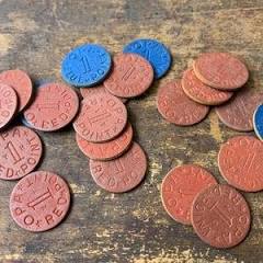
The Board of Trade decided to issue a monthly letter to the Wellfleet citizens serving in the armed forces.
Joseph C. Lincoln, the prolific Cape Cod writer, died in March.
On April 3, sixteen-year-old Warren Hopkins, who lived with his parents off Lecount Hollow Road, was injured when he tried to take apart a “practice bomb found near his home.” The report in the Provincetown Advocate explained that the U.S. Navy dropped these bombs from planes, aiming at a target on the beach. Each consisted of a heavy-metal casing containing an explosive that emits a burst of smoke when hit. Young Hopkins was injured on his face and right hand and was brought to the hospital in Hyannis.
In 1944, the U.S. Navy obtained a permit to use a portion of Camp Wellfleet’s property as a temporary bomb target. The incident caused additional warnings to fishermen and others not to touch mysterious objects found on the beach or in the water.
In April, the Wellfleet Board of Trade held its annual “Ladies Night” meeting, a chicken pie banquet. The group decided to honor its members serving in the military by inviting their wives to the event. The honorees included Lt. Oliver Austin, serving in the South Pacific, Lt John Worthington of the Army Ferry Command, Lt. Charles E. Frazier, Jr., with the U.S. Navy in Kansas City, Major Stuart Hamilton with the Army Medical Corps in North Africa, and Sgt. Edwin Hill with the Army Engineers in the South Pacific. They included Paul Chavchavadze, serving with the American Red Cross in England. The event also mentioned men serving in the U.S.: Franklin Lane, Kenneth Paine, Wilfred Trahan, and Norman Young.
The Board of Trade sent messages to each man, pledging to “Keep things going in the good old Cape Cod way, making no changes before their return, and helping to fashion a post-war world more to our liking in which your sons will not have to go to strange lands to fight the things they hold dear.”
Frank Shay reported at the meeting that Wellfleet had more than doubled its metal-collection goal during last fall’s drive, collecting 127,000 pounds, and that a new drive would be held in August.
Major Calvin Leek, Camp Wellfleet’s Commanding Officer, spoke to the group about Army rations, explaining the differences between rations served at the peacetime, garrison field level, C, K, and Philippine levels. He assured the audience that every U.S. soldier was getting the right food to stay in “the pink of health.” He discussed how the Army equips its soldiers and the significant challenge of producing clothing for a wide range of sizes and climates. He showed a training film that teaches men how to avoid booby traps and anti-personnel mines. He demonstrated the Garand rifle. A group of enlisted men from Camp Wellfleet entertained the group with a skit and music.
The Barnstable Patriot reported that more than 500 people on the Cape wanted telephone service, but there was insufficient equipment available due to the war. Later in the year, the paper reported that 238 phones, or 65% of all the phones, needed repair in Wellfleet.
The Patriot covered the closing of the Teacher’s College in Hyannis, a decision the outer Cape towns protested. Another story covered Northeast Airlines’ plans to begin service linking Boston, Provincetown, Hyannis, Oak Bluffs, and Nantucket.
On a Thursday in early May, 200 Wellfleet citizens were invited to Camp Wellfleet for tours, as a way of thanking them for their kindness and thoughtfulness as neighbors of the Anti-Artillery men and officers. The 571st Anti-Artillery Battalion demonstrated the Army’s half-tracks, armored vehicles with wheels at the front and tracks at the rear. The visitors were divided into small groups and taken around “the finest installation in the land” to inspect all the buildings: administration, enlisted men’s barracks and recreation hall, “developing and computing rooms,” officers’ quarters, and the post exchange. As the Provincetown Advocate described the tour:
They were taken by motor convoy to the firing point where the deadly “tracks,” most mobile of the anti-artillery weapons, put on an exhibition of firing. Poor weather prevented the planned shooting at target sleeves, but in their stead, whizzing rockets and land-based targets were utilized to show the potency of the multiple machine guns.
The group was then allowed to inspect the half-tracks at close range.
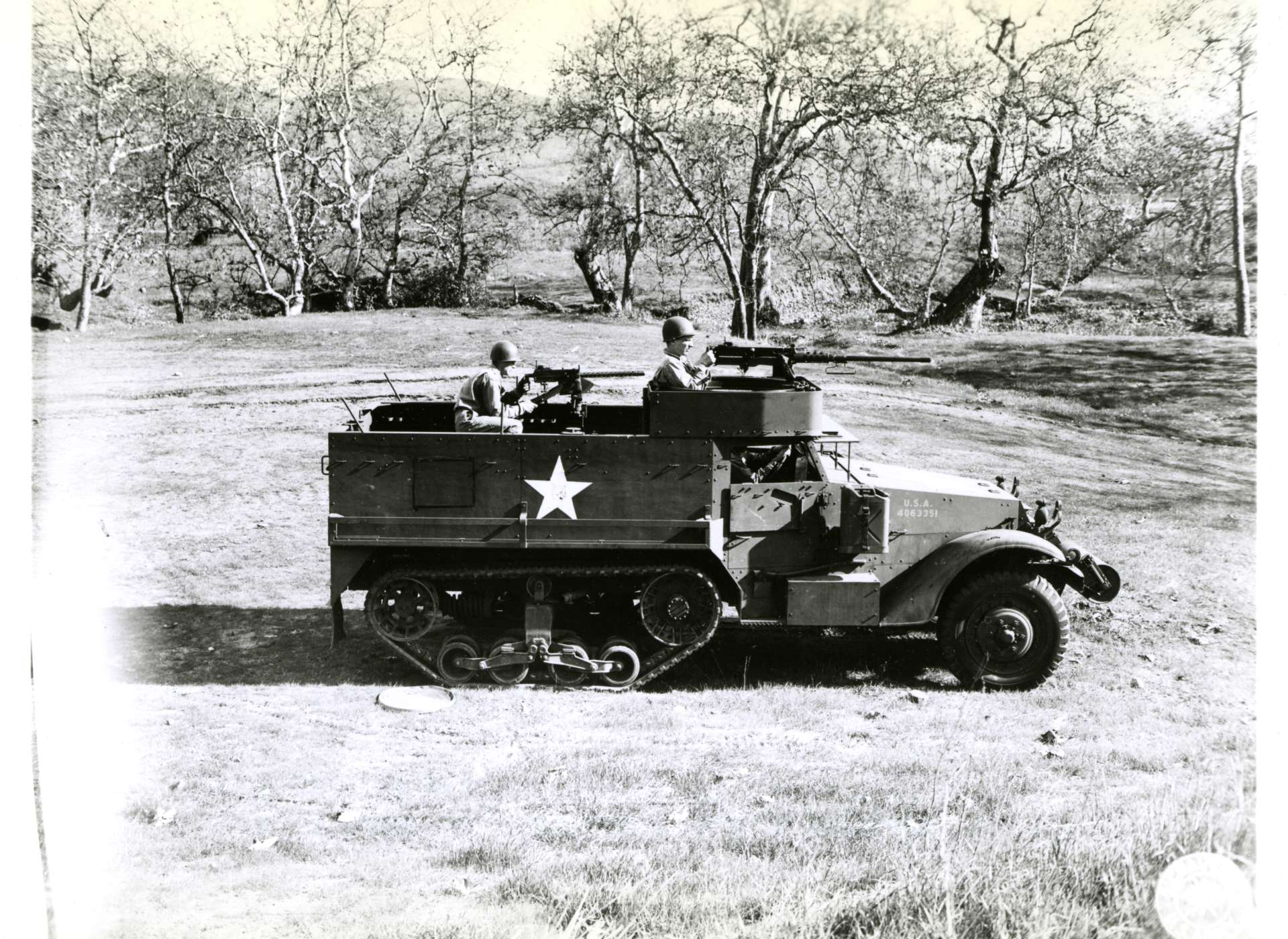
At the Wellfleet Board of Trade meeting in May, after a meat loaf supper, the Board heard from Selectman Jacob Horne, who also served on the Wellfleet Ration Board, that the town was not getting its fair share of meat. He said that Orleans and Provincetown were getting more. Two chain stores in town had decided not to offer meat because its profit margin was low. Harry Bachelder, owner of the Trading Post, said he had tried to start selling meat but could not obtain supplies from meat packers because his store had been exclusively a grocery store since before rationing began. It was reported that the Wellfleet Market was receiving only one-fourth of its usual meat supply. There was concern that the “thousands of summer visitors” needed to be served. The group decided to take their case to the Office of Price Administration in Boston, and perhaps to Washington, D.C.
Chester Bowles, the OPA Administrator in Washington, wrote to the town explaining that he could not help with their meat supply problem because he had no control over stores that chose not to sell the product.
The group urges the town Selectmen to have the signs around town repainted for the summer season and to plant flowers at the town entrance.
Three Navy airmen were lost a short distance off Provincetown during a practice run at crash diving when their plane failed to pull out of a dive. They were based at Quonset Naval Air Station in Rhode Island. Quiet groups of people gathered near the pier to witness the transfer of the bodies from the rescue vessel to the Navy ambulance.
Wellfleet High School received its first movie projector, made possible by funds from war-salvage materials. The high schools also contributed from their class funds. The Superintendent of the Outer Cape Schools spoke at the Board of Trade’s meeting, explaining how teaching would now use film, a technique the U.S. Army had developed for its training programs. The group watched several movies made by the U.S. Government, including “Prelude to War,” showing the history of Nazi, Fascist, and Japanese plans for world conquest. They also watched a film explaining the development of diesel power.
On their regular Thursday publication date on June 8, both The Barnstable Patriot and the Provincetown Advocate covered the reaction to the news that D-Day had begun on June 6th. The Patriot wrote that all the churches had opened their doors so that people could come in to pray. Some rang their bells when the news came that morning. The churches in Provincetown had special services for the Navy men stationed there. The Advocate said that the invasion was a “prelude to a chapter that might have much heartbreak.”
In June, Vice-Admiral Waesche predicted that the lighthouses on the Cape would no longer be needed because radar would replace them. The Highland Light was described as “dimmed so that it hardly winks.”
The Army’s Eastern Defense Command announced in June that cameras would be allowed on Atlantic Ocean beaches, but no military installations, equipment, or areas used for defense purposes could be photographed. The public was still banned from certain beaches fronting the ocean between sunset and sunrise.
Lt. Commander Chester Nimitz Jr., 29 years old, and the son of Admiral Nimitz, was awarded a Gold Star in place of a second Silver Star for “conspicuous heroism.”
In late June, citizens were warned to stay away from Monomoy Point on Monomoy Island, where heavy bombers were using the range for combat training flights from Westover Field in Chicopee, Massachusetts.
1944 Part Two: Wellfleet in the War Years
Posted on March 25, 2026 by pamticeblog@gmail.com
This is the twelfth post in a series about life on the Outer Cape during World War II.
The summer of 1944 appears to have been relatively normal; the “Day Cape Codder” ran from New York to Hyannis, along with passenger trains from Boston to Hyannis. The ship Steel Pier made daily runs from Boston to Provincetown.
The war news continued; a Truro soldier, Marine Corporal Cleveland, was killed in the Saipan invasion. Most likely, his parents learned of the news upon receiving a Western Union telegram, as most families did. Sometimes an officer or a chaplain would accompany the delivery. Beginning in October 1944, all commanders stationed in the theater of war were ordered to write letters of condolence to the families of service members killed under their command.
The Primary election was held on July 11; only 68 people in Wellfleet voted.
The Principal of the Wellfleet Consolidated School, Antone Duarte, joined the U.S. Navy as a Lieutenant JG.
On July 20, the annual meeting of the Wellfleet Board of Trade, Wellfleet Associates, and the South Wellfleet Neighborhood Association took place at the Congregational Church. Mr. Melcher of Publishers’ Weekly spoke to the group about the town’s assets and achievements and emphasized the importance of attending to both the small and large factors that shape the town’s image. He spoke positively of the Wellfleet products, beach plums and clams, and how the town had “invented the banana.” He stressed that everyone must work together on the town’s image, taking care of the small things, such as planting petunias in an old dory or taking down an unsightly building.
Miss Margaret Dooly, the President of the SWNA, expressed her regret that the soldiers at Camp Wellfleet had been moved away. She expressed dismay at the amount of money spent to create the Camp, only for it to now be closed. Of course, during this summer of the war, more than two million troops were moved to Europe to begin the liberation of Western Europe.
Elbert Blakeslee spoke about the importance of the War Fund Drive over the summer and highlighted events to support it. There would be a Swap Shop under the direction of Lydia Newcomb in the “Freeman building,” where Miss Elizabeth Freeman’s office was located. Later in the summer, a “Plummer’s Ball” was held at the Legion Hall, with admission a certain amount of beach plums. By August, it was reported that Wellfleet had raised $900, more than 40% of its quota for the war bonds.
Princess Juliana of the Netherlands came to the Chatham Bars Inn from her wartime home in Canada, bringing her three little princesses with her, for a relaxing six-week stay.
In August, The Barnstable Patriot reported that Kathleen Kennedy, wife of Lord Harrington of England, flew from England to Boston to join her parents as they mourned the death of their oldest son, Navy flier Joseph P. Kennedy, Jr., who was killed in a mission over France. She stopped at Charlestown Naval Hospital to visit her brother John, who was recovering from injuries suffered on the mission in the South Pacific. Less than a month later, her husband would be killed by a sniper’s bullet during a battle with the Germans in Belgium. Kathleen would die in a plane crash in France in 1948.
The Barnstable Patriot reported that several hundred German prisoners captured in Tunisia were being held at Camp Edwards. The POWs would be used to harvest strawberries in Falmouth that summer, and, in September, they would join soldiers from the Camp in cleaning up after that month’s hurricane. They were paid 80 cents per hour, or $6.00 per day, but were allowed to keep only one hour’s pay, and the remainder was taken by the U.S. Treasury Department.
As another sign that the soldiers were leaving the United States, the USO club in Hyannis was closed in September.
In September, Charles Frazier was spotted at the Flagship in Provincetown, enjoying an evening out with friends. He was on his way to the South Pacific, where he helped run the military government that the United States established on the conquered island of Okinawa.
The Provincetown Advocate reported on September 14 that the hurricane warning flag, a red flag with a black square in the center, was flying on Monument Hill. The U.S. Navy moved all craft to the Cape Cod Canal. The hurricane hit the Cape that night, and the next week, the Advocate would declare it “the worst blow in history.” Rumors would start about Provincetown being “under martial law.”
Wellfleet lost both electricity and phone service, and people used their hand pumps to get water. The Taylor Funeral Home was totally destroyed when two large trees fell on it. The funeral director assured the town that he would conduct funeral services in people’s homes and that the Home would be rebuilt.
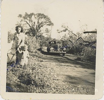
damage, 1944″
Looking ahead to the end of the war, the Provincetown Selectmen ruled that all liquor stores and bars would be closed for 24 hours when the declaration was made.
The bodies of two U.S. Navy fliers were found in a rubber raft ten miles off Provincetown.
In late September, Massachusetts residents were warned of a coal shortage and advised to endure a few cold mornings early in the winter to make their coal supply last through the season. In late December, a warning was issued that the U.S. supply of processed food was insufficient to sustain the population through the next harvest, and that more stringent rationing would be needed.
In the November election, Wellfleet voters chose Dewey and Bricker with 333 votes, and gave Roosevelt/Truman 126 votes. They also voted to continue to keep the town dry.
In early December, both The Barnstable Patriot and the Provincetown Advocate announced that the Cape Flotillas would be honored by the U.S. Coast Guard in a ceremony at Orleans High School. The Cape Flotillas were in Division 6B of the Coast Guard Temporary Reserve; Wellfleet’s Flotilla was numbered 614. The Flotillas were part of the Port Security Program, and men worked many hours on duty without pay. They patrolled the beaches on foot and the inshore waters by boat. Many turned their boats over to the Coast Guard. Now they were placed on “unassigned status,” which seemed to signal the end of the program.
In mid-December, the Massachusetts Department of Public Works announced that when Route 6 was completed past Eastham, the road in Wellfleet would not follow the old route through the town. Instead, it would turn west at Holbrook’s Filling Station and come back to the present route at Gull Pond Road. Of course, the work on the road would not begin until 1948, and the bypass in Wellfleet was constructed in 1949. I wrote about the roadbuilding project in this blog post.
1945 Part One: Wellfleet in the War Years
Posted on March 29, 2026 by pamticeblog@gmail.com
This is the thirteenth post in a series about life on the Outer Cape during World War II.
The winter of 1945 had to have been a hard time for many Cape Codders. The Battle of the Bulge had been raging in Europe since mid-December, and, although reporting was tightly controlled, newspapers published accounts of the fighting. While there were over 100,000 casualties: deaths, wounds, or men reported missing in action, the War Department’s Office of War Information was directed to hide this information from the American public. Even the massacre of 84 American prisoners of war near the Belgian town of Malmedy was revealed, although the details were not.
The Barnstable Patriot published a story about warnings from the OPA (Office of Price Administration) that there would be ongoing shortages of canned foods, butter, tires, gas, building materials, fuel oil, clothing, blankets, and more. Later in the year, there were complaints that there was not enough meat available on the Cape, and people were sick of eating fish.
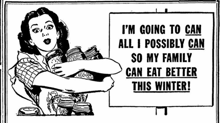
The Provincetown Advocate appears to have more war-related announcements of local soldiers winning commendations, being injured, killed, or missing in action. The January 18th issue printed a detailed story of a Provincetown soldier’s experience with the 313th Combat Engineers Battalion in Italy, and a note about a missing Private from Truro. On January 4th, Joe O’Brien, Mary Heaton Vorse’s son, a photographer’s mate with the U.S. Coast Guard attached to the War Information Office in London, wrote a long account of D-Day. On January 25th, an Army Private with the 398th Infantry Regiment described the fighting in Eastern France. Reports in February covered the award of a Purple Heart to a Provincetown soldier, and another reported on fighting in Luzon.
Wellfleet’s Paul Chavchavadze was serving as a Red Cross Field Representative in France. He received a special commendation from General Patton for his work with a Displaced Persons Center in April of 1944, helping with Russian refugees. The details of what he did remained a secret.
At its January meeting, the Wellfleet Board of Trade announced a plan for a survey of Wellfleet and its “future economic possibilities.” The announcement said that the group “expected 15% of the Wellfleet population” would return after the war. Citizens were asked to send ideas to the Survey at P.O. Box 63.
In early February, it was announced that the U.S. Navy would occupy Camp Wellfleet with a Navy unit attached to the Naval Auxiliary Air Facility in Hyannis. Lieutenant Sumner Whittier, who had been in charge of a Navy unit in Provincetown, was the commanding officer. Lt. Whittier was a member of the Massachusetts State Senate. When the Navy began operations in South Wellfleet in 1944, there had been no formal announcement.
The February Town meeting in Wellfleet was pro forma, with the tax rate kept at $28.80, schools funded at $18,000, the fire department at $2,640, and streetlights at $2,150. There was no police department
In February, author John Dos Passos was shot down in the plane he was in near Manila in the Philippines. He was on assignment with Life Magazine covering the fighting there. He survived the event, as reported in the Provincetown Advocate in early March.
In March, two Navy airmen and one seaman lost their lives in Cape Cod Bay, off Provincetown, when their plane crashed into the superstructure of a Navy Auxiliary Target Vessel, used to tow other targets. One of the bodies was not recovered until late March, when a fisherman found it.
Fishermen under 30 were reminded in March that, because of the ongoing need for troops, they may not receive an automatic deferment for working in an essential industry.
Sergeant Wiles of Wellfleet wrote home about fighting in Iwo Jima with the Army Air Force.
Throughout the winter and early spring, there was continuous coverage of both the boys’ and girls’ high school basketball teams. The Provincetown boys played the Navy men of the U.S. S. Schenk, which was based there, raising funds for the Red Cross.
Wellfleet was assigned a quota of 35 people to travel to Hyannis to donate blood at the Mobile Blood Unit as part of a Cape campaign in March. There was an “urgent need for the men on the savagely contested fighting fronts.”
In April, a United Nations Clothing Collection campaign was announced, the first of many, as Cape Codders were asked to donate “stressed clothing” for people in Europe.
Provincetown’s Commander Donald MacMillan, renowned Arctic explorer, returned from active service with the U.S. Navy, as reported by the Provincetown Advocate. An expert on the frozen lands of the north, he received a commendation from the Navy Secretary for his work. The Commander had to reconstruct the map of Greenland’s inland and northern regions because the Germans had stolen the original version from the Danish Government. Four planes under the Commander had completed aerial mapping of Greenland’s icecaps for use during the war, and, it was said, the maps would be of greater value after the war for transatlantic air routes for commercial carriers.
Finally, after months of reporting on the war in Europe, on POW camps, concentration camps, uncertainties over Hitler’s death, the unconditional surrender of Germany was formally announced by President Truman early in the morning of May 8, 1945. Liquor stores and bars were closed, and churches were open. The Provincetown Advocate of May 10 reported V-E Day, noting that the church bells rang and that some churches held services that day or in the evening. The Pilgrim Monument was relit, as were the Statue of Liberty in New York Harbor and the Washington Monument in the District of Columbia. The same issue reported another death of an Army lieutenant from Provincetown.
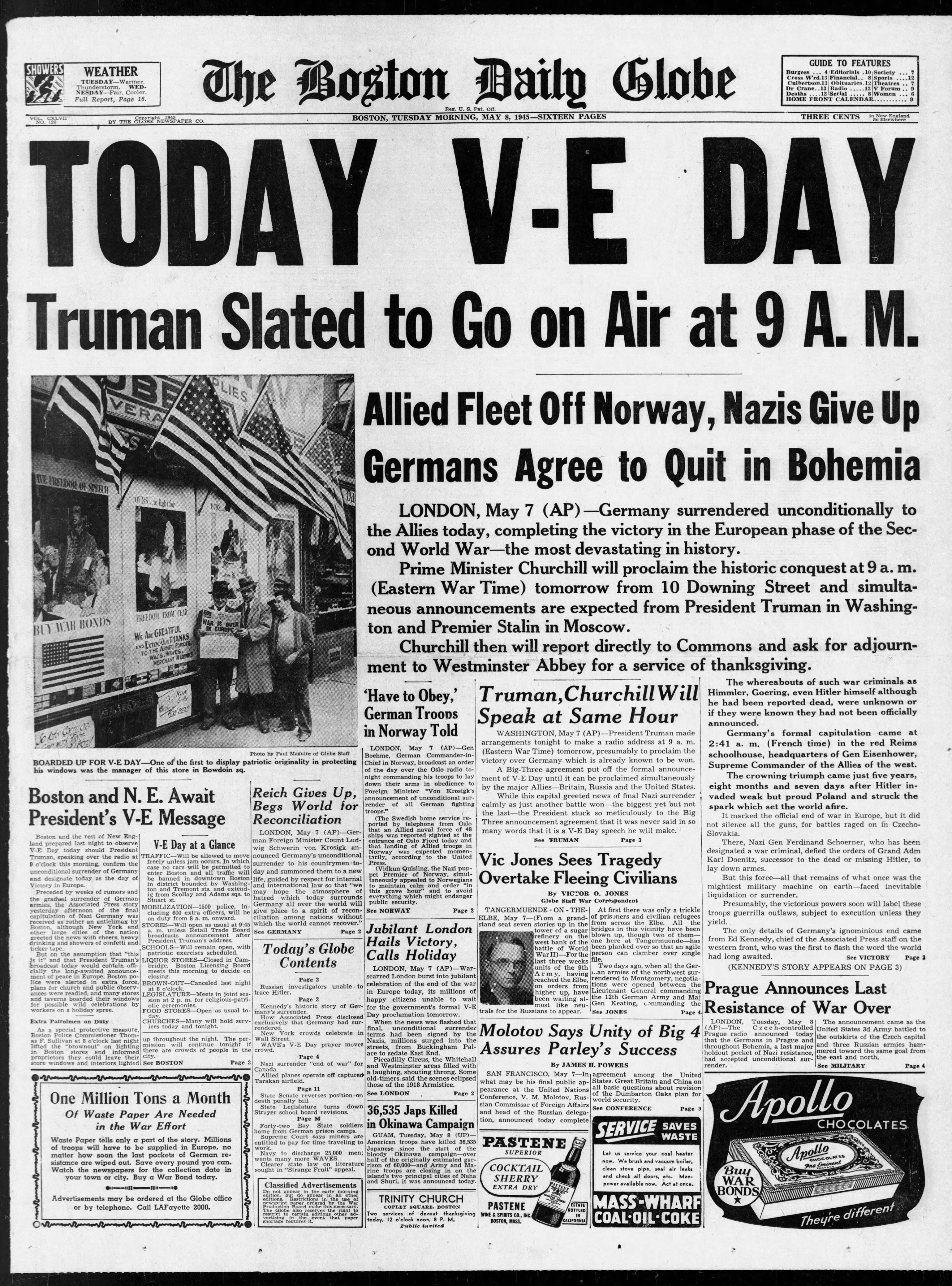
On May 9, the Massachusetts Committee of Public Safety disbanded all local units, removed the telephone service used to report incidents, and returned supplies to the towns.
The Provincetown Advocate also reported on May 10th, Wellfleet’s Naval Lieutenant Commander Charles Frazier’s award of the Bronze Medal for his work in April in Okinawa, establishing a model camp and speedy restoration of order “among the terrorized citizens,” and in organizing “efficient working parties to correct sanitary deficiencies.” Frazier’s Naval unit was attached to the 10th U.S. Army, whose commanding officer made the award.
In the same issue, the Advocate printed a letter from Frazier. He revealed his relationship to Wellfleet in this paragraph:
You know, I was proud to represent the town and in my egotistical way felt I could do it some good. Many people used to consider what they thought was an apparent lack of ambition, and couldn’t understand why a young fellow would waste his time in so small a community. I think they were all wrong and just didn’t appreciate the feeling of satisfaction that one can get from being a part of waking an old town from its lethargy and helping it realize its splendid potentialities.
Later in May, it was reported that 100 people in Wellfleet were waiting for telephone service. The Lower Cape sent five tons of clothing to Europe, with the parishioners of Wellfleet’s Lady of Lourdes church donating 885 pounds, and the children of Wellfleet’s Consolidated School donating 1407 pounds.
Memorial Day was solemn, as the war dead were remembered and everyone contemplated the continuing war in the Pacific. Soldiers returning from the European theater waited to see if they would be sent there next.
The Provincetown Advocate continued to publish stories from soldiers and sailors about the war and their experiences. The paper often referred to Outer Cape residents as“Cape Enders.”
Frank Shay of Wellfleet was given a byline in the Provincetown Advocate of June 28 for a long article about the celebration planned in Wellfleet in mid-July on the life and times of Captain Lorenzo Dow Baker and his ability to bring bananas to America. Church suppers, a concert, and a dance at Legion Hall were planned. And, it is hoped, that the town will have a few bananas on hand. Or, he wrote, they would all be singing the famous song.
1945 Part Two: Wellfleet in the War Years
Posted on April 1, 2026 by pamticeblog@gmail.com
This is the fourteenth post, the last (in addition to some post-war notes) in a series about life on the Outer Cape during World War II.
The first part of July brought many stories about plans for the Lorenzo Dow Baker celebration in Wellfleet, as the event expanded from a single event to a weeklong series. Wellfleet was celebrating again. On July 5 in the Provincetown Advocate, Frank Shay shared numerous banana recipes, including banana gingerbread. He commented, “These may have to be saved in your safe deposit box until the fruit is available again.”
On July 16th, The New York Times covered the history of the banana and Wellfleet in detail, and announced Frank Shay’s good news that United Fruit was sending four tons of bananas to the town’s merchants. A 40-pound box would be the door prize at the dance at Legion Hall. Also planned at the dance was the introduction of a new dance song to a calypso beat, “The Banamba,” written by Les Montgomery, a member of the Wellfleet summer colony.”
The Advocate editorialized, “Wellfleet will have a good time. It always does as it draws together all of its people once again into a proud and friendly community doing something together.”
In July, the Provincetown Advocate announced the award to Katherine Young Hulings of Provincetown, of the Bronze Star for her service as the Commanding Officer of the 8th Army Air Corps Headquarters Women’s Air Corps Detachment in England. She married Major Thomas Hulings of the 8th Army Air Force in 1944. (The Hulings lived a long life after the war, ending up in Atlanta, Georgia, parents to two children. When he died in 1998, his obituary gave a detailed account of his service during the war, including his award of a Distinguished Flying Cross. Her extraordinary military career was not mentioned, nor did I find an obituary for her.)
In July, Cape Cod historian Donald Trayser, who had recently been elected to head the Cape Cod Chamber of Commerce, spoke at the summer joint meeting of the Wellfleet Board of Trade, Wellfleet Associates, and South Wellfleet Neighborhood Association. He spoke of the Cape towns sharing the same issues of highway construction, bridges, pest control, and forest preservation, and how they could speak with a stronger voice through the Chamber of Commerce.
On July 12, the Provincetown Advocate reported that New England Telephone and Telegraph Company would be building an attractive new telephone exchange building in Wellfleet on “Route 6 at the bend in the road.” The building still stands today at the corner where Main Street, Holbrook Avenue, and Briar Lane meet. The company was also completing additional storm-proof cable from Orleans to Provincetown. Wellfleet would be replacing hand-crank telephones with modern handsets.
Finally, the end of the war came, bringing immense relief. On August 6, the atomic bomb was dropped on Hiroshima, and on August 9th on Nagasaki. Japan surrendered on August 14th, and President Truman declared that day V-J Day, although it lasted into the following days as well. The formal surrender was on September 2, with the treaty signed aboard the USS Missouri in Tokyo Bay. Admiral Nimitz was a signatory and delivered a speech alongside other military leaders.
The big-city papers reported a mix of details and great pride in the scientific research that led to the development of the bomb. A few wrote about the apprehension at what was unleashed on the world and what it would mean.
The only mention of the bomb in the August 8th issue of the Provincetown Advocate was to declare the Manhattan Project’s Vannevar Bush practically a local man, much like Wellfleet claimed Admiral Nimitz. Bush’s mother was from the Paine family of Provincetown, and his father was a Unitarian minister from Dennis.
To digress a bit: There were other connections on the Cape to Vannevar Bush and his work. In 1940, President Roosevelt established the NDRC, the National Defense Research Committee, at the suggestion of, and under the leadership of, Vannevar Bush. The NDRC’s purpose was to coordinate, supervise, and conduct scientific research, except for flight, for war purposes. The office worked with the military but was independent of its control. In another year, it would be brought to the Office of Scientific Research and Development. Of course, their best-known work was the Manhattan Project.
After the war, a special citation was given to Mrs. Considine of Brewster for her work in hosting “numerous radar experts” at the Considine House and the nearby Elm Tree Inn. Vannevar Bush was among the men who stayed there. Was he visiting the Army Signal Corps radar work in North Truro? We also know today that the LORAN monitoring station was established at the Chatham Coast Guard Station, a highly secretive operation managed by SPARS women, the Coast Guard’s female branch established during the war.
Vannevar Bush had a summer home in Dennis, and when he died in 1984, he was buried at the South Dennis Cemetery. Vannevar Bush is also credited with helping to build the connection between academic research and the U.S. government that is being dismantled today.
The Provincetown Advocate wrote in its August 15th issue about the “wild gay celebration” in Provincetown. Many towns organized parades. August 15th and 16th were declared legal holidays, with almost everything closed; telephone operators, however, had to work overtime to keep up with the volume of calls.
Wellfleet’s parade was not covered by the Cape papers, but my mother took these two photographs I found in her album.
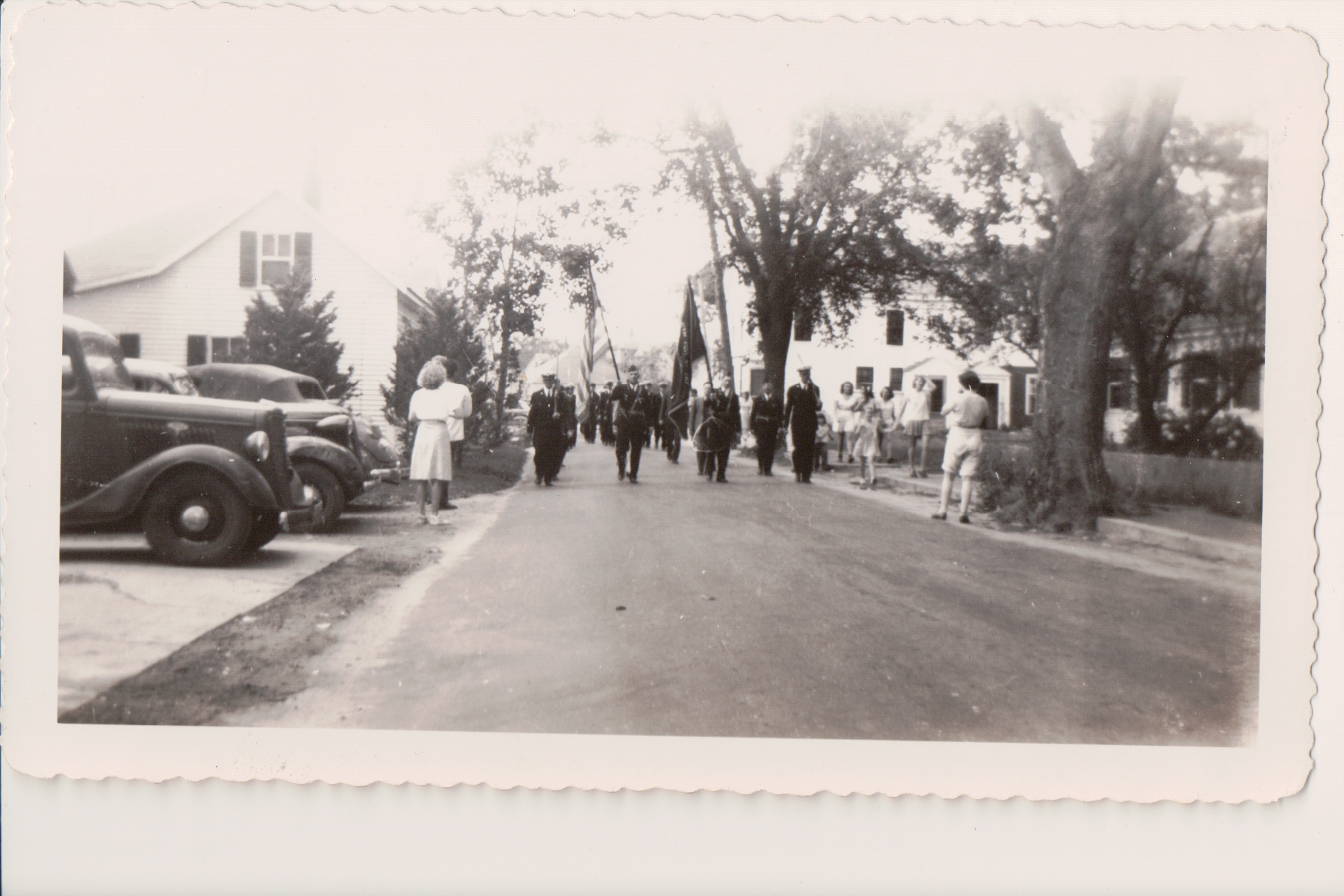
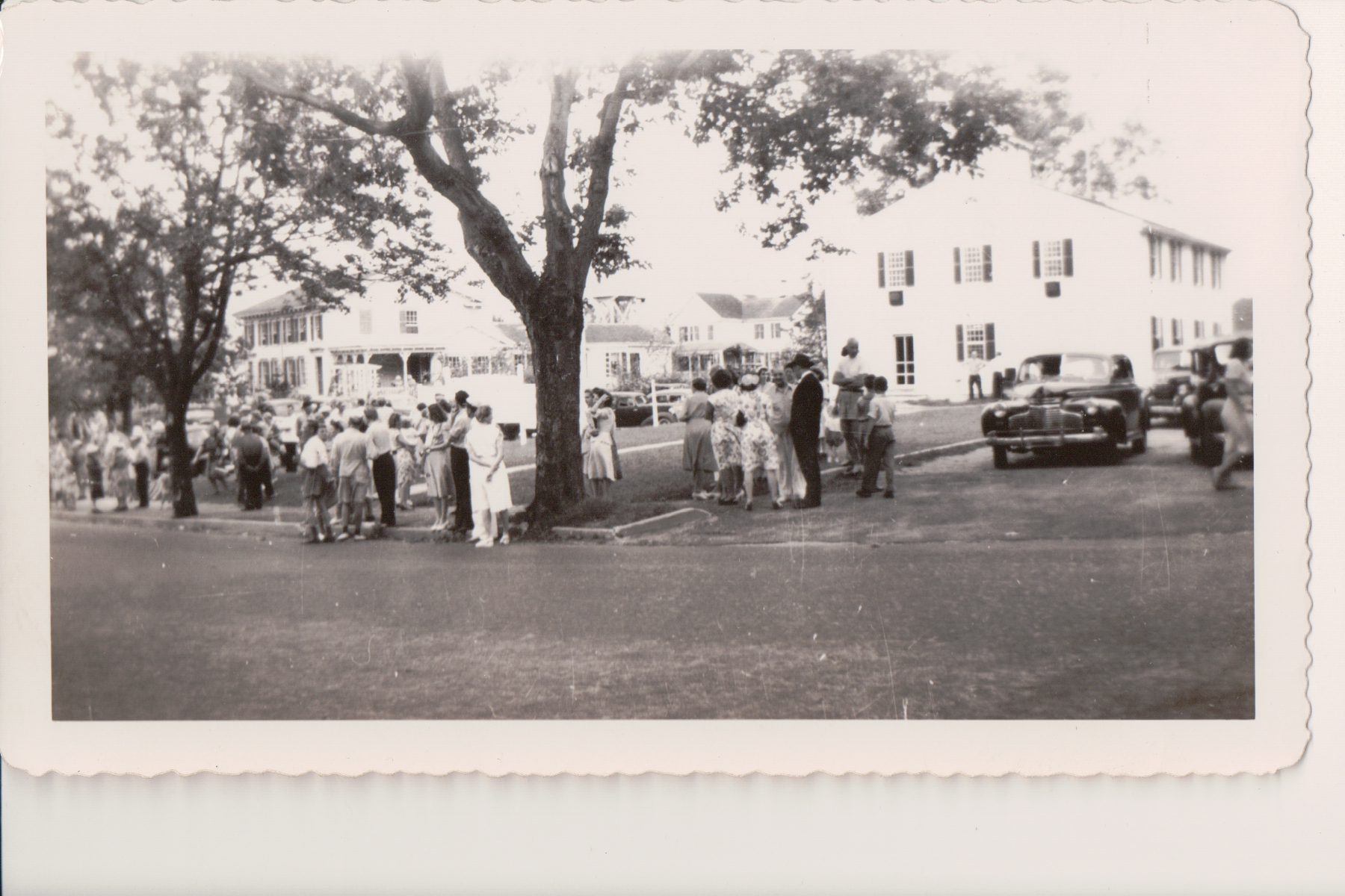
The August Wellfleet Board of Trade meeting was reported on in the August 23 Provincetown Advocate. After a supper of baked beans, potato salad, and peach shortcake, summer resident Frederic Palmer addressed the members on the importance of securing the town’s rights to the roads leading to the “Wellfleet lakes” before it is too late. The group discussed the need for a pavilion at Town Beach and for replacing the sign at the southern edge of town.
A Cape story about drunken sailors from the Naval facility in South Wellfleet was covered in numerous newspapers. Two men stole a fisherman’s truck in Provincetown and had eight crashes before they were arrested. The civilian police turned them over to the U.S. Navy.
In September, 500 men received certificates from the U.S. Navy for their work during the war for the First Naval District, which stretched from Block Island to the Canadian border. The Yarmouth Register published a list of the Cape Cod men who participated; there were 18 in Provincetown and one in Wellfleet, Harold C. Payne. These men had helped combat “the menace in the Atlantic” during the time when German submarines were damaging shipping. Using short-wave radios, they reported the location of submarines so that convoys could be rerouted. When the submarine commanders learned they were being observed, they had to move underwater, slowing their destructive work. The program began in May 1942 and ended on May 31, 1945.
In September, Western Electric announced that it was making many more telephones now that its work for the U.S. government on radar and other electronic equipment had ended, but it would be some time before the company could catch up with demand.
Another story in September revealed the vital importance of the Cape Cod Canal during the war and the important role it played in “saving millions of tons of shipping” from destruction off the New England coast.
The fall months appeared to be a revival of the post-summer quiet time on the outer Cape. Beginning in late summer, numerous reports highlighted the urgency of rebuilding Route 6. Announcements continued of military service, and honors awarded to Outer Cape men.
Provincetown appears to have revived its Veterans of Foreign Wars chapter, founded in the 1930s, which now had space in the old Conant Street School. Wellfleet and Truro did not have VFW posts.
Only one number plate would be issued for each registered car in 1946.
In early October, the Provincetown Advocate wrote that the U.S. Navy would be giving Camp Wellfleet “back to the natives soon.” They would also be returning the Torpedo Retrieving Center to Provincetown. Meanwhile, a skeleton crew would be on duty at Camp Wellfleet, with no new assignments there.
In October, the Advocate announced that the U.S. Coast Guard would be returned to the U.S. Treasury in January and would resume its duties of patrolling ports and the coast, aiding ships in distress, and maintaining navigation aids.
In November, Paul Chavcavadze spoke to the Wellfleet Board of Trade about his work in Europe helping people who had been freed from work camps and concentration camps return home.
Late in the year, the State of Massachusetts announced the results of its 1945 census, conducted every ten years. In Wellfleet, 851 people were counted, and 630 were legal voters. In 1935, Wellfleet reported 948 residents in the state census. These state censuses are not available online.
Provincetown planned a big Armistice Day celebration in November. Unfortunately, it rained on the big parade, but it went forward as planned.
There was regret in mid-December that there were not enough colored lights to decorate Commercial Street in Provincetown for the holiday season. The Christmas spirit was sure to be strong, though.
In late December, Wellfleet’s legal notices about taking back land for non-payment of taxes in 1943 and 1944 took up two pages of the Provincetown Advocate. Most of the notices were for “Seashore Lots, Wellfleet Harbor,” and a few for “Wellfleet By the Sea” on the ocean.
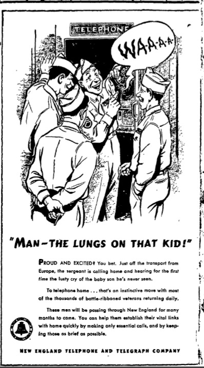
Post War Notes
Posted on April 3, 2026 by pamticeblog@gmail.com
Here are a few notes about World War II matters that might be useful
- The Provincetown History Project has a scrapbook from the Provincetown American Legion chapter online here:
provincetownhistoryproject.org/PDF/lib_500_001-morris-light-post-71-american-legion-scrapbook.pdf
The newspaper clippings in the scrapbook cover the WWII years (scroll halfway down), mostly about Provincetown men, though a few are about Wellfleet and Truro soldiers. These are from The Cape Cod Standard Times, which, as I mentioned in the Introduction, is not readily available online.
- The Provincetown History project archive also has this clipping about the first Provincetown soldier killed during the war:
- In 2019. The Cape Cod Times printed a long story about Wellfleet’s Richmond Bell and his military service during the war. Bell was about to be inducted into the French Legion of Honor for his service in helping liberate France. Bell was the son of beloved Wellfleet doctor Clarence Bell.
Wellfleet veteran to be honored for aid to France
- The Wellfleet World War II Honor Roll is in the Town Hall, on the first-floor lobby. The dedication says Dedicated to the citizens of Wellfleet, Massachusetts, who served their country in World War II –Lest we forget — This tablet is the expression of the Love and Admiration of Mary K. Lawrence.
Who was Mary K. Lawrence? She is mentioned in various posts about the war years, but when she died soon after the war’s end, at age 85, on May 5, 1946, the Provincetown Advocate devoted a long article to her in the May 9 edition. She and her husband did not have children, but she was deeply interested in child welfare work and was a Director of the Massachusetts Society for the Prevention of Cruelty to Children. She offered courses in manual labor and domestic science to young people in the basement of her home. Today, Wellfleet remembers her by naming the land where new housing is under development “Lawrence Hill.”
In 1944, at the Town Meeting, Wellfleet accepted Mary Lawrence’s gift of an Honor Roll to be placed in the “Colonial Hall,” the name that was still used for the Town Hall. She left a fund to create the large plaque we have today.
- The World War Two Honor Roll lists 65 men and women who served in the Army, 60 men and women who served in the Navy, eighteen men who served in the Coast Guard, two in the Marines, two in the Merchant Marines, and one in the Red Cross. 148 in all, or about 15% of the Town’s population at that time.
- Two men who served in the war were later memorialized in Wellfleet. Wilbur Ryder, born in 1893, served in the Navy in both World War I and World War II. He died in 1977. In 1979, the American Legion dedicated a “Wilbur Ryder Square” in his honor. The square is at the junction of Commercial Street and Holbrook Avenue.
Leonard Pierce, born in 1918, served as an Army Air Force pilot in World War II. He was shot down twice and saved his crew both times. He served as Selectman after the war. He died in 1965, at age 47, rather young. In 1998, the Town named the Long Pond Bridge, over Route 6, in his honor.
- An E-Mail with a Memoir
My former neighbor in the Old Wharf neighborhood, Bruce Eastman, has been in touch with me as I’ve worked on South Wellfleet history. His mother was a Barker, the owners of the old farmhouse from the early 19th Century that still stands today.
During the war, his father, a Captain in the U.S. Coast Guard, was “skippering Army troop transports between the U.S. and Europe, and as far as India, Singapore, and the Philippines.” His mother moved to the farmhouse with her sons.
Bruce sent an email after reading a couple of these blog posts about the World War II years in Wellfleet. His mother shared memories of those years, and he shared those with me. She shared the “palpable fear” on Cape Cod that the Germans might invade, and the agency that made sure everyone drew their shades at night and that cars used only their parking lights while driving at night. No street lights were illuminated in the town.
Two of Bruce’s brothers joined the U.S. Coast Guard and are listed, with their father, on the Wellfleet Honor Roll. (Note that since the U.S. Navy takes over the Coast Guard in wartime, all Coast Guardsmen are listed with the Navy.) Captain Eastman reminded his family often that he was truly pained to see the white Coast Guard vessels painted battleship grey during the war years.
When I first wrote about Camp Wellfleet, Bruce had told me the surprising story of the U.S. Army appearing at their door, and asking or ordering the family out of the way while they used the hill near the house for maneuvers. In this email exchange, Bruce shared a conversation with his older brother, who thinks that the Army stayed on their property for about a week.
- World War II soldiers were known for their silence about the war after they returned home, and put the war behind them. My father-in-law left no war stories for his children, but he did leave a paper file of Army orders that helped me figure out where he was and when during his time in Europe. Another friend mentioned a father-in-law who told of almost stepping on a landmine, but being pulled away by an unknown soldier. Irene Paine emailed about her “Uncle Jay,” Abbott Paine Jr., who served through the Battle of the Bulge, was shot, and spent time at a hospital in Europe. He would never speak of the battles. He returned to Wellfleet, surveyed the new Route 6 as it ran through Wellfleet, and lived his life in a home near the fire tower.
Not a WWII item. My cousin is selling his complete Joseph C. Lincoln library as a lot, including all books and rare plays. If you are interested, contact him for details at edfranklin2@gmail.com