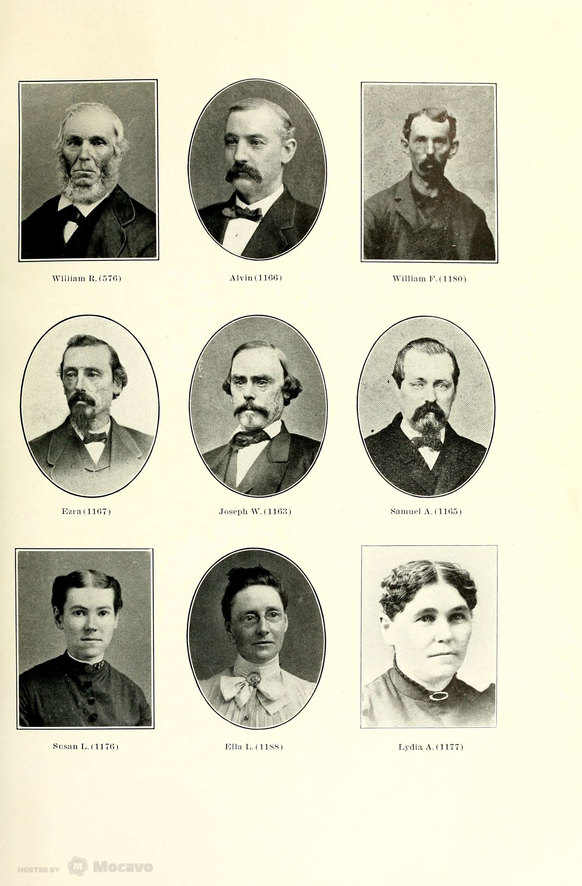
Isaac (Ikie) Paine, born in 1867, was the son of Alvin Paine and Eliza Foster. Alvin Paine had a successful career as a sea captain, and then became the owner of the South Wellfleet General Store in 1880. Eliza’s father was the well-regarded Captain Scotto Foster. Alvin Paine purchased the second Arey home in 1877, right next to the home where Eliza Foster grew up. Both houses are still with us today.
Isaac (Ikie) Paine married a Stubbs daughter(see below). His sister Mabel married Fred Doane, who lived close by — their home was moved to the east of Route 6 when the road was widened in the late 1940s.
The Paine, Foster, Doane, and Stubbs families have all been covered in previous blog posts. They all lived between the South Wellfleet Cemetery and the General Store.
Ikie Paine—a name my aunt remembered from her childhood South Wellfleet summers—sometimes appears as Ikey, but I have adopted Professor Hicks’ spelling here.
Ikie Paine married Mary Stubbs, daughter of the successful South Wellfleet shell fisherman, Joseph A. Stubbs, who brought his shellfish company and family to Cambridge, Massachusetts, where it grew and became quite successful. The Stubbs family had their company’s operation at the head of Blackfish Creek (Stubbs’ Landing) and spent their summers in South Wellfleet. Mary had married Thomas Attner of Cambridge, but he died, leaving her with a daughter, Bernice.
Isaac Paine and Mary Stubbs Attner married in 1905, when he was in his late thirties and Mary in her forties. Ikie must have known her as a young woman when she and her family came to South Wellfleet from Cambridge. This was after the death of Ikie’s mother, Eliza, who had her own mother in their home in 1900, with her two children, Isaac and Mabel, in their thirties, living there too.
In the federal censuses of 1910 and 1920, Isaac Paine is noted as a grocer in the occupation column. From my earlier blog post about the South Wellfleet Store, we know he sold it in 1923.
Professor Hicks moved in next to Ikie Paine in 1936 or 1937, and over the years of his South Wellfleet summers became a friend to his closest neighbor. My previous post notes Professor Hicks’ stroke which he suffered late in life. He begins this 1953 essay by noting that, after sixteen summers, he was writing about his friend and neighbor. Although this seems to contradict my note that Professor Hicks was unable to write after his stroke, the essay came to me as a typewritten document with editorial notes made in Professor Hicks’ distinctive hand, but may have been typed by someone else.
Professor Hicks ends his essay with the sad tale of Ikie’s death from a fire that started in his barn. Hicks refers to the fire as a December 1943 event. However, the Boston Herald reported his funeral on September 16, 1943, and Ikie’s Masonic record shows his death in that month too.
Professor Hicks also wrote a short piece (printed here also) that noted the garbage collection arrangement with Lewis Hatch, who lived in the area of Wireless Road, past the South Wellfleet Cemetery. As covered in a previous post, Mr. Hatch died in a fire in December 1939, during weather conditions that were like the ones described here by Professor Hicks. I must wonder if Professor Hatch confused the circumstances of the fires that killed the two old South Wellfleet men.
SOURCES
Federal census data on www.ancestry.com
Family trees on www.rootsweb.ancestry.com
Newspaper articles on www.genealogybank.com.
Professor Hick’s 1952 essays about his neighbors in South Wellfleet
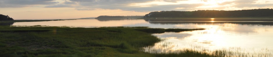
When we bought our place on Cape Cod, we thought we were just getting a summer place in which to relax and recuperate. We didn’t think of it as a community the members of which were worth knowing for their own sake. We already know some of them, “natives” as well as Summer people, but we didn’t come here because of them. We came because of the climate and the scenery and the swimming, and the little side roads leading down to the “hollows” to the ocean, or to the beaches on the bay-side. Now, after sixteen summers, we still love these same things, but we love the people even more. We have neighbors here, even though the houses are few and far between.
Our nearest neighbor used to be Ikie. You could just see his old house, pretty much rundown, through the trees. They were locust trees with a few apple and pear trees. The latter were relics of a shipwreck off the ocean shore, many years ago, in the time of Ikie’s father. The ship was loaded with fruit trees destined for Boston and vicinity. When the ship broke up, the shore was littered with slips of trees of varieties unknown then to Cape Cod, and the inhabitants took their pick, and planted them near their dooryards. They never grew to be large, nor were they very fruitful, but they lived. Besides the locusts and the fruit trees, there were willows. These willows dwarfed Ikie’s house and the barn back of it. Their branches spread out to cover a diameter of nearly a hundred feet, and their trunks were massive. Underneath one of them there was a well, and prior to that there was a bubbling spring. The spring was there before the trees were – in fact that was why the trees came to grow there. It came about in this way. So many years ago that no one now living can vouch we now live, drove his father’s cow over to the spring, as was his nightly custom. In his hand he carried a willow with, and while the cow was drinking, he stuck a willow with into the soft wet sand at the edge of the spring, and left it there. Miraculously, no one ever removed it, the cows did not trample it, and the winter’s snow and frost did not kill it. It took root, it grew and flourished like the Cape willow tree that it was, majestic and sheltering. Ikie loved that tree and the others which grew up around it. It sheltered him for sixty years, from the time when he brought his young bride from Boston to live in the old house under the shade of the old tree, until he died. The tree lasted only two years longer than Ikie did. It also had run its span of life.
The first time I saw Ikie was when I came down to look over our place with a view to buying it. We had admired the house many times as we drove by on the highway, five hundred feet away, but we didn’t know how much land went with it, or where the boundaries were. “Ask Ikie Paine,” people said, ”If anyone knows, he will.” And he did. “I certainly hope you will buy the place,” he said. “Nobody has lived in it for twenty years, except a few months in the summer, and we miss seeing a light there. There’s nothing so cheering as seeing a neighbor’s light on a dark night.” Ikie put on his rubber boots and we went out in the searching November wind and walked the limits of the seventeen-acre plot, struggling through huckleberry and beach plum bushes, pitch pine trees, and low-growing hog-cranberry vines, following the lines of old rail fences down to the marsh meadow on the bay-side. Keeping to the edge of this meadow, we came to the corner of Ikie’s land, from which the dividing line of the two places ran straight East to the main road. Here it became evident that the entrance to what was to be my driveway trespassed on his land. And so I proposed, in case I bought the place, to buy from Ikie a strip of his land running back the whole space from the road to the bay. He agreed that that would be a good thing to do. The next summer we consummated the plan. At the main road, we measured off twenty-five feet running due north, and at its end placed a stake and stone. At intervals w repeated this process, but adding tall stakes along which we could sight. As we approached the bay, it was seen that this strip, because of the lay of the land, would give me a swale where Ikie pastured his cow. So we ran the line off at an angle, from that point on, to the satisfaction of Ikie and his cow, and without any disadvantage to me, but Ikie had many misgivings whether he ought to accept the change of plan, since he had given his word. The last stake and stone that we placed was between high and low water at the edge of the salt meadow. We didn’t get the deed drawn up until eight o’clock that night. It was Saturday night, and Ikie had to go to Orleans to his lodge meeting. I said, “well, we can sign it tomorrow morning, and then I can start for home.” “That is one thing I can’t do,” said Ikie. “I never do business on Sunday, but if you can be here before midnight tonight, we can sign it.” And that is what we did, in the brief interval between Ikie’s arrival from his lodge and the stroke of twelve. Two weeks later I was again on the Cape, and Ikie came over to see me right away. “I’ve been worrying since you left,” said he, “about something I’ve done. I have sold you some land that I don’t own. That last stake we put in down at the meadow is below highwatermark, andmy land runs only to highwater. I didn’tmean to do this. Do you think I will get into any trouble?” I set hismind at rest by assuring him that I intended to put the place through the Land Court,and that all such details would be straightened out. I had begun to learn that here was an honest man.
When we finally got the old house repaired and had begun to live there, Ikie and his wife began to shower us with little attentions. If their son-in-law brought them a catch of mackerel, or a bucket of quohogs, Ikie would come struggling through the tall grass, across the field to our side-door, and leave them for us. Or he would bring us a head of lettuce or some ears of sweet-corn. Not to be outdone, Mary would send over a bunch of roses accompanied by a penciled note,
“These are grown across the way —
I send them to you
For your bouquet.”
And when Helen was ill for a few days, Mary sent her a pie:
It makes no difference
If sick and on a bed you lie,
You sure must have
A piece of pie.
So open your mouth and take a bite,
And ten to one, you’ll
Come out right.”
On a morning we could hear singing coming through the trees. It was Ikie, we soon learned, singing at his chores, or working in his garden. The only songs he knew were hymns, which he sang in a high tenor, at the top of his voice, “There shall be showers of blessings,” or “Pull for the shore, sailor, pull for the shore.” Or “Come all you faithful.” His cow was a pet, and every hen was named, not forgetting the rooster. Three days a week, Ikie got out his old beach-wagon, loaded it with vegetables and eggs, and started on his round of summer houses. It was his only source of income, and that only for a short season. Either the Model T beach wagon was out-of-order or Ikie had lost confidence in himself, for he didn’t turn it around except in case of dire necessity. He didn’t back and fill, but drove around in chosen places where he could take a wide sweep. He used to have confidence enough when he drove a delivery horse and wagon for his father’s general store at the Old Wharf. In those days, the Old Wharf was a thriving settlement where a packet landed from Boston, and where dozens of fishing boats came to discharge their catches and to refit. Here Ikie learned the lingo of fishermen which he used as naturally as if he had been bred to the sea.
Talking about the world war, he said, “the trouble is, they’s throwed God overboard, and the Devil’s walked aft and got the wheel. Like many another Cape Codder, he was a Republican, and he didn’t like Roosevelt. “When any man thinks he can run this whole country alone, he’s lost his head. He thinks because he’s got HARVARD COLLEGE stamped on the seat of his pants, he’s a superman. “Education?” he continued, –“Now you take honey. Honey is good, but if you ate nothing else, you’d spew it all up, wouldn’t you? Same way with education. It’s all right, but you got to have something else too. You got to have common sense. If you want a school of mackerel, you’ve got to throw bait. The foolishist thing we ever did was to elect Roosevelt President.” Despite these remarks, Ikie revered education and was proud of the fact that his father had gone to an academy and “knew more than twice two.” He used to quote his father as saying,
“Live and larn
Die and forget it all.
I never thought I’d take
Up ashes in a sasser.”
I have no idea what the last two lines mean, but they meant something to Ikie.
He was cautious about predicting what the weather would be. On a cloudy day with the wind blowing hard, he would squint at our weather vane, made for us by Fred Doane in the form of a black-fish, and say,”If she backends up into the East, we’re going to have a spell of weather.” Or, in answer to an inquiry whether it was going to clear up, he would quote the seamen’s rhyme,
“Long foretold
Long last.
Short notice
Soon past.”
A thunderstorm was always referred to as a “tempest,” and a morning fog which burned off by noon as an “Easterly mull.” After a long spell of rain, he would say, “It aint a going to clear up till the moon changes.” One calm day, hot and sultry, he would announce, ”The breeze came up with the tide.” Observing a leaning tree, he would say, “That tree must have been in a breeze of wind; it’s canted over as though it was like to fall.” Most of his prognostications were prefaced by “I wouldn’t say it will, I wouldn’t say it won’t.”
Tall stories are told about mosquitos on the Cape, and Ikie had his share of them. He remembered when they weren’t any worse here than anywhere else. When farmers raised salt hay for their cattle, they would keep the meadows ditched so that the hay would not rot, but when their sons gave up farming and there were fewer cows and horses to need hay, ditching was given up, and nobody knew what to do about the mosquitoes. They would settle so thick on the side of a horse that couldn’t see the horse at all. In a carry-all, going to the train, you couldn’t see the roof for mosquitoes. Everybody wore big hats with mosquito nets tied over their heads. People would come down on one train to stay for the summer and go right back on the next. Then the Mosquito Control came along, and solved the problem by doing just what the farmers used to do, they ditched the meadows.
When I complained about the wood-ticks,a seasonable though harmless pest which infests the Cape inJuly and early August, he rected some verses that he had learned from a newspaper clipping
I sing of the little wood-tick
The Cape’s own rural pet,
Though he’s intimate and loyal
I’ve not learned to like him yet.
I sing of the little wood-tice
Clinging closer than a brother,
The rural vamp of field and camp
Than which there is no other.
I sing of the little wood-tick.
A-sitting on a log.
I waged a battle with him
(line does not finish)
And that unhappy puppy,
Most miserable of ours,
Found the unwelcome insect
His ‘tic doloreuse!
I’m praying now for August
When his family will increase
And leave the clock of allmy hours
Inquiet, tickles peace.
Our dog, Brownie, would have joined in this prayer if a dog could pray. It was a daily job to “tick” her. Ikie would sometimes watch me, and say, “”She likes that like all get out, don’t she?”
Oystering and fishing used to be the chief industries in Wellfleet when Ikie was a boy. The fishing fleets would be away six or eight weeks, and fishing went seven days a week. But in the fall, when mackerel were running in Cape Cod Bay, the Wellfleet fleet would come home on Saturday night to lay up over Sunday. For this reason, the Gloucester fishermen, who fished on Sunday, called the local fishermen “Bible-faces.” The Wellfleeters used to oyster in winter and mackerel in summer. Ikie had a simple explanation why the oyster business here declined and final died. The mackerel ceased to come here, and so the men were out of work in summer. They moved away, and then there were not enough men to carry on the oystering.
A famous character that Ikie loved to tell about was John Cheever, who lived toward the Old Wharf, and was a jack of all trades including fishing. He spoke spontaneous-in doggerel verse. Once when he came home at two a.m. after being away for six weeks, he knocked a Jacob Rice’s door expecting Rice’s wife Betsy to let him in. He knocked again louder still, and when a window was raised, he called out,
“Betsy Rice
I called you twice
While you lay in bed and snore.
Why don’t you awake
And see Uncle Jake
Just home from Bay Chaleur?”
He was a big clumsy man, always behind and always happy-go-lucky. He raised hens and traded his eggs in at Ikie’s father’s store. When Ikie opened the store in the morning, he would find notes telling what Cheever wanted delivered to his house during the day. Ikie remembered one of the notes:
Mr. Paine, please bring to me
A quarter pound of your good tea,
One of rice, and two of bread,*
Of Munroe’s tobacco please bring one head.**
An empty barrel
A bag of corn
When your team at noon
Comes along.
Take my eggs
If I’m not there.
Your humble servant
John Cheever, Esquire.”
*Pilot Bread ** Plug tobacco.
On board ship, there wasn’t much variety in the way of food. The fishermen used to tell about eating what they called “hog’s back son-of-a-bitch,” a combination of salt pork, stale vegetables, with stale bread on top. These were cooked covered in a spider. (Note: A Spider is a cast-iron pan with feet.) The hard bread was softened by the steam, but the result wasn’t very palatable. When the men got home, the first thing they wanted was a good meal of vittels. A favorite with them, according to Ikie, was fried huckleberry pie, You covered the bottom of an iron spider with pie-crust, you filled it with huckleberries, put on a top crust, and fried the pie with lard. When it was nearly done, you poured hot molasses on top and finished the cooking. It was very sticky and sweet but satisfying.
These are some of the things I remember about Ikie and talks we had together when he came over to our house. He was a little bit shy and almost timid in manner, as though he wanted to be sure that he wasn’t intruding. When he had brought us something, he was ready to leave as soon as he had made his little presentation speech. But if you made it plain that you wanted him to stay, he was glad to talk.He liked companionship and didn’t have much of it. Nevertheless she didn’t want to force himself on the “strong-bean eaters.” When he was a boy, that is what the natives called the Summer visitors, because they were here only when string beans were in season. He would try to turn the conversation to subjects in which he thought you would be interested, rather than to talk about his own affairs. But we would inquire about Mary, and then about his daughter and her husband, and finally he would get started on some story of the old days on Cape Cod. Then a pleasing glint would come in his eyes, and the weather beaten wrinkles about them would deepen, and he would be relaxed and happy. But soon his expression would change, and he would say, “I must be getting back. Mary isn’t very well, as O told you, and she forgets things. She knows I came over here, but she’ll be wondering where I am. She’ll be saying I’ve gone off with another woman. “That was one of the perpetual jokes in Ikie’s household.
Sometimes we went over to Ikie’s house to see Mary. We could drive all around his house in one side and out the other. One of the drives was only a right-of-way which, after fifty years, was contested by a new occupant next door. An obstacle was placed in the way. Ikie didn’t say anything, but drove around it. After a while the obstacle was removed. We would park our car under the old willow tree, and go up on the old back steps to the kitchen door.(The front door hadn’t been opened in years.) There were trumpet vines about the door, as if to herald a welcome, and Mary’s exclamations would complete the illusion. From the kitchen we were led with royal ceremony into the dining room where there was a great stove with isin-glass windows, and then into the sitting room. Here was another stove. All the chairs and furniture were old from years and old from use, but clean in spite of their rather forwsly (sic) appearance. In a bedroom opening off this room was a beautiful Franklin stove.
On a couch near Mary’s chair was a place for the cat, and often, there was a litter of kittens. Salutations over, Mary would bring out her treasures, old pieces of china and lustre-glass, and photographs of her family. This would start her telling us again about her home in Boston, and the prosperous days of her youth. She had lived with Ikie on the Cape for more than thirty years, but she didn’t consider herself a Cape Codder. She was still a Bostonian. “You know,” she would say, “those queer Cape Cod stories they tell aren’t exaggerated a bit.” Then Ikie would smile an indulgent smile, and Mary would laugh. It was an old argument, and from repetition Mary became more convinced that Ikie and all Cape Codders thought they were a little better than people down Boston way. That was strange because Mary’s father was born on Cape Cod, and got his start in business by selling buckets of clams on Boston Common. From this beginning, he built up a great fish and shellfish business, the successor of which is still going strong. Every day, we see the great refrigerated trucks go by on the way from Provincetown to Boston. Mary’s remembrance went back only to the prosperous days after the business was started, and her first knowledge of the Cape was when the family came down for the Summer. Her father bought her a pony which pulled her over the deep, sandy roads, in a pony cart, to the envy of all the native children. I don’t know how Mary and Ikie met. Maybe it was when he was delivering groceries from his father’s store, when she was a “string bean eater,” and he was a “native.” She was the sophisticated city girl, well educated, and talented, while Ikie got all the learning that he had from hard knocks and in the old school house which is now the Social Union Hall of the South Wellfleet Neighborhood Association and Social Union. (How the association got this name is a story in itself.)
I don’t know when or where they were married, but I do know that Ikie was the happiest man in the world. His wife was young and beautiful. She was the life of the community, and of every party. She gave readings as was the vogue of the time, and she got up plays and entertainments using local talent. Everybody liked her, and Ikie was very proud.
After the business at the Old Wharf died out, along with the fishing industry which had centered there, Ikie went into business for himself. His store was on the knoll just south of the present South Wellfleet Post Office. It was right alongside the Railroad Station, which for some years now has been a thing of the past. Now, only two freight trains, and no passenger trains, come through every week –not enough to keep the rust off the tracks. Long before the trains were stopped, business except for Summer had declined. And Ikie and Mary were getting old. The store was given up, and Ikie took up the task of making a living off of his land surrounding the old house and the willow trees. It wasn’t much of a living but they got along. He made his garden, he fed his cow and his hens, he did his milking and gathered the eggs, and in summer he pedaled his surplus to his regular customers. There used to be quite a settlement in their neighborhood, but the old families had died off, and the children had moved away, and the Winters, when the Summer people were away, were pretty lonely. But you wouldn’t know from Ikie that the going was tough, and he was never sad, never too downcast to sing hymns when he was doing his chores, never worried except when he referred to Mary’s waning health, and compared her present forgetfulness with the clever quickness of her youth. Neither of them wanted to leave the old place and go live with their daughter. They wanted to live out their last days together in their old house. And Ikie wanted to live to take care of Mary. The last time I saw them was in the Fall, just before we were leaving for the Winter. We had had a long visit in their sitting-room, and had come out on the back porch. It was in the morning because it was the only chance for a last talk. Mary had her working dress on and a cloth tied about her hair. As she stood in the doorway, frail-looking and bent over a little, she was a picture to remember. I said to her, “I’d like to take your picture just as you are. I have my camera here. Will you let me do it?” “In this dress, looking the way I do? No Sir. And besides, do you think I want Ike showing my picture to his second wife?” “He wouldn’t do that,” I replied, laughing. ”Yes he would,” said she, “you don’t know Ike.”
Sad news came to us that winter. No one knows just what brought on the disaster, but the following facts are known. On a December night, about two o’clock in the morning, something woke Ikie. He partly dressed, lighted a lantern, and went out to the barn. A little while later, he was heard by Fred Doane, who lived directly across the road, calling out in great distress, “Come Fred, right away, I’m burned. The barn is on fire.” Fred pulled on his trousers, put on his shoes, and an overcoat, and hurried over. He found Ikie in the house, on the couch, writhing in pain. Most of his clothing had been burned off him. At that time, there was no doctor in the town, so Fred telephoned to the district nurse. In the meantime, sailors at the naval station had seen the blaze of the burning barn, and had come over. Learning that no doctor was available, one of them went back to the station, and brought back the navy doctor, who gave Ikie an injection of morphine. As soon as possible, the district nurse took Ikie in her car to the Cape Cod Hospital in Hyannis. Ikie died the next night.
Mary lives with her daughter now, and, very mercifully, she does not remember how Ikie died, or any of the events of that terrible night.
II.
To go to Hatchie’s house, you turn off the main road just opposite Ikie’s place, between Fred Doane’s house and the cemetery, and across the railroad track, and then along a sandy road which looked too deep for automobiles, until you came to a little group of buildings. If you went a little further you would come to a cedar swamp, and if you looked back from Hatchie’s you would see the top of Fred Doane’s house, a quarter of a mile away. The distance wasn’t great, but on account of the lay of the land, the location seemed more isolated than it really was. As you drove in between the house which stood on the left, and the out buildings which flanked it close by on the right, you felt as if you were ten miles from nowhere. But there was plenty of life right there. The old sow was grunting in the pig-pen, and the little pigs were squealing, and the chickens were running away from the strange car, and the fat little mare was stomping and switching the flies away, and a fierce-looking dog was coming out of the house, growling. A voice from the house commanded the dog to be silent, and then Hatchie appeared calling out roughly “What are you coming here for? I’m eating my breakfast. Who are you anyhow?” Shoes, pants and shirt were all he had on, and his gray hair was touseled. Blinking in the sunlight, he said again in a different tone, “who are you, anyhow?” I explained my errand which was to ask him to come twice a week at least to get our garbage. I had seen him driving about with his wagon loaded with several foul smelling barrels in which he gathered “swill” for his hogs. He was an important person in the economy of our community, for there was (and still is) no public convenience here. We had already dug a large hole in the tree well back from our house in which to dump cans and other refuse, and we had discovered that this had been the practice for generations past. Digging almost anywhere on the place you might come upon such a cache with no sign of it showing on the surface. When you dumped garbage in such a hole you were supposed to cover it with sand, and this gradually fill up the hole. If you didn’t cover the garbage with sand, you were leaving an extra attraction for skunks. It was a nuisance, the whole business, and Hatchie was the answer. He was the sanitary department of our community.