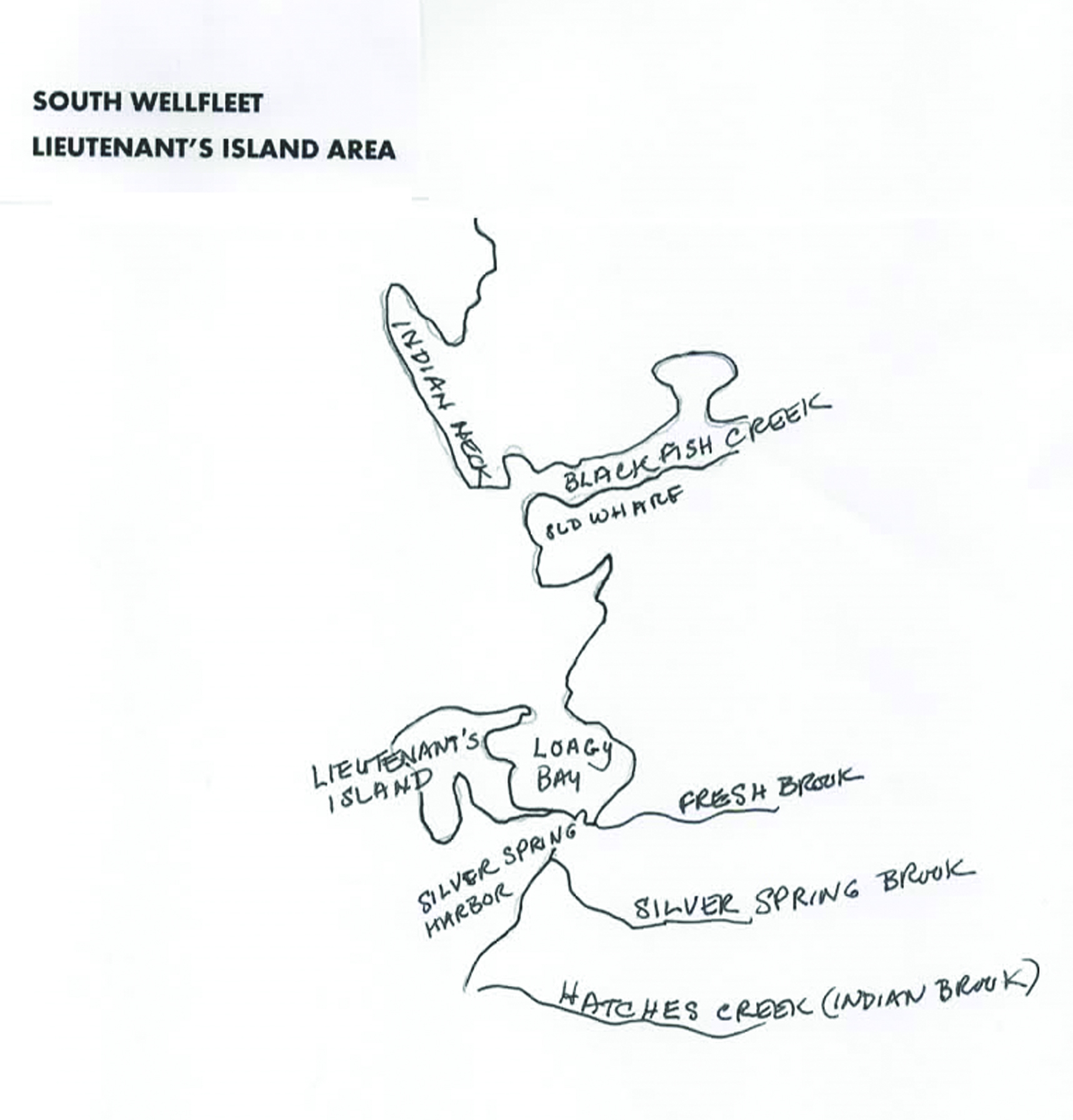
Pleasant Point’s summer colony in South Wellfleet marks the beginning of the change of Wellfleet’s economy from maritime pursuits to tourism. The land developers Robert Howard and Edward Reed simultaneously promoted land sales on Lieutenant’s Island and the Old Wharf, but lot buyers did not build as many cottages there as were developed on Pleasant Point from 1890 to 1910. Pleasant Point and the Cannon Hill developments — perhaps because they were closer to the South Wellfleet Depot — created groups of summertime residents who began to have an impact on Wellfleet’s economy and its residents who provided services to them. Wellfleet’s population was at its lowest level in these years, with barely 800 people left in the town that had been abandoned by its maritime population.
By 1910, there were 25 cottages at Pleasant Point. Middle-class families began to come either for the summer — or the women and children did — while the men commuted. Some owners rented their cottages to families that began to make annual visits, establishing another group of summer visitors who appreciated Wellfleet’s summer charms. In contrast, up to 1910, Lieutenant’s Island had only six cottages developed, and there were four out on the Old Wharf, with only one, my great grandfather’s, on Prospect Hill.
This twenty-year period of cottage building came just before the development of automobile tourism, when day-trippers in automobiles added another layer to the servicing of visitors, with tourist camps for motorists. Of course, not everyone who sought a summer residence built a cottage. Many purchased old Cape homesteads from families whose children could no longer make a living in the town.
The social changes that made a “vacation” possible for many more people came after the Civil War, as Massachusetts industrialized in its urban locations. Even the conservative clergy came to recognize that humans needed a break from work, preferably in the fresh air of the mountains, on a farm, or at the seaside. By the 1870s and 1880s, other parts of New England and the upper Cape were developing the facilities — hotels, tours, trains — that got people out of the cities and to their countryside destinations. A growing middle class began to accept that this break in routine was needed, and they had the funds to pursue it. The Old Colony Railroad’s extension all the way to Provincetown was an important precursor to the Cape’s tourism development.
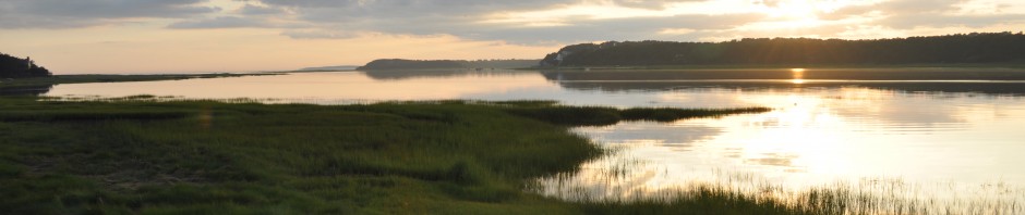
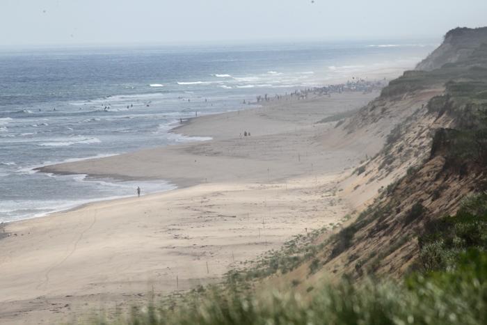
While the leafy towns on the upper Cape developed their hotels and Methodist camps in the 1870s and 1880s, the outer Cape towns – those past Orleans — took a bit longer to gain appeal. When Thoreau took his outer Cape walk in 1849, he wasn’t the first to describe the barrenness of the landscape, the poor soil, and the lack of trees. In the early postcard views of Pleasant Point offered here, the lack of green in the landscape seems not to have mattered to the cottage owners, as they faced their summer cottages toward the tidal Blackfish Creek. Like other Cape towns, Wellfleet developed its “vibe” – the fishing village with elderly sea captains, the industrious people that represented Yankee thrift and hardiness, and even the salty characters that lived there. I’ve written about “The Little Man” of South Wellfleet previously.
Pleasant Point’s Walker Plan
It is in this context that Howard and Reed established their Cape Cod Bay Land Company around Wellfleet’s bayside, with plans of cottage lots laid out for each area. Pleasant Point’s plan was named the “Walker Plan” for the previous owner, Thomas Walker, Jr. Thomas’ father, Thomas Sr., settled in Wellfleet after growing up in Maine, marrying Wellfleet girl Mary Hatch, daughter of James Brown Hatch and Jane King. Thomas was a fisherman, and perhaps selected his land, purchased in 1829 from the Doanes, because he was just across Blackfish Creek from the South Wharf. Later, he purchased woodland from Nathaniel Bell. The 1829 purchase refers to the “Old Mill Pond” which is today’s Drummer’s Pond, the site of a fulling mill that I’ve written about previously.
There isn’t a map that would show the site of the Walker homestead. The lives of the Walker children are a sad tale, but somewhat typical of 19th century childhood. Thomas Jr. was born in 1824. A sister, Jane King Walker, was born in 1821 and died in 1822. John Wesley Walker was born in 1830, but died in 1832. Like other families, the same name was given to another male child, born in 1835, but he died in 1838. Sally Walker, born in 1839, died at age 25 in 1846. All of them are buried in Pleasant Hill Cemetery in Wellfleet, the Methodist Cemetery. Their mother, Mary, died in 1867 and is buried there also, as are both Thomas Walker Sr. and Jr.
The Walker family is listed in the Federal censuses in Wellfleet in 1830 and 1840; in 1838, a newspaper article lists Mr. Walker as one of Wellfleet’s Democrats. By 1850, the family is living in Boston, with Thomas as the only child. In Thomas Jr.’s obituary, it mentions the successful firm of Walker & Rich, fish dealers, at the Quincy Market, established in 1842. Leaving Wellfleet to become a fish dealer in Boston was a common choice for Wellfleet men. According to the Boston City Directory of 1872 and 1879 the Walkers were in business with an Abram Rich who was from the Truro Rich family.
After Mary died, Thomas Sr. married again, to a woman named Susan, who appears in the 1870 census. In 1868, Thomas Walker Jr. married Emma Stidder. His prosperity as a Boston fish dealer supported his purchase of two cottages at the Lakeview Association in South Framingham, part of the New England Chautauqua organization, affiliated with the Methodist Church.
In August, 1890, when Thomas Walker Jr. signed over the land that became Pleasant Point, his wife Emma signed the deed, as well as his stepmother, Susan R. Walker.
Pleasant Point Develops
In the early 1890s, Howard and Reed purchased the adjoining land east of the “Walker Land,” from the Paine family, and created a second area of cottage lots, “The Walker Plan Addition,” and another portion, “The Paine Plan.” These lots are part of the Pleasant Point community today.
The 1890 “Walker Plan” laid out by Tully Crosby, like the other South Wellfleet development plans, gives street names to the area that are a bit more creative than the numbered and lettered streets on Lieutenant’s Island. One of the main streets, Pleasant Point Avenue, ran behind the lots on the bluff where several cottages were built. This street name soon gave the growing colony its overall name. In newspaper reports in the earlier years, it’s referred to as “Point Pleasant;” but the designation of Pleasant Point was given pretty much after 1910.
The Cape Cod Bay Land Company ran advertisements in print publications in the Boston area, with their Boston office listed at 230 Washington Street. “Sea Shore Cottage Lots” were advertised at $25, or $5 down, and $5 per month for a lot of 2800 square feet. They advertised “fine gunning” for hunters, and boating, fishing and bathing. The lots were near the depot, the post office and a store. Applicants got a “testimonial from well-known businessmen who have bought lots and from the town’s Selectmen.” Of course, not everyone traveled to South Wellfleet to make their purchase. One writer has commented that for those who did travel to the Cape on the train, and subsequently purchased land, their rail fare would be reimbursed.
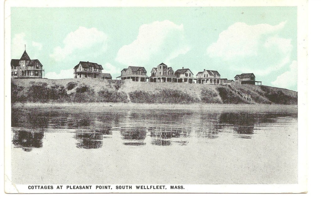
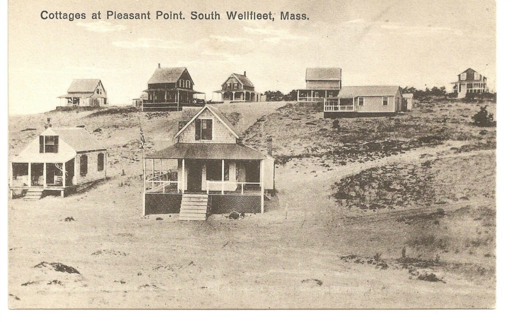
Sales of lots on the Walker Plan began in 1890. Earliest sales were closest to the water — the bluff with the seven houses that are still there today where the grandest house was built. The large Queen Anne-style house on the western end deserves its own story, which I’ll write about in my next post.
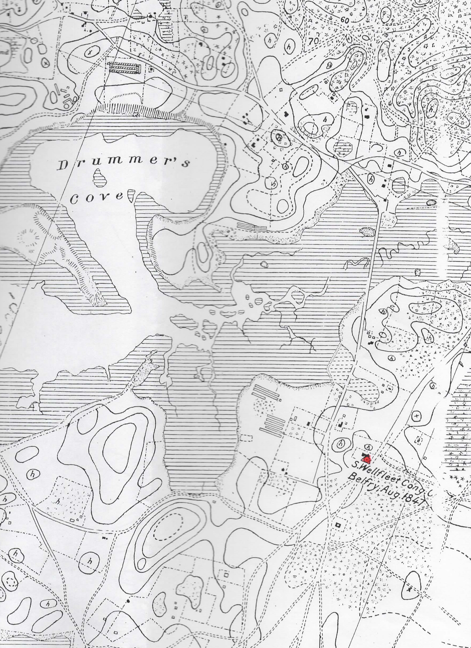
There is no evidence of which cottage was built first. By studying deeds of early purchasers and noting their transfers of property, the existence of a building is noted, telling us that the owners built a structure. On the 1907-1910 map of Wellfleet, a map detail, shown here, notes on which lot a cottage occupied; there are 25 structures, including three to the east, where the owners must have enjoyed a view of Drummer’s Pond.

Detail of 1907-1910 map showing cottage lots with owners
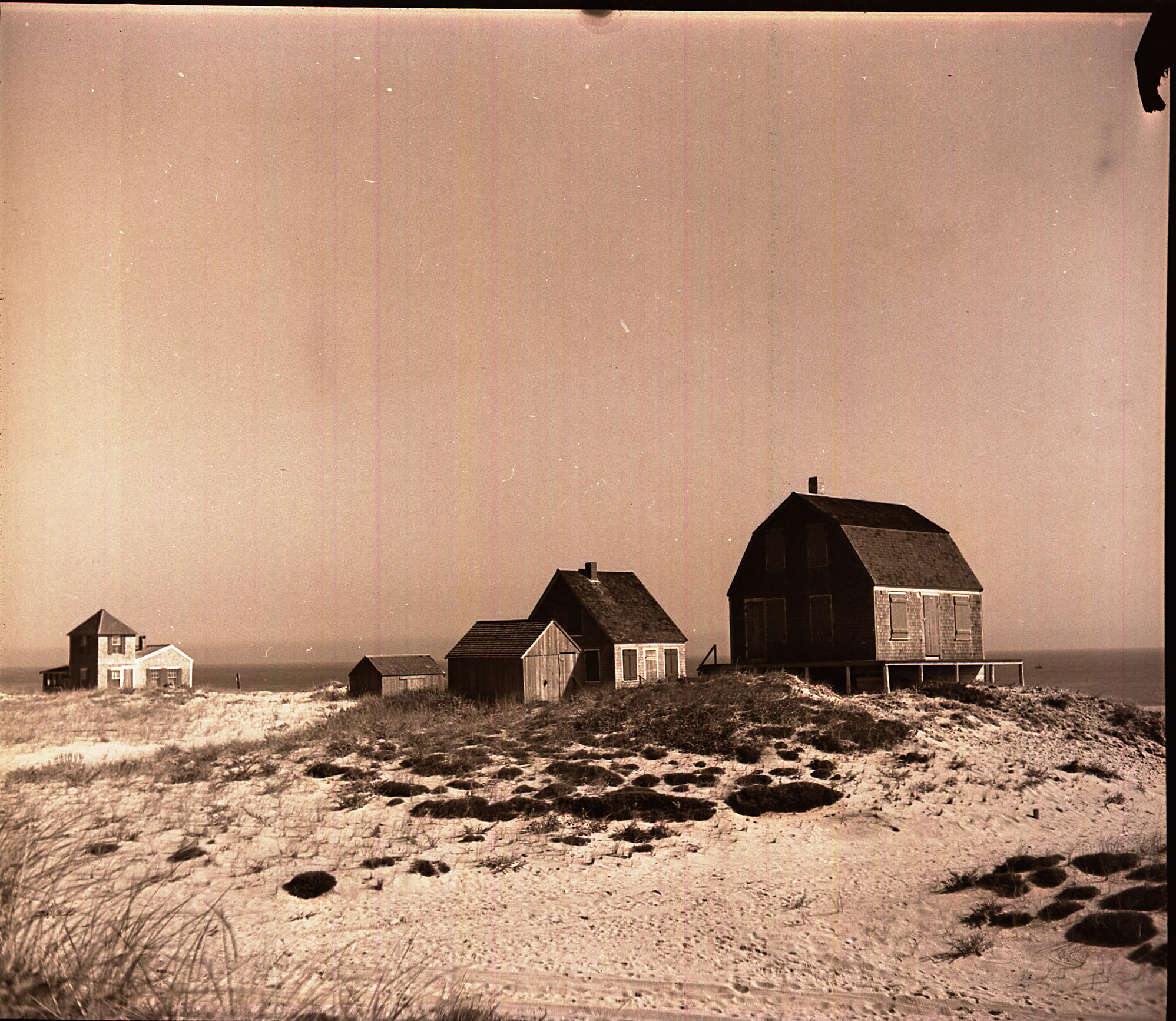
Most early cottage builders chose a simple wood-shingled style of one and sometimes two stories. From time to time, a little “tower section” made the cottage distinctive. Very often, names were bestowed upon the small building: Gull Cottage, Valley View, Sea Breeze, Bay Vista, Bay Pines, and so on.
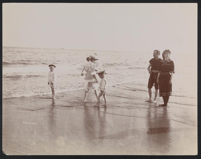
The early cottages were lit with kerosene lamps, had outhouses, and used ice to keep food cool — one step away from camping, for the most part. Bathing, boating, and fishing were daily activities, and perhaps reading for leisure, playing games, and visiting with neighboring families. The key was to relax, to enjoy the sea air, the release from the work day, and the constraints of city living.

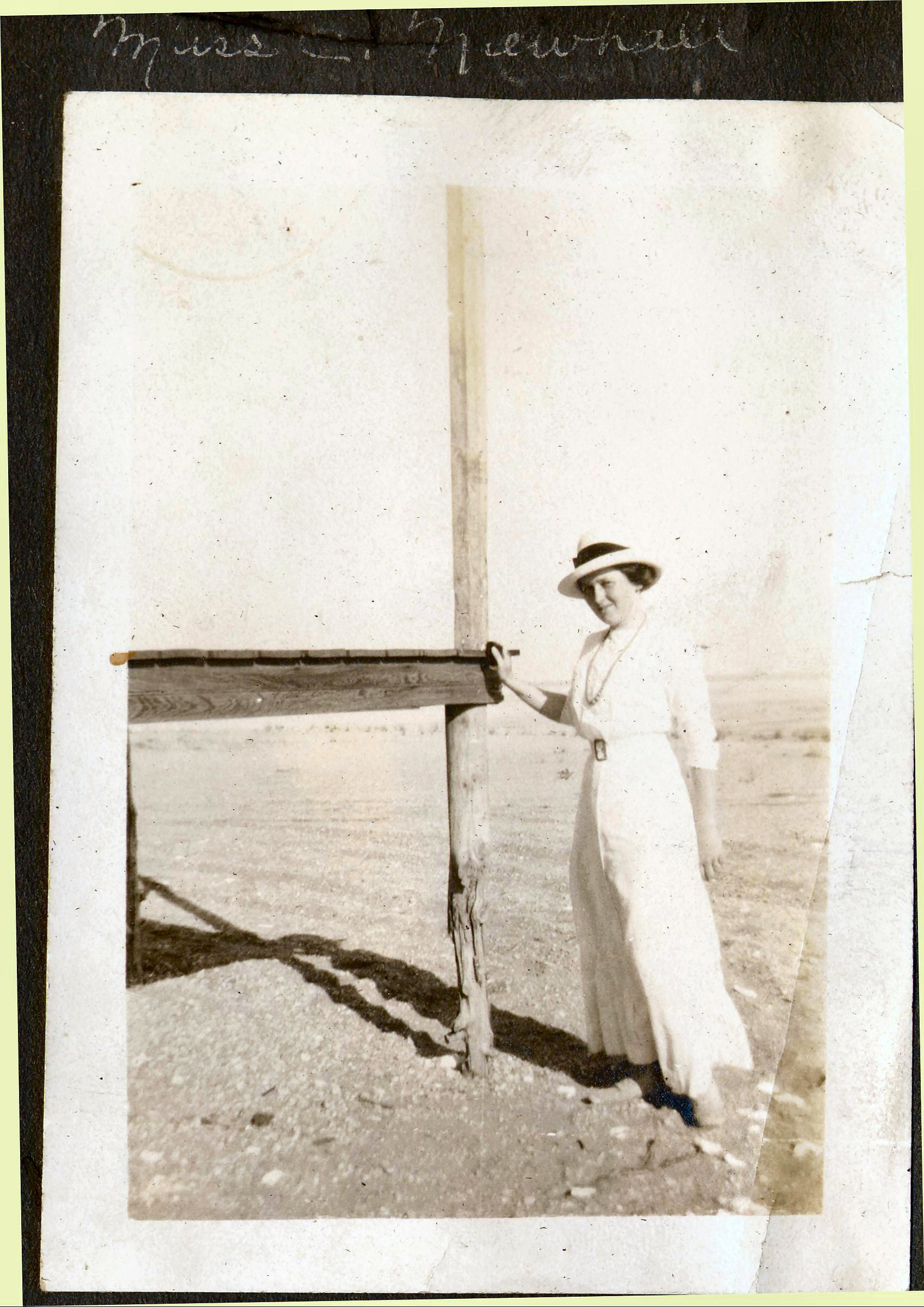
Bathing Costumes, turn of the century. Photo courtesy Museum of the City of New York
Just after 1900, a Pleasant Point Water Company association was formed and it purchased a small triangular lot from Mr. Reed, and gaining his permission to put up a windmill and another small building. The lot was turned over to Wellfleet resident James Chandler in the summer of 1897. A news report from 1904 mentions Frank Fisher “erecting” a galvanized water tank for the “water system” at Pleasant Point. There is still a “pump house” lot listed under “Pleasant Water” on the Wellfleet Assessor’s Database. Today, the Pleasant Point Water system serves about forty cottages.
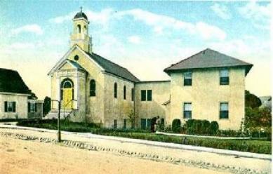
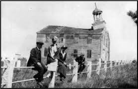
Early summer visitors to Pleasant Point had access to supplies both at the General Store at the Railroad Station, as well as a seasonal store that Mr. Newcomb eventually established at “Hinckley’s Corner” which is where “Way 112” is today. Wellfleet purveyors came around with wagons to sell meat, fish and fresh vegetables. The South Wellfleet Congregational Church was pretty much out of operation by the time Pleasant Point was developed, but churchgoers may have found the remaining congregants meeting at the nearby Pond Hill School. The Ladies Social Union was in operation at Pond Hill during those early years, and they developed a summer sale of homemade items to generate a bit of income from summer visitors. In 1914 the South Wellfleet Public Library was established on the second floor of the Pond Hill School, thanks to Mary Paine, perhaps in response to the burgeoning summer community. The Wellfleet Public Library made it an official branch in 1923.

South Wellfleet Congregational Church early 1900s
Starting in 1902, and led by Edward Reed, there were petitions to the Town to layout, build, and harden a road to Pleasant Point. The records of road making are a bit sketchy, but in the 1914 Town Report, an appropriation was spent and reported on to create a “Pleasant Point Road.”
William and Carrie Hill
Another way to determine if a cottage was built on a purchased lot is to rely on news accounts in the South Wellfleet column in the Barnstable Patriot. The paper’s earliest mention of the Hill cottage is in 1894. William Hill, an engineer from Springfield, Massachusetts, and his wife, Carrie, purchased a lot on Lieutenant’s Island in 1889. In 1892, he sold that lot back to Edward Reed, and instead purchased a Pleasant Point lot from him, not on the bluff, but a bit further back. The Hills are mentioned again in 1900. In 1903, they sold the cottage, and it passed from one buyer to another in 1913, 1917, 1927, and 1955. One of the owners purchased additional land and settled elsewhere in the summer colony. The “Hill cottage” is still there, with a family enjoying it today.

Another post card view of the smaller cottages set back from the bluff
Miss Marsh and The Trueworthys
Another early cottage owner is Miss Matilda Marsh from Lowell, Massachusetts, who purchased her land in 1892. One of the news articles mentions her cottage in 1903. By 1908, she had passed away and her property passed on to the Trueworthy family, Alden and Helen, a married couple from Lowell with a number of children. They may have had a connection to Miss Marsh, as there is a record of her loaning money to Alden in 1894; that loan was backed up by additional property he owned north of Pleasant Point. Mr. Trueworthy was a carpenter and is said to have built a number of summer cottages in South Wellfleet; I plan to write more about him in a separate post. He remained in South Wellfleet throughout the year, while his wife was in Lowell, raising their numerous children. She came to the Pleasant Point cottage in the summer.
A Byron Trueworthy also purchased two properties on the bluff at Pleasant Point but sold them to others before 1900. Mr. Trueworthy was from Ellsworth, Maine, as was Alden Trueworthy, so they may have been brothers. Byron Trueworthy returned to Maine and is listed there in the Federal censuses of the early 20th century.
Miss Martha Orne and The Knowles Family
Another summer visitor was Miss Martha Orne, a teacher, who purchased her lot in 1891 with Adeline Jordan, a dressmaker. Miss Orne is mentioned in numerous news articles. She adopted a girl, Ethel Herrick, first taking her in as her “ward” and then apparently formalizing her adoption. Ethel married Walter Davis in 1912, and, after Miss Orne died in 1915, inherited the Pleasant Point property. Tucked away behind the seven “bluff houses” the property today is owned by the same family that owns the cottage developed by Nancy Goodwin, described further on.

Postcard of Pleasant Point Cottages
The Reeds
Mr. Howard’s partner, Edward F. Reed and his wife, Mary, and their three children, Edward, Arthur and Carlotta, soon established their cottage on the bluff at Pleasant Point, as did Edward’s brother James and his wife, Ida. Edward F. Reed was born in 1843, and, as a young man, apprenticed to a West Bridgewater cabinetmaker, where he can be found in 1860. In 1880, he was working in a shoe factory and living with Mary in his in-laws home. We don’t have evidence of how he switched to selling real estate, or how he met Mr. Howard, but by 1900, when the census taker came to his home in Chelsea, his occupation became “capitalist.” Eventually, the Reed property came to one of Carlotta’s children, Dorothy LePage, whose name appears on deeds on Lieutenant Island in the 1950s. The two Reed cottages on the bluff are still there.
Frank Stacy Family
Another lively character in the Pleasant Point summer community was Frank Stacy of Springfield, Massachusetts. His parents bought their first Wellfleet property on Lieutenant Island and must have built a cottage there because, in 1903, Mr. Trueworthy moved it to Pleasant Point. Their son, Frank, eventually became the owner of the Stacy Pleasant Point property. From news reports of his career, Mr. Stacy appears to have had a “day job” of running the family hardware business, although he also directed the DeSoto Orchestra. He became a City Councilmember, and then an Alderman in Springfield. In 1910, when minstrel shows were still in vogue, he performed as “Bones” in the Men’s League of the Waverly Congregational Church at the New England Hardware Dealer’s Convention. He was elected President of the New England Hardware Dealers (perhaps due to his minstrel performance?) and then used his role to bring the convention to Springfield in their new convention hall.

The seven houses on the bluff
Stacy’s political career was helped by his boosting his hometown, and, in 1914, he was elected Mayor of Springfield, with a campaign costing $637.64. The “genial Mayor” was reported as sending bushels of Wellfleet oysters back to Springfield. In 1919, six weeks after leaving office, Frank Stacy died. However, his wife and children continued annual summer visits to Pleasant Point, with their daughters and son maintaining their contact through the 1950s. Their youngest daughter, Madeline Stacy, must have had some of her father’s personality, as she organized dance classes in 1929 and a season-ending show at the South Wellfleet Ladies Social Union – the building we again call “The Pond Hill School” today.
Louise Shepard
Mrs. Shepard was a widow with two children from Lowell, Massachusetts, the city where many early Wellfleet buyers came from. She purchased one of the bluff lots in 1897, next to the Reeds. In the 1900 census, she describes herself as a “real estate agent,” an unusual occupation for a woman at the turn of the century. In 1914, she sold the Pleasant Point land and its buildings — evidence that she’d built a cottage —to Frank and Jennie Rogers of Springfield, and they owned it until 1938.
The Lovejoys and The Bracketts
In 1897 John and Grace Lovejoy bought two lots on the Blackfish Creek shore in the Paine Plan. Mr. Lovejoy was a grocer in Hyde Park, Massachusetts, although later he bought a farm in Franklin, Massachusetts. The Lovejoys purchased two adjoining lots from Mr. Reed in 1898, but sold them soon after. By 1903, the Barnstable Patriot was regularly reporting their arrivals and departures from the Pleasant Point community, usually mentioning their son, Sefton. In 1901 and 1904 they had two more children, Clarice and Richard. One of the early plans to create a road to the summer community mentions “Hinckley’s Corner to the Lovejoy Cottage.”
The Lovejoys must have enjoyed many years of Wellfleet summers, because it wasn’t until 1950 that Grace Lovejoy passed the property on to her son, Sefton, and his wife, Ethel, who then enjoyed more years there with their daughters Mabel and Priscilla. In 1972 Sefton sold to the family that now owns the property, located on Crest Avenue. Today the remodeled structure is called “Sandune” cottage.
The Bracketts were close by to the Lovejoys — their cottage was called “Camp Norton” — Mrs. Lyman Brackett’s maiden name. The family’s visits were often mentioned in The Barnstable Patriot. They purchased from Robert Howard in 1902 — land and buildings, the same structures he referenced in the deed as purchased from the Paine family. In the deed, Alma Norton Brackett was charged with paying for the repairs Howard had put into the buildings. The Bracketts owned the home until the 1940s, when it passed on to others; notes on the structure indicate that a Reverend John Williams renamed it “Wide Horizons” after extensive remodeling in the 1960s.
Daniel and Jennie Runnels, The Dodges, Jeremiah F. Rich, and Professor and Mrs. Merrill
Another of the more distinctive structures I’ve watched on Pleasant Point for many years is the farthest house on Pleasant Point Road (now labeled Pleasant Point Landing) – a road that was originally named Pond Avenue. The house always seemed to be dangerously close to Blackfish Creek, especially when there was a big storm, with waves breaking against the seawall there. The Runnels were from Lowell, Massachusetts, and he was a house painter. The Runnels purchased many parcels, including the one at the Pleasant Point Landing. In 1903, they sold a bluff lot to the Stacy family, and another to the Trueworthy family. Their own cottage was further back from the water’s edge, on what became Chief Street. Jennie died in the 1920s, and Daniel sold the cottage to Charles Pillsbury, who was his sister’s husband.

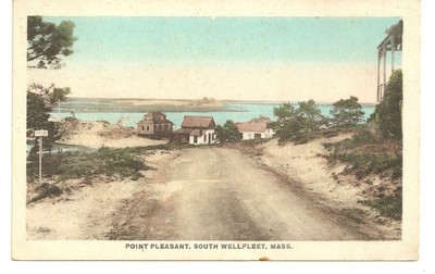
Post card of the road approaching Pleasant Point
In 1911 the Runnels sold the waterfront land to Winifred and Hayward Dodge who then built a cottage, because later deeds refer to a building. Mr. Dodge was a hardware dealer in Dorchester, Massachusetts. The Dodges only stayed for five years, and sold their property in 1916 to a “J. Frank Rich,” who turned out to be Jeremiah Franklin Rich who, with his wife Euphemia Adelaide Rich, were longtime residents of South Wellfleet, perhaps affected by the loss of fishing. Perhaps they thought they might enjoy a bit of profit from the growing Pleasant Point community. The Richs only owned it for a year, and then it passed to Professor and Mrs. Merrill. By the 1920s, Mr. Rich was supplying ice in the summer months. Interesting to me, the Richs were housing Frank Fisher in 1920, one of the South Wellfleet characters I remember from my childhood — “Frankie” pumped gas at Mr. Davis’s General Store.
Professor Alleyn Merrill was a senior professor in the Department of Mechanical Engineering at MIT. The Merrills became a fixture in the Pleasant Point community for years, until he retired in 1934, and they moved to Maine. In 1937, Mrs. Merrill, then a widow, sold the Wellfleet property. From there, the property changed hands several times until the present owners purchased it.
The Moodys and the Sacketts
Lillian and Frank Moody built another of the original cottages sometime after they purchased Pleasant Point land from Reed in 1895. The Moodys sold a portion of their lots with a building to George and Ellen Sackett of West Springfield, Massachusetts in 1911 and 1913. Meanwhile, the Moodys purchased land in South Wellfleet near Doctor’s Hill and retired there.
The Sacketts with their two children, Charles and Elizabeth, appear to have enjoyed many years at Pleasant Point. George Sackett died in 1939, and his daughter must have died as well, since it was her husband, Murray Root, who sold the property to the next owner in 1945. The cottage is still there today.
The Oxfords
Mary and Joseph Oxford lived in Cambridge, Massachusetts where Joseph was a furniture dealer. In addition to purchasing their Pleasant Point lot, in the Paine Land Addition, they also bought lots in the Ocean Plan and the Nauset Beach Plan. Their cottage is further back from the shore, and is still there, although extensively renovated in the 1940s.
The Davenports
The Davenports of Ludlow, Massachusetts, purchased lots of land from Mr. Reed in the late 1890s and held it in trust for their son and daughter, Edwin and Alice Davenport. News reports as early as 1904 mention their summer visits. Their cottage remains today, called Gull Cottage, and known for its unusual hip roof.
The David Buitekans
Annie Ross Buitekan and David Buitekan came to Wellfleet sometime between 1910 and 1920. In the 1910 Census they are living in Brooklyn, New York, where David was a printer. David was born in 1872 in Boston to parents born in Holland; Annie Ross has Scottish parents. They were married in Manhattan in 1903; they did not have children. Their earliest purchase of property in Wellfleet was in 1908, when they bought an older home in South Wellfleet. In 1912, George Sackett sold them Walker Plan land near the shore at Pleasant Point Landing. David Buitekan built a cottage that’s still there, offering it for summer rentals. Eventually, the Buitekans settled in South Wellfleet and became the owners of Isaac Paine’s general store in 1923, as I’ve written about in an earlier post.
Nancy Goodwin
I’ve been looking at a white cottage with green shutters on the shore of Blackfish Creek all of my life, and now know who built it. In 1897, Nancy Goodwin, a widow from Wrenthem, Massachusetts, bought her first lots of land to the east of the bluff, on the nearby shore, from Howard and Reed’s Cape Cod Bay Land Company. She added to her holdings in 1917. Nancy Goodwin lived with her sister Ella, and her brother-in-law as listed in the censuses from 1900. Since women’s abilities to earn money were limited, I thought that her purchase might have been funded from a family legacy or from her husband. However, in 1880, I found her with her brother and sister, already a widow, living in Providence, Rhode Island, where both she and her sister listed their occupation as “waitressing in a restaurant.” However she did it, Nancy Goodwin she was able to buy this summer place, and keep it until 1923 when she sold it to Lillian Givan.
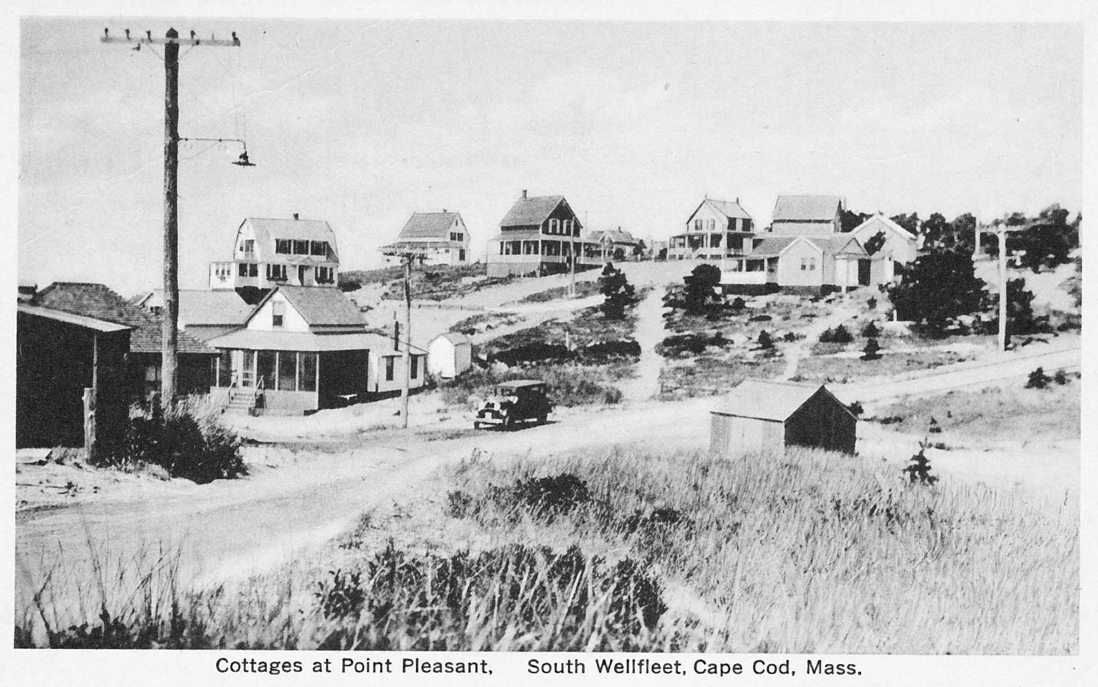
An added note: thanks to a note from Jude Ahern, here’s a 1934 photo of Pleasant Point Cottages with the “water shed” in the foreground.

Cottages at Pleasant Point 1934 — note water shed in foreground

My photograph of Pleasant Point in the 1970s
Sources
Brown, Dona Inventing New England: Regional Tourism in the Nineteenth Century. Washington, D.C., Smithsonian Institution Press, 1995
U.S. Federal Census collection at www.ancestry.com
David Kew’s Cape Cod history site: www.capecodhistory.us
Barnstable Patriot (various) online archive: www.sturgislibrary.org
Barnstable County Deeds available at www.barnstablecountydeeds.org
Newspaper account online at www.genealogybank.com
Cape Codder available at www.snowlibrary.org
Wellfleet Town Reports at the Wellfleet Public Library
Historic house reports at the Wellfleet Historical Society and Museum
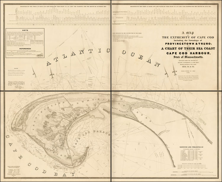
Atlas of Barnstable County, Walker Lithographic and Publishing Company, Boston, 1910
The 1858 Map of Cape Cod, Martha’s Vineyard and Nantucket, Henry F. Walling, re-published 2009, OnCape Publications.


