
South Wellfleet’s Fresh Brook Village, south of Blackfish Creek, has long been described as a “lost village,” once bustling with a tavern, a school, a store, a church, and a post office.
The National Park Service, now in control of much of the area as part of the Cape Cod National Seashore, identifies the village as the cluster of sites along Fresh Brook where evidence of human habitation has been found. But a 19th-century historian, Frederick Freeman, defined Fresh Brook as one of three divisions of Wellfleet, the other two being North Wellfleet and South Wellfleet. Freeman’s definition applies to the part of Wellfleet between Lieutenant’s Island and the Eastham Town Line, about three miles.
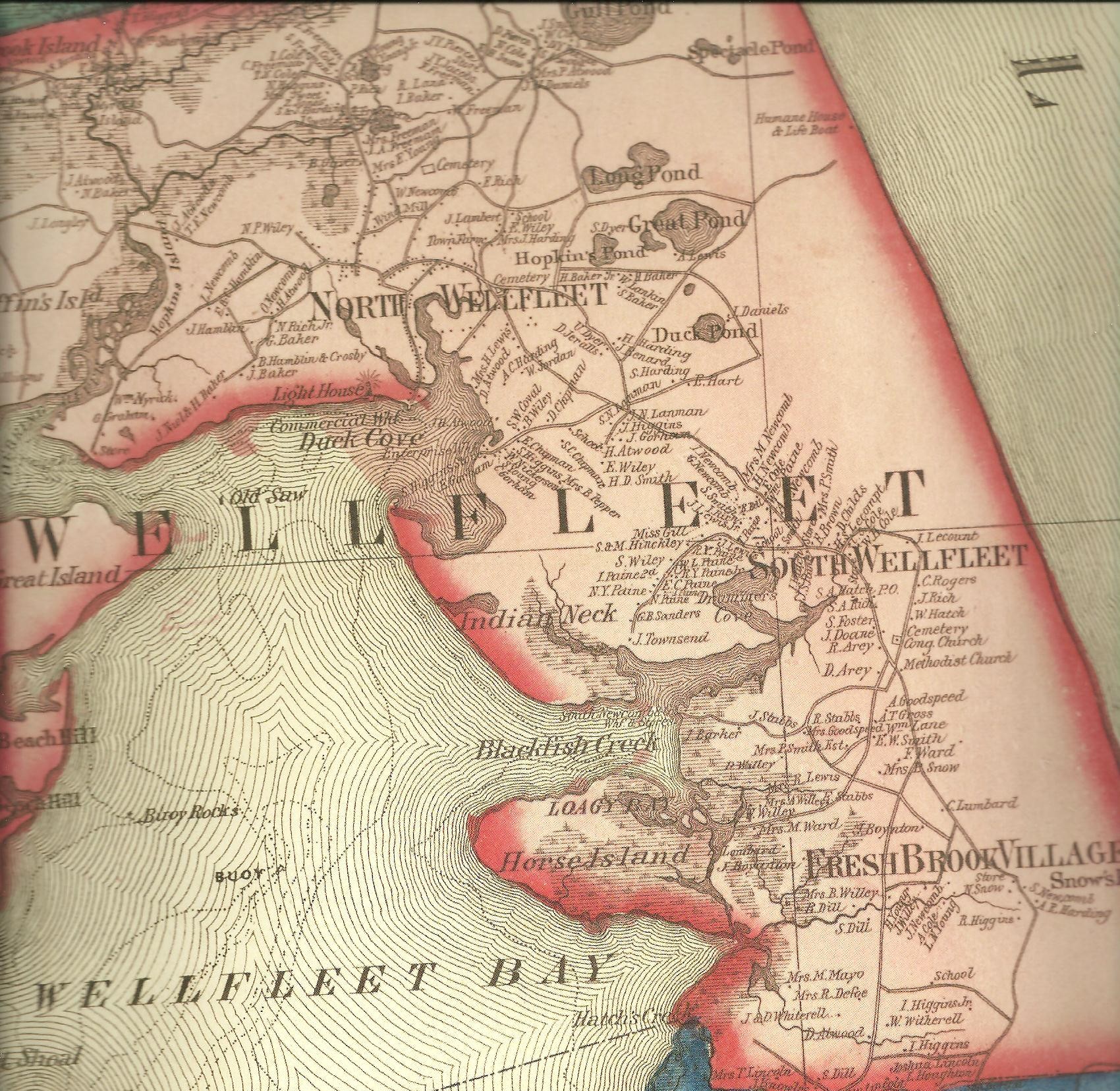
The 1858 Walling Map used this designation in its Wellfleet atlas, naming the same three areas. This expanded version of Fresh Brook helped me interpret the village’s later definitions. It wasn’t just the homes near the brook; it was a wider area of Wellfleet.
In 2014, the Wellfleet Conservation Trust featured Fresh Brook on its annual September walk, when devoted National Park volunteer Rusty Moore spoke about the cellar holes near the brook. Mr. Moore made Fresh Brook Village his special project, researching landowners’ real estate records along the brook and mapping the area. This followed an era when the Park Rangers and the Eastham Hike Club offered regular guided walks of “Fresh Brook.”
Around fifteen years ago, efforts began to restore Fresh Brook as a waterway, a project now coming to fruition. The Brook is in the news for its ecological restoration project, small compared to the work at Wellfleet’s Herring River, but still important.
The restoration project is simple: remove a concrete flow device near the Rail Trail to allow minimal tidal flow and passage for migratory fish, including the salter and the sea-run brook trout once pursued by trout fishermen. In the future, the fishing community hopes to reconstruct two other culverts.
18th Century Background to Fresh Brook
Fresh Brook is one of three freshwater streams fed by springs that are between Blackfish Creek and the Wellfleet/Eastham Town Line. Hatches Creek, once called Indian Brook, marks that line. North of that is Silver Spring, and Fresh Brook lies further north. The Massachusetts Audubon Society’s Wellfleet Bay Wildlife Sanctuary’s northern landscape preserves a significant portion of the Silver Spring area today.
When I began my research on South Wellfleet, I looked for the earliest colonial residents and wrote about the late 17th century, when the area was called Hither Billingsgate, the closest land to Eastham. The Eastham Town Records name numerous land and meadow grants near Silver Spring, but none named Fresh Brook, which made me wonder when the name became fixed.
In 1721, the Eastham Town Meeting voted to lay out a 40-foot highway, designated the King’s Highway, from the Harwich line at the head of Namskaket to the Truro boundary. This gave official status to the old cartway that ran through South Wellfleet, much farther east of today’s Route 6, winding around the heads of the three streams and Blackfish Creek.
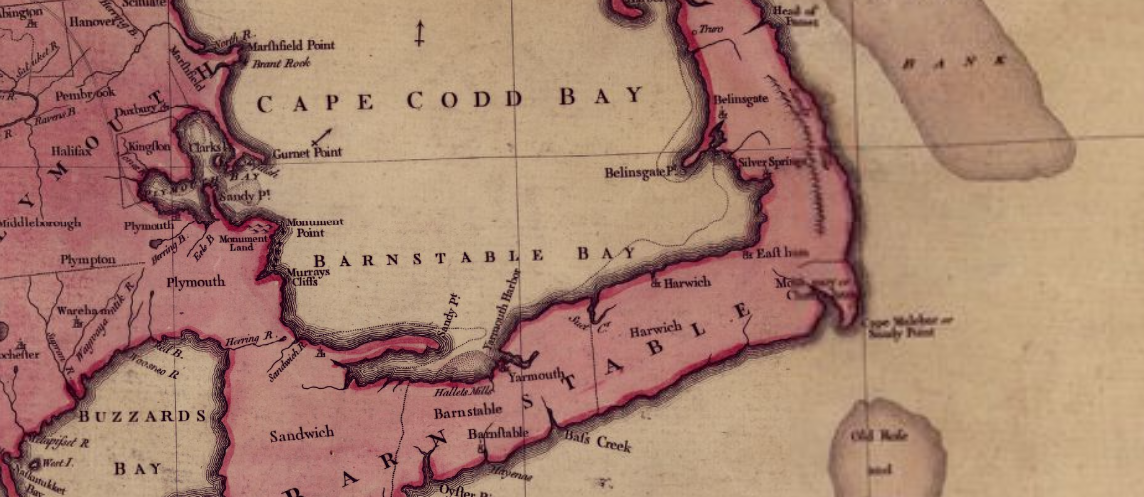
The western shore, where Silver Spring empties into the bay, was designated Silver Spring Harbor in the eighteenth century. The 1738 Eastham Town Meeting noted it as a resource, which may have delayed designating the surrounding land as part of Wellfleet. In 1755, a British map by Thomas Jeffreys of the “most inhabited part of New England” noted Silver Spring Harbor, establishing its importance.
Another 18th-century event occurred in 1723, when Billingsgate was granted permission to have its own minister; the line was drawn at Blackfish Creek, leaving the southern part of the district as part of Eastham. In 1734, Billingsgate was formally designated the “North Precinct.” Sylvanus Snow and five others in the southern part of the town, now stretching to Hatches Creek, were allowed to pay their taxes at the Eastham Meeting House because they lived so far from the Wellfleet Meeting House on Chequesset Neck. I haven’t found any record that shows exactly where these families lived.
The 1717 wreck of the pirate ship Whydah off today’s Marconi Beach adds another layer to Fresh Brook’s reputation as a place of mystery. One Wellfleet historian placed Samuel Harding, who may have buried treasure from the wreck, in Fresh Brook Village. I wrote about the wreck’s aftermath here.
19th Century Fresh Brook
In 1802, the Massachusetts Humane Society published a pamphlet naming the hollows that cut into the outer bank of dunes along the eastern coast of the outer Cape, and where a stranded sailor might find a house. The pamphlet named “Snow’s Hollow”(today’s LeCount Hollow) two miles south of “Cohoon’s Hollow,” and “Fresh Brook Hollow” a mile and a half south of Snow’s. This was the first time I found Fresh Brook named to designate a wider area. (But in the 1858 Walling Map, Fresh Brook hollow is now called Snow’s Hollow, recognizing that family.)
People settled in this southern part of Wellfleet as the growing fishing industry boosted the town’s economy in the early 19th century. Wellfleet added the South Wharf at Blackfish Creek in 1830, as Silver Spring Harbor lost significance. Wellfleet’s population grew from 1117 in the 1790 census to 2411 in 1850. After 1850, the population fell, reaching 1201 by 1900. The town would not reach the 1850 level until the 1970s.
After the Civil War, mackerel fishing declined for numerous reasons, but most significantly because the Grand Banks demanded larger boats, schooners too large for the shallow harbors in towns like Wellfleet. David Balch wrote about Wellfleet fishing in his “Anatomy of a Fishing Village, Wellfleet 1860-1865, a copy available at the Wellfleet Public Library. I wrote a post about this era, The Diminishing Fish and People.
The 1850 federal census is a useful tool for understanding Fresh Brook in Wellfleet. For the first time, that year the census listed everyone living in a dwelling, by family. The Wellfleet census taker moved through the area called Fresh Brook, listing all the families we can see identified also on the 1858 Walling map. Each page lists 42 people, and it takes more than four pages to reach South Wellfleet and the Blackfish Creek families. Fresh Brook has an estimated 200 residents in 1850, with 37 dwellings housing 39 families.
In this census, 44 adult men in Fresh Brook are listed as mariners, the designation for fishermen. Four homes have young men mariners unrelated to the family, probably brought there to help with fishing.
The accompanying 1850 agricultural census listed four farmers living in Fresh Brook: Seth Newcomb, Levi Young, and John Higgins near the brook, and Theodore Brown and Isaac Higgins, living in the southern area of the village. The census lists two Wellfleet crops: rye and Indian corn.
At a time when building new houses was important, Fresh Brook residents John Witherall, Edward Knowles, and Asa Newcomb were carpenters. Two young men are listed as yeomen, a designation for a male living on owned land, perhaps a small-time farmer. One young man was listed as a coach maker, and there were the two pastors of the churches. All the women “kept house.”
The families in the 1850 Fresh Brook area of Wellfleet included many of the same branches as in other parts of Wellfleet: Snow, Higgins, Wiley, Newcomb, Cole, Young, Dill, to name a few, and, near the Eastham town line, Lincoln, Witherell, and Mayo. In early census work by researcher David Kew, the women of Fresh Brook had maiden names from the same list of Wellfleet families.
A female head-of-family is listed in 1850: Mrs. Betsey Wiley, a 38-year-old widow with seven children and her mother-in-law. Another, Hannah Nickerson, age 85, lived with two other women in their sixties, perhaps a home for the aged before such institutions existed. A very old Mr. Boyington lived in Mr. Levi’s home, and a very old Mr. Taylor lived in a young Mr. Boyington’s home.
Nathaniel Snow and his wife Betsey lived near the brook in 1850 when he is listed as a mariner. But in the 1860 census, his occupation is carpenter. When he died in 1876, he was buried in Evergreen Cemetery in Eastham, showing the continuing relationship for some residents with a church in Eastham. (Several Fresh Brook residents are also buried in the South Wellfleet Cemetery.)
The local families are all related through marriages. Seth Newcomb, one of the farmers, had a daughter, Thankful Snow Newcomb, who was married to Amaziah Harding, who lived close by. Seth Newcomb’s sister, Priscilla, was Asa Newcomb Cole’s mother; Mr. Cole is noted later here as the last person living in the area near the brook.
The 1858 map shows a school south of Fresh Brook. Two churches were close by: the 1833 South Wellfleet Congregational Church and the 1835 South Wellfleet Methodist Church. The 1850 federal census lists the two church pastors who lived in the Fresh Brook area. The first post office was at Reuben Arey’s house in South Wellfleet’s Blackfish Creek neighborhood.
In 1850, all families living close to the brook, except farmer Seth Newcomb, were mariners. That explains the disappearance of the dozen or so houses, probably flaked and moved, as was the custom at the time, leaving the cellar holes there today.
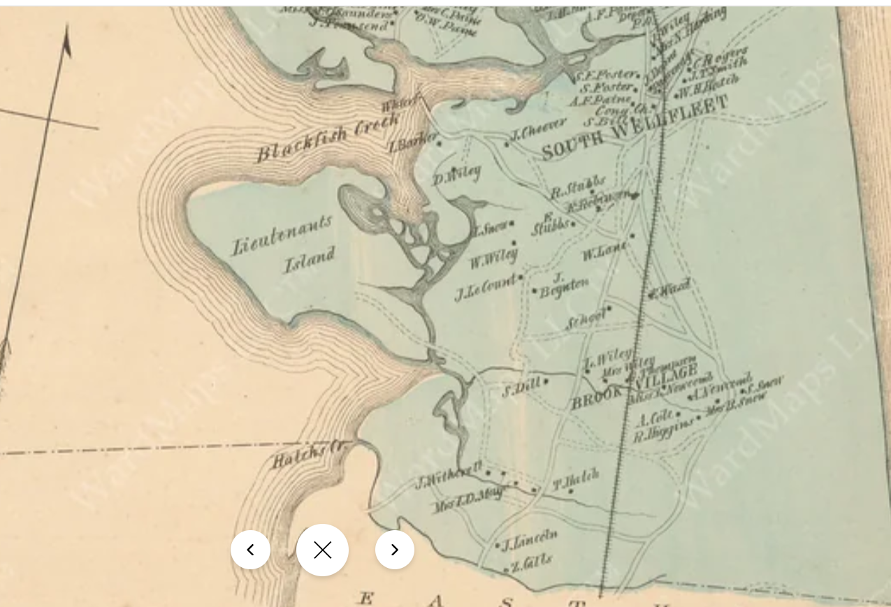
An 1880 Walker map of Wellfleet identifies and places the families living in Wellfleet. The Fresh Brook area of town is now labeled “Brook Village.” In the 1880 federal census, the same headcount pattern starts at the Eastham town line and moves north. By the time the census taker reaches the families south of Blackfish Creek, he has enumerated about 88 people. As the Wellfleet school districts consolidated, the school moved north of Fresh Brook, reflecting the population decline. And, of course, now the railroad ran through the area.
The Fresh Brook Tavern
The tavern in Fresh Brook appears in many articles and reports about the area around the brook. In Deyo’s 1890 history of Wellfleet, which covers South Wellfleet in a few paragraphs, he describes the tavern as near the church, which would be the South Wellfleet Congregational Church, since the Methodist Church lasted only a short time. He mentions another one, though, belonging to Deacon Newcomb, near the brook. Is Deacon Newcomb farmer Seth Newcomb, the farmer?
By 1890, Fresh Brook is not named as a distinct part of the town. South Wellfleet was more important, with its church, railroad station, and stores.
Researchers today place the tavern on the King’s Highway, the sandy cartway, near where the road crossed Fresh Brook. The 1858 Walling map labels it as a store, and later researchers located Nathaniel Snow and his wife as the occupants.
The tavern keeper, Lydia Ward Arey Taylor, was the former wife of Reuben Arey, who lived near Blackfish Creek. She married him in 1777, at age 17, and they had eleven children. Their son, the second Reuben Arey, stayed in the Blackfish Creek area and became South Wellfleet’s first postmaster.
Lydia’s husband died in 1801, when she was 41. In 1799, Reuben Arey took an ad in the Massachusetts Mercury newspaper that his wife had “eloped” and he was not responsible for any of her debts. These ads were common at the time, when “eloped” meant a wife had run away. Lydia Arey married John Taylor in 1808. Where was she in the intervening years? I couldn’t find a record, as censuses from that time listed only heads of households.
The tavern Lydia Taylor operated as Aunt Lydia must have been established after the Taylor marriage, but no record shows how long it lasted. Lydia died in 1850, and John died in 1851.
When the Park Service began assembling historical information about the South Wellfleet area, they interviewed Bernice Wiley in 1967, who repeated the tavern story. Mrs. Wiley was a stepdaughter of Ikey Paine, who lived in one of the old Arey houses. She was highly educated and had lived in numerous places until she and her husband returned to the area. She added some spice to the tavern story, describing it as a place of “high jinks and strong drink,” and Lydia Taylor called it “Aunt Jib-boom.” At a time when a woman running a tavern was frowned upon, perhaps the runaway wife Lydia had lost so much respectability that becoming a female tavern owner did not matter.
Mrs. Wiley described the Taylor home and tavern as one of two houses left in the area around Fresh Brook in the early 20th century, when Mrs. Wiley was a child.
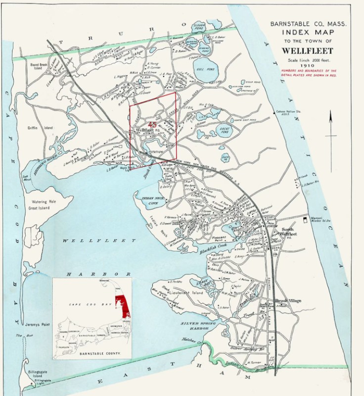
In the early 20th century, another change occurred in the Fresh Brook area. Richard Freeman, of a prominent Wellfleet family, bought 84 acres there and established a private, members-only fishing camp, stocking the brook with trout to supplement the native salters. During that time, Fresh Brook was labeled Trout Brook, as shown on the map below. By 1943, when the U.S. Army took over the area and created Camp Wellfleet, the fishing camp was long gone.
Fresh Brook researchers name Asa Cole as the last citizen to live near the brook. Mr. Cole was a farmer and lived there with his wife, Hattie. He died in 1905 and is buried in Eastham’s Evergreen Cemetery.
Today, much of the area encompassing the Fresh Brook district is part of the National Seashore and remains as it was, with more to discover. The Park Service protects and monitors it. The area west of the old railroad tracks, now the rail trail, has numerous new developments, and the two streams, Fresh Brook and Spring Brook, are used as street names. Captain Bellamy of the Whydah also got a street name.


