My family had tales of Prohibition-era rum-running in Wellfleet; my mother and aunt spoke of “watching the lights over at the Old Wharf from the attic window” during the 1920s and 1930s. Another person recently interviewed laughingly spoke of the “pirate” living at the Old Wharf who not only brought in the liquor, but also had a strong Ford truck to drive it off-Cape. “He’d be gone all night.” Yet another account, this one a bit more sinister, was the memory of someone living south of Loagy Bay remembering hearing gunshots on a dark night coming from the Old Wharf area.
So it was with these accounts in mind that I pursued my research on how the Old Wharf Point developed into today’s South Wellfleet neighborhood. (For this posting, I am referring to the same lots 1-19, Block A, of the Old Wharf Plan as I did in the previous post. These were the lots that lined the bluff on Old Wharf Point.)
No single fact I have discovered points to the Old Wharf life in the Prohibition era, but, taken together, and considered in light of the “tales” of others, something unusual was surely going on! Now, of course, it’s an amusing South Wellfleet story, part of the other Wellfleet tales of the time. And not just Wellfleet tales, since Donald Sparrow writes about the same issues in his work on Eastham.
In the early 1950s the Cape Codder published a series of stories about rum-running on the Outer Cape, collecting reminiscences of Cape Codders barely twenty years after Prohibition ended. The writer used a pseudonym, and no name or place is named directly, but the stories put these Cape folks directly into the picture. The writer says,
The leaders of the smuggling craft came from outside the Cape – but they had many Cape Cod recruits and many a tidy sum was netted by the local men who were familiar with the remote inlets, the best roads for getaway and were sensible enough to be guarded in their talk. The local men were relied upon to handle the drops – whiskey carefully packed into burlap sacks – and load them in fast cars or trucks. The truckers were especially valued. A number were “all set” when the Prohibition era came to an end.
Much of the illegal liquor landed in North America on the French island of St. Pierre et Miquelon off Newfoundland, and was “delivered” on fairly large ships positioned on “Rum Row” three miles off the U.S. coast, and supplied the smaller boats venturing out there while trying to avoid the U.S. Coast Guard. Daniel Okrent’s book, Last Call, The Rise and Fall of Prohibition, describes this history in great detail.
My Old Wharf research was greatly helped by A.F. Joy’s book on spending his summers with Aunt Leah and Uncle Mel in the Old Wharf cottages. That’s where I learned that Uncle Mel had owned a liquor distribution business until Prohibition, when the revenue agents destroyed his stock, and he had to load what was left of his supply into the two Cadillacs he owned. He was no supporter of Prohibition, and he was angry at the U.S. Government for their actions. Uncle Mel also had a forty-foot boat and a Ford truck.
Most of Mr. Joy’s book concerns Aunt Leah, who seemed to have one venture after another to make money after the business was destroyed, from collecting Cape pinecones to sell to florists in Boston, and to making lots of Beach Plum jelly to sell to vacationing visitors. She had a jelly stand out on Route 6 for a while, but eventually moved her jars to a little shed beside the house and ran her shop right out on the Old Wharf Point. One of the Goss family members told me in an interview last year that he remembers “Miss Leah and her jelly.”
Mr. Joy also writes about how Uncle Mel and Mr. Barney — “another early settler on the Old Wharf” –worked to build a dike and road that made a useful access point to the homes on the bluff. The Barker family remembers their grandfather working on this project too. They did a good job and we still use that road today.
Mr. Joy’s information provided a basis for my further research on the Old Wharf property owners after 1910.
First, in 1912, Mr. Oberg, who owned the furthermost house (Lots 17-19) sold his cottage to Mr. Earl Barney and his wife Bertha. When I checked the 1910 Federal census for the Barney family of Boston, I found that he was a salesman in a wholesale liquor business. Further, in his World War I draft registration, he lists “E.M. Rogers” as his employer.
E.M. Rogers is Mr. Joy’s “uncle,” and I characterize him that way because in all the property transfers, Mr. Rogers is “unmarried,” as is Leah Joy — Aunt Leah. She really was his actual aunt, but they appear to never have married. He was originally from Orleans, and as late as 1947 when he is named as one of the executors of his sister’s will, the documents notes he is “unmarried.” In the censuses I looked at for 1910 and 1920, he is listed living in a boarding house, sometimes with a woman named Rogers. There, he is recorded as “married” by the census taker. It’s important to note, however, that one unrelated person may have provided the information on the boarding house tenants.
In 1918 Elisha Rogers purchased Lots 4 and 5 from the Davis family, and then transferred the purchase to the ownership of Leah Joy. She was a 30-year-old single woman in the 1910 census, living in her parents’ home, and working as a ”cashier in a distributing company.” The Joys were a good-sized family: six children, older brothers and younger sisters. Mr. Joy’s memories are of many family members coming to the Cape to enjoy vacation time together. He mentions a second cottage – and, indeed, in 1920, Leah purchased the Robinson property, the house next to the Davises. Now she owned two cottages.
In 1919 Leah bought Lot 2 from Frederick Mountain. She also bought the land Mrs. Mountain had purchased on Prospect Hill, and then sold it back to George Barker in 1936. In 1923, Leah Joy sold the Robinson property on Lot 1 to Frank McCallum of Brookline, and, in 1927, she purchased a home in Auburndale, Massachusetts, possibly the family home she had grown up in. Leah Joy bought additional land on the Old Wharf in the “B” section in 1927, 1933, and 1958, and, in 1957, Lot 6 on the bluff.
In the 1930 Federal Census, Leah is still living with her parents in Newton, and, for the first time, E.M. Rogers is the household as well, listed as having an occupation in an automobile garage (but unemployed), which matches Mr. Joy’s recollection in his book. Leah is listed in 1930 as a “gift shop clerk” which matches Mr. Joy’s memory of her shop in Auburndale — the same shop that she apparently moved to South Wellfleet in the summers.
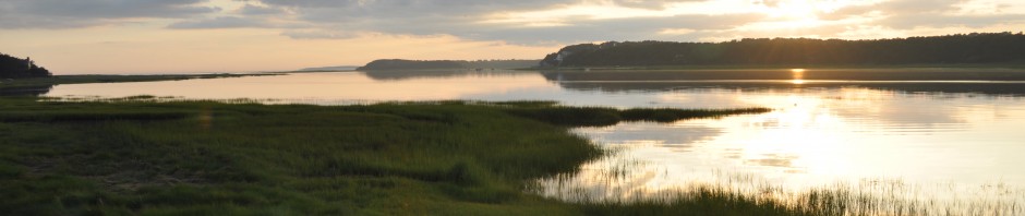
In the 1940s and 1950s life on Old Wharf Point remained pretty much the same, except one assumes that the rum-running nighttime activity of the 1920s and 1930s had ceased. This photograph shows the treeless landscape, and also the long dock protruding out into Loagy Bay – with thanks to Mr. Joy for printing this in his book. I have not found another Old Wharf photo – although I’m sure there must be some in family albums.
Old Wharf Point house with dock from A.F. Joy’s
book listed below
By the 1960s the pace of property sales and development picked up. The Stubbs house was sold to Charles Zehnder, the modernist architect. Now, Luther A. Crowell, the grandson of the inventor, started assembling his land holdings and making plans to develop them. One of his purchases was the remaining land still held in the Old Wharf area by the Cook family.
On the Old Wharf, as well as on Lieutenant Island, Crowell’s plans kicked up a conservation firestorm, as he initially proposed to fill in marshland to create a road to the very end of the Point, and proposed a similar road on Lieutenant’s Island. By this time, new development had to be approved by the Wellfleet Planning Board, and in cases when wetlands are involved, the Conservation Commission. Crowell did not get his approvals in the initial round, but eventually he got it, with a subdivision plan reflecting the lot sizes of this later time, which replaced the Howard Plan of 1890. One of the first houses of this era was the modern structure out on Old Wharf Point, near the still-visible pilings of the South Wharf. The southernmost house, near the road that ends at today’s public landing, is a cottage along with other buildings that were described to me as the former “garage” for the first house up on the bluff. Perhaps it was also created out of the Robinson cottage on Lot 1.
Mr. Crowell, in his efforts to get his subdivision approved in 1967, found a 1927 map that showed a road along the “north shore” of the Old Wharf land. This must have been the roadway used by the 19th Century fishermen to get their supply carts and horses out to the Wharf buildings, and their barrels of fish to the South Wellfleet Railroad Station.
Sources
A.F. Joy, Return to Cape Cod , Saturscent Publications, South Wellfleet, 1985, available in Cape libraries
U.S. Federal Census collection at www.ancestry.com
David Kew’s Cape Cod History site: www.capecodhistory.us
Barnstable Patriot (various) online archive: www.sturgislibrary.org
Barnstable County Deeds available at www.barnstablecountydeeds.org
Barker Family interview.
