Robert Howard and his partner in the Cape Cod Bay Land Company, Edward Reed, began developing new cottage neighborhoods in Wellfleet in the late 1880s. The mackerel fishing had fallen to new lows, many Wellfleetians were moving elsewhere and had property to sell, and there was a new interest in the Cape as a vacation destination, a new concept in American life.
Robert Howard was the step-son of Luther C. Crowell, the inventor, who married Mrs. Jeremiah Howard, born Margaret Atwood, from Wellfleet. After their three children were born, Mrs. Howard — widowed and running a boarding house in Cambride — somehow met Mr. Crowell, and they married in 1863. The Crowells lived in Brooklyn, New York, for a few years when Mr. Crowell was employed by Hoe & Company. The company was using his patented inventions for folding paper items and figuring out mass production — including the square bottom paper bag, the item Crowell is remembered for. In 1888, the Crowells came to Wellfleet as summer visitors, buying and moving the Eleazer Cole house. The Crowells had two sons, Luther F. and Edgar.
In an earlier blog post on the fishing industry in South Wellfleet, I wrote about the ownership of the South Wharf, starting in 1831 when Major John Witherell sold land to Richard Arey and the Battelle & Little firm of Boston. That property exchanged hands a number of times in the years that followed, and ended up in the hands of the Southern Wharf Company. In her book Eva and Henry, Irene Paine notes the final years of the company in 1888, with Blackfish Creek silting up and the mackerels’ diminishment. Indeed, in 1889, the Southern Wharf Company sold their property to Edwin P. Cook, known for his land purchases all around the town.
Mr. Cook rather quickly turned his purchase around, selling 20 acres of “Old Wharf land” to Robert Howard, who hired Tully Crosby, Jr., a Brewster attorney and surveyor, to lay out a plan of cottage lots. In various deeds, the waterfront-facing area of the land is named as “Brier’s Cliff”, and this name has been retained on one of the old roads. The whole area is, of course, an island, much like Lieutenant’s Island. I’ve only found one reference to a name for this spot: Edmund’s Island. This is in the will of Reuben Arey, who died in 1837 and left pieces of his land holdings to children and grandchildren, including “the heirs of Asa Packard Arey.” Those children’s mother, Betsey, married Isaiah Barker, who settled into the farmhouse near Old Wharf, making barrels for the fishing operation there. A contemporary member of the Barker family recalls the family calling his land Edmund’s Island.
Mr. Cook did not sell the wetland on the southwestern edge of the “island” to Howard – in 1885, this land was being converted to a “cranberry swamp” which Cook sold to a Lewis Stone. They made a deal: Cook would grow and harvest the cranberries, and keep half the harvest. This bog is clearly shown on the Old Wharf Plan, and the dike edging the bog may have been the access point to the island, since the dike/road we use today was built much later. The Barker family also had a small bog on their property, as did the Alvin Paines, who were living in an Arey house on the County Road by this time.
The development of summer homes along Brier’s Cliff — today’s Old Wharf Point — is best understood from the layout of the cottage lots in the 1890 Plan. In a conversation this summer with an older Wellfleet resident, she recalled her father calling these “handkerchief lots” – small pieces of land for the city folks, laughable to the Wellfleet citizens whose land holdings were much larger, and divided into upland, salt meadows and woodlots.
Along the top of the cliff, from south to north, the lots are designated as “Block A,” and numbered from one to nineteen. Today, the properties there have Bay View Avenue addresses, the road that runs behind the homes.

The Old Wharf Property Plan 1890
While I have found one advertisement for the Cape Cod Bay Land Company, I do not know where the company advertised its land. However, as the lots were purchased and written in deeds, my research on the families who made the land purchases showed their connections.
In 1890, Mr. Howard sold Lot 1 on the bluff to Elizabeth and Joseph Robinson of Lowell, Massachusetts. The Robinsons were immigrants from England with four children; Mr. Robinson’s occupation is listed in the census as “overseer.” The Robinsons built a cottage; my great grandfather rented it in 1893, according to a Barnstable Patriot note, the first evidence I’ve found of my family’s interest in South Wellfleet. The Robinsons kept their cottage until 1920, when they sold it.
Also in 1890, Mr. Howard sold Lots 2 and 3 to a Frederick Mountain of Lowell. Mr. Mountain, who also bought lots in the nearby Prospect Hill development a couple of years later, was also an immigrant, from Canada. There is no evidence that he ever built a cottage, and eventually he sold his land.
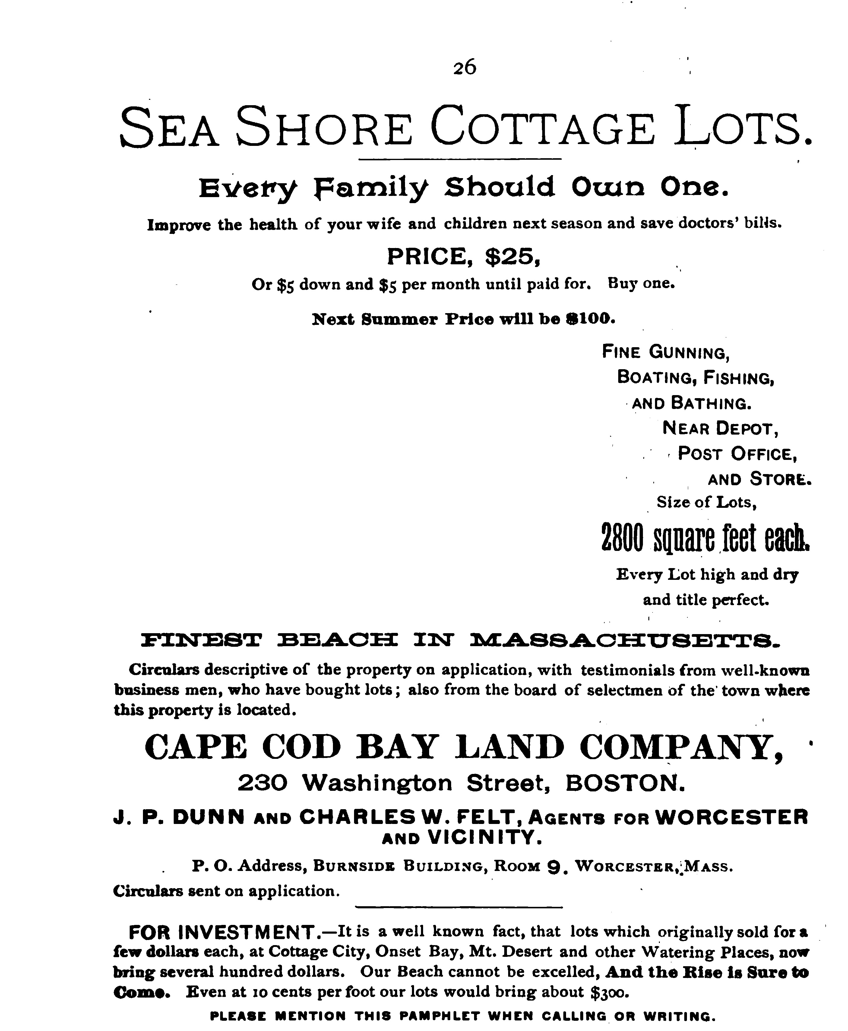
Cape Cod Bay Land Company advertisement
Another 1890 sale went to Caroline Sugden of Lowell for Lots 10, 11, 12, and 13 in Block A, and additional land in Block B. The Sugdens were also English immigrants; Mr. Sugden’s occupation as a manufacturer of something related to a press, may have had a relationship to Luther Crowell’s work. (The census taker’s handwriting is not clear, so my interpretation is a guess.) The Sugden daughter, Amy, married John W. Stubbs in 1899, and became the parents of Mary and Caroline Stubbs, who were active Wellfleet citizens throughout their lives. Their grandfather Joseph A. Stubbs’ oyster business was at the height of its success on Blackfish Creek at this time — see my earlier blog post about the Stubbs family. The Sugdens built a house on Old Wharf Point.
In 1891, Mr. Howard sold Lots 4 and 5 to a Mary Wiley; by 1907 this land was the property of William and Annie Davis of Lowell. The Wileys built a cottage, since such a building was mentioned in the 1907 deed to the Davis family.
Meanwhile, Mr. Howard and Mr. Reed, partners in the Cape Cod Bay Land Company, were buying up property around South Wellfleet and creating similar plans. This is how Lieutenant’s Island was developed; no one lived there until Mr. Howard came along, and I hope to discover more about its history in the future. Interestingly, there was a plan filed to build the bridge to the Island in 1893, from the Old Wharf Point, near Mr. Robinson’s property, out over the waters of Loagy Bay.
Mr. Howard and Mr. Reed also developed plans for cottages at Paine’s landing, Cannon Hill, and a rectangular piece of land with one straight street between the Old Colony Railroad tracks and the ocean, just south of the Wireless Road.
Mr. Howard never married, and lived in Boston in boarding houses in the census records I found. Mr. Reed also lived in Boston, and I found no evidence of his wealth; in the 1880 Federal census he is working in a shoe factory and living in his father-in-law’s home, and in 1900 he has his own home and his occupation is “capitalist.”
Through mentions of him in the Barnstable Patriot, we know that Mr. Howard built a cottage on Lieutenant’s Island, purchased a sailboat, and visited his mother often. Mr. Crowell died in 1903, leaving Margaret Crowell as his widow. She died in 1911. Hannah Howard Mitchell, Margaret’s daughter, died in 1914. Mr. Howard died at age 59 in 1916, leaving his property in Wellfleet to his sister’s son, Howard Mitchell, and to the Crowell sons.
Continuing back along Old Wharf Point, in 1893 James Barnard of Nashua, New Hampshire, purchased Lots 14 and 15, and in 1893 increased his holdings by purchasing Lots 17, 18 and 19. Howard had sold these lots in 1891 to Joseph C. Batchelder, who re-sold in 1892 to William Walker. Walker next sold to Mr.Barnard in 1895, and then Barnard sold to Lizzie Heald Buswell. All of these owners were from Nashua, New Hampshire. Lizzie Buswell sold the property back to Mr. Howard in 1904.
In 1907, Mr. Howard sold Lots 17, 18 and 19 to Andrew Gustaf Oberg and his wife. Mr. Oberg was a Swedish immigrant, living in Boston. Someone had built a cottage there earlier, because a building is mentioned in the 1907 deed. Soon after his purchase, Andrew Oberg transferred the property to his son Percy Oberg, and in 1909 he was released from the mortgage Robert Howard had granted them.
In 1910, a map with property owners shows four houses on Old Wharf Point: Robinson, Davis, Stubbs, and Oberg. There are no homes indicated on the remainder of the Old Wharf land. We can imagine families coming to South Wellfleet on the train, buying their supplies and getting their mail at Mr. Paine’s General Store and the South Wellfleet Post Office, and walking to the ocean, and to the Marconi Towers.
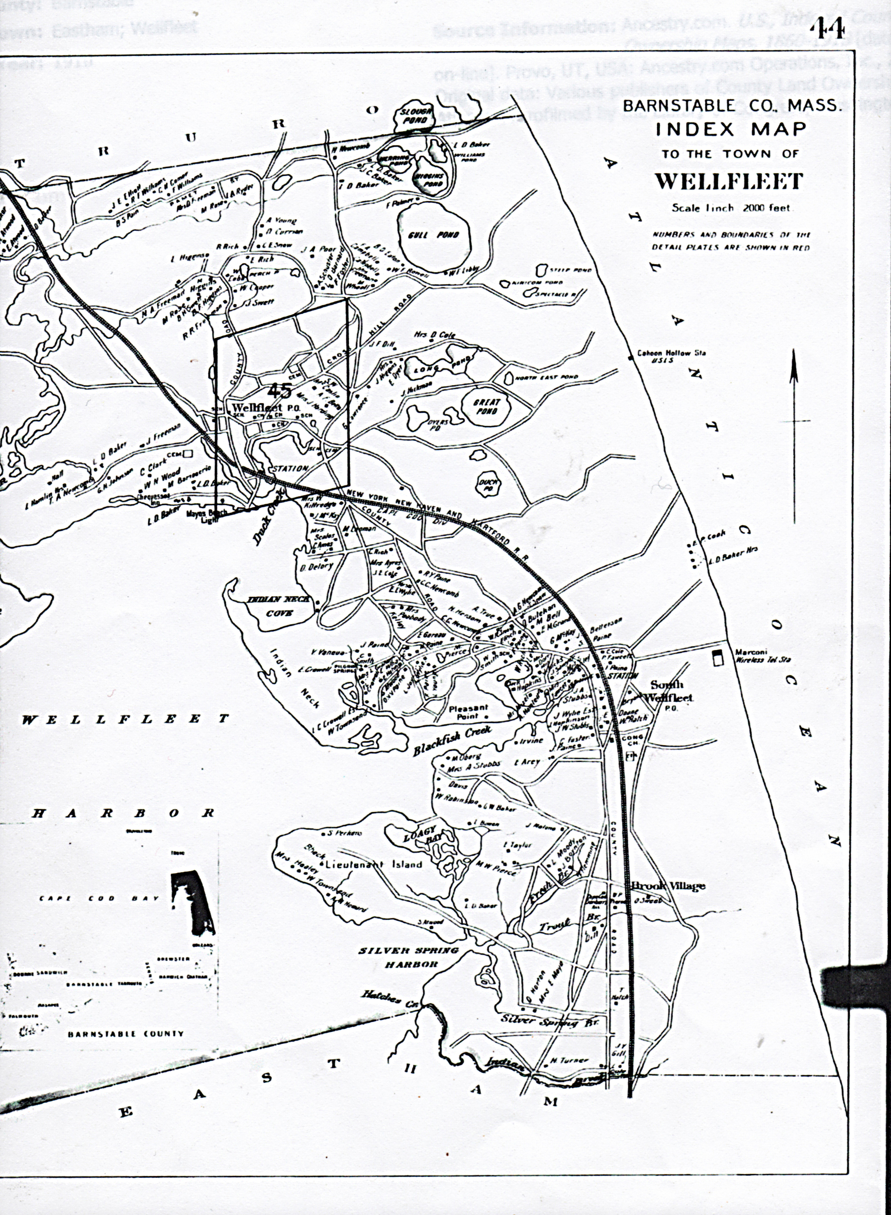
1910 Map of Wellfleet with property owners
Local people, including the Barkers, had gardens and produced vegetables they sold to the summer people. Mr. Bell had a meat wagon he rolled around town, and others sold fish from wagons. The flats were open for people to dig clams, oysters and quahogs. Irene Paine writes about older sea captains taking visiting families out for a sail if they did not have a boat of their own.
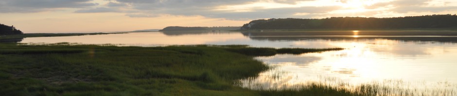
This neighborhood of South Wellfleet had become a vacationer’s paradise.
Sources
U.S. Federal Census collection at www.ancestry.com
David Kew’s Cape Cod History site: www.capecodhistory.us
Barnstable Patriot (various) online archive: www.sturgislibrary.org
Barnstable County Deeds available at www.barnstablecountydeeds.org
Barker Family interview.

Pam:
Thanks for sending me all our latest blogs which I read with great fascination. In so glad they are always available online at your blog. Did you see the Historical Society exhibit I worked on, hung at the Library august 3-17?
It was much too short.
Terry
TERRY GIPS
tgips@coldmeadow.com
http://www.coldmeadow.com
508-243-0987 cell
PO Box 316
South Wellfleet MA 02663